| Home | City Bus | Maps | Villages | Cities | Rail | Tourist Places | School | College | Pin Codes | Corona Cases Count |
| Distance Calculator Bus Services IFSC Codes Trace Mobile Number Weather Search Place Trace IP Available Cash ATM/Banks Locate Polling Booth Report an Error contact People |
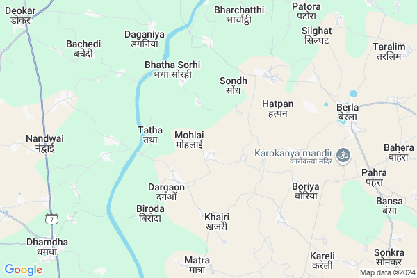
Mohlai
Mohlai Map
EDIT Map
Add Your House
 ..
..
Current Corona Virus Infected Patients Count in Durg District
| City Name | District Name | Total Covid cases |
|---|---|---|
| Bhilai | Durg | 1 |
Locality Name :
Mohlai
( मोहले )
Tehsil Name : Dhamdha
District : Durg
State : Chattisgarh
Language : Chhattisgarhi and Hindi, Urdu
Current Time 09:06 AM
Date: Saturday , May 03,2025 (IST)
Time zone: IST (UTC+5:30)
Elevation / Altitude: 312 meters. Above Seal level
Telephone Code / Std Code: 07821
Assembly constituency : Bemetara assembly constituency
Assembly MLA : Dipesh Sahu
Lok Sabha constituency : Durg parliamentary constituency
Parliament MP : VIJAY BAGHEL
Serpanch Name :
Pin Code : 491332
Post Office Name : Berla
Commodities Prices : Bemetara Market / Mandi
Mohlai Live Weather
Temperature: 34.9 °C
clear sky
Humidity: 37%
Wind : 5.28 mt/sec towards SW
StationName : "BemetÄ\u0081ra"
observed on Now
Temperature: 34.9 °C
clear sky
Humidity: 37%
Wind : 5.28 mt/sec towards SW
StationName : "BemetÄ\u0081ra"
observed on Now
Mohlai Weather Forecast for Next 5 days
04-05-2025
26.1°C to 41.3°C
clear sky, few clouds, light rain, scattered clouds
26.1°C to 41.3°C
clear sky, few clouds, light rain, scattered clouds
05-05-2025
28.7°C to 41.3°C
few clouds, clear sky, scattered clouds, light rain, broken clouds
28.7°C to 41.3°C
few clouds, clear sky, scattered clouds, light rain, broken clouds
06-05-2025
28.3°C to 42.1°C
scattered clouds, clear sky, broken clouds
28.3°C to 42.1°C
scattered clouds, clear sky, broken clouds
07-05-2025
29.6°C to 42.2°C
broken clouds, few clouds, clear sky, overcast clouds, scattered clouds
29.6°C to 42.2°C
broken clouds, few clouds, clear sky, overcast clouds, scattered clouds
08-05-2025
30.0°C to 41.9°C
few clouds, scattered clouds, broken clouds, overcast clouds
30.0°C to 41.9°C
few clouds, scattered clouds, broken clouds, overcast clouds
Rivers Near Mohlai
Kulhan
Kharun River
Kulhan
Kharun River
About Mohlai
Correct below Info and add more info about MohlaiMohlai is a Village in Dhamdha Tehsil in Durg District of Chattisgarh State, India. It is located 44 KM towards North from District head quarters Durg. 15 KM from Dhamdha. 43 KM from State capital Raipur
Mohlai Pin code is 491332 and postal head office is Berla .
Dargaon ( 3 KM ) , Khajri ( 4 KM ) , Hatpan ( 5 KM ) , Biroda ( 5 KM ) , Tarkori ( 5 KM ) are the nearby Villages to Mohlai. Mohlai is surrounded by Dhamdha Tehsil towards South , Saja Tehsil towards North , Bemetara Tehsil towards North , Bhilai Tehsil towards South .
Bemetra , Durg-Bhilai Nagar , Birgaon , Bhilai are the near by Cities to Mohlai.
Mohlai 2011 Census Details
Mohlai Local Language is Chhattisgarhi. Mohlai Village Total population is 1403 and number of houses are 348. Female Population is 49.8%. Village literacy rate is 54.2% and the Female Literacy rate is 22.7%.
Population
| Census Parameter | Census Data |
| Total Population | 1403 |
| Total No of Houses | 348 |
| Female Population % | 49.8 % ( 698) |
| Total Literacy rate % | 54.2 % ( 760) |
| Female Literacy rate | 22.7 % ( 319) |
| Scheduled Tribes Population % | 0.0 % ( 0) |
| Scheduled Caste Population % | 33.7 % ( 473) |
| Working Population % | 49.0 % |
| Child(0 -6) Population by 2011 | 257 |
| Girl Child(0 -6) Population % by 2011 | 53.7 % ( 138) |
Mohlai Census More Deatils.
Politics in Mohlai
Bharatiya Janata Party , BJP , INC are the major political parties in this area.Polling Stations /Booths near Mohlai
1)Mohbhattha2)Tendubhatha
3)Navagaon
4)Danganiya
5)Tarkori
HOW TO REACH Mohlai
By Rail
There is no railway station near to Mohlai in less than 10 km.Colleges near Mohlai
Govt. College Bori Bujurg
Address : Vill & Post-bori
thana- Bori
dist- Durg
chattisgarh
pin-491001
Sri Sai Polytechnic Nandini Road Durg 490036 (c.g)
Address : Ward-14 Banbarad-ahiwara
Schools in Mohlai
Ms
Address : mohlai , dhamdha , durg , Chattisgarh . PIN- 491332 , Post - Berla
Govt Health Centers near Mohlai
1) PHC Dargaon , Dargaon , ,2) SHC Matara , SHC Matara , ,
3) SHC Sondh , SUB HEALTH CENTER-SONDH , SATNAAMI PARA , REVE ROAD
Petrol Bunks in Mohlai,Dhamdha
HP PETROL PUMP - JYOTI FUELS
HP Petrol Pump Berla; Tehsil Berla; Raipur; Chhattisgarh 491332; India
9.3 KM distance Detail
Indian Oil Petrol Pump (TAMRAKAR)
Dhamdha; Bemetara; SH-7; Durg Bemetara Highway; Dhamda; Dhamdha; Chhattisgarh 491001; India
11.4 KM distance Detail
more ..
About Mohlai &
History
How to reach Mohlai
Tourist Places Near By Mohlai
Schools in Mohlai
Colleges in Mohlai
Temperature & weather of Mohlai
places in Mohlai
Mohlai photos
More Information
How to reach Mohlai
Tourist Places Near By Mohlai
Schools in Mohlai
Colleges in Mohlai
Temperature & weather of Mohlai
places in Mohlai
Mohlai photos
More Information
Village Talk
Post News or Events about this Village
Near Cities
Bemetra 27 KM near
Durg-Bhilai Nagar 36 KM near
Birgaon 36 KM near
Bhilai 39 KM near
Bemetra 27 KM near
Durg-Bhilai Nagar 36 KM near
Birgaon 36 KM near
Bhilai 39 KM near
Near By Taluks
Berla 11 KM near
Dhamdha 14 KM near
Saja 17 KM near
Bemetara 33 KM near
Berla 11 KM near
Dhamdha 14 KM near
Saja 17 KM near
Bemetara 33 KM near
Near By Air Ports
Raipur Airport 55 KM near
Jabalpur Airport 223 KM near
Sonegaon Airport 278 KM near
Khajuraho Airport 446 KM near
Raipur Airport 55 KM near
Jabalpur Airport 223 KM near
Sonegaon Airport 278 KM near
Khajuraho Airport 446 KM near
Near By Tourist Places
Bhilai 37 KM near
Raipur 41 KM near
Durg 42 KM near
Kawardha 65 KM near
Rajnandgaon 67 KM near
Bhilai 37 KM near
Raipur 41 KM near
Durg 42 KM near
Kawardha 65 KM near
Rajnandgaon 67 KM near
Near By Districts
Raipur 42 KM near
Durg 42 KM near
Kabirdham 65 KM near
Rajnandgaon 67 KM near
Raipur 42 KM near
Durg 42 KM near
Kabirdham 65 KM near
Rajnandgaon 67 KM near
Near By RailWay Station
Bhilai Power House Rail Way Station 37 KM near
Raipur Junction Rail Way Station 40 KM near
Bhilai Power House Rail Way Station 37 KM near
Raipur Junction Rail Way Station 40 KM near