| Home | City Bus | Maps | Villages | Cities | Rail | Tourist Places | School | College | Pin Codes | Corona Cases Count |
| Distance Calculator Bus Services IFSC Codes Trace Mobile Number Weather Search Place Trace IP Available Cash ATM/Banks Locate Polling Booth Report an Error contact People |
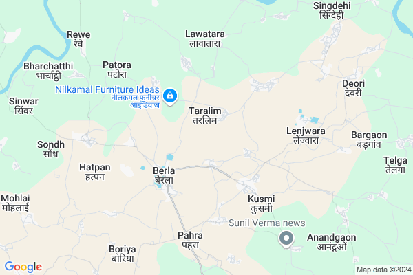
Atargadi
Atargadi Map
EDIT Map
Add Your House
 ..
..
Current Corona Virus Infected Patients Count in Durg District
| City Name | District Name | Total Covid cases |
|---|---|---|
| Bhilai | Durg | 1 |
Locality Name :
Atargadi
( ाटरगाड़ी )
Tehsil Name : Berla
District : Durg
State : Chattisgarh
Language : Chhattisgarhi and Hindi, Urdu
Current Time 05:14 AM
Date: Saturday , May 03,2025 (IST)
Time zone: IST (UTC+5:30)
Elevation / Altitude: 280 meters. Above Seal level
Telephone Code / Std Code: 07825
Assembly constituency : Bemetara assembly constituency
Assembly MLA : Dipesh Sahu
Lok Sabha constituency : Durg parliamentary constituency
Parliament MP : VIJAY BAGHEL
Serpanch Name :
Commodities Prices : Bemetara Market / Mandi
Atargadi Live Weather
Temperature: 30.2 °C
clear sky
Humidity: 41%
Wind : 1.3 mt/sec towards SW
StationName : "BemetÄ\u0081ra"
observed on 1 Hours Back
Temperature: 30.2 °C
clear sky
Humidity: 41%
Wind : 1.3 mt/sec towards SW
StationName : "BemetÄ\u0081ra"
observed on 1 Hours Back
Atargadi Weather Forecast for Next 5 days
04-05-2025
26.5°C to 39.0°C
clear sky, scattered clouds, light rain, broken clouds, few clouds
26.5°C to 39.0°C
clear sky, scattered clouds, light rain, broken clouds, few clouds
05-05-2025
27.5°C to 40.5°C
few clouds, clear sky, light rain, overcast clouds, broken clouds
27.5°C to 40.5°C
few clouds, clear sky, light rain, overcast clouds, broken clouds
06-05-2025
28.4°C to 41.9°C
broken clouds, few clouds, clear sky, scattered clouds
28.4°C to 41.9°C
broken clouds, few clouds, clear sky, scattered clouds
07-05-2025
28.8°C to 42.1°C
clear sky, few clouds, scattered clouds
28.8°C to 42.1°C
clear sky, few clouds, scattered clouds
Rivers Near Atargadi
Shivnath :Seonath
Kharun River
Shivnath :Seonath
Kharun River
About Atargadi
Correct below Info and add more info about AtargadiAtargadi is a Village in Berla Tehsil in Durg District of Chattisgarh State, India. It is located 53 KM towards North from District head quarters Durg. 41 KM from State capital Raipur
Atargadi is surrounded by Saja Tehsil towards west , Dhamdha Tehsil towards South , Bemetara Tehsil towards North , Dharsiwa Tehsil towards South .
Bemetra , Tilda Newra , Birgaon , Raipur are the near by Cities to Atargadi.
Atargadhi 2011 Census Details
Atargadi Local Language is Chhattisgarhi. Atargadhi Village Total population is 764 and number of houses are 133. Female Population is 50.8%. Village literacy rate is 49.9% and the Female Literacy rate is 20.5%.
Population
| Census Parameter | Census Data |
| Total Population | 764 |
| Total No of Houses | 133 |
| Female Population % | 50.8 % ( 388) |
| Total Literacy rate % | 49.9 % ( 381) |
| Female Literacy rate | 20.5 % ( 157) |
| Scheduled Tribes Population % | 1.8 % ( 14) |
| Scheduled Caste Population % | 53.0 % ( 405) |
| Working Population % | 50.0 % |
| Child(0 -6) Population by 2011 | 128 |
| Girl Child(0 -6) Population % by 2011 | 52.3 % ( 67) |
Atargadhi Census More Deatils.
Politics in Atargadi
Bharatiya Janata Party , BJP , INC are the major political parties in this area.Polling Stations /Booths near Atargadi
1)Taralim2)Bhalesar
3)Sondh
4)Surholi
5)Bemetra
HOW TO REACH Atargadi
By Rail
There is no railway station near to Atargadi in less than 10 km.Pincodes near Atargadi
491332 ( Berla ) , 491335 ( Bemetara ) , 490036 ( Nandini )Colleges near Atargadi
Govt College Armarikala
Address :
Demo Mobile Colllege
Address :
Chhattisgarh Institute Of Management And Technology Bhilai
Address :
Gov.collage Of Art,commerce & Seince Jamgaon R
Address : Jamgaon R , Patan ,durg ,chattisgarh
Govt. College Bori Bujurg
Address : Vill & Post-bori
thana- Bori
dist- Durg
chattisgarh
pin-491001
Schools near Atargadi
Govt.ms Singdehi (ssa)
Address : singhdehi , berla , durg , Chattisgarh . PIN- 491332 , Post - Berla
Govt.ms Silghat (ssa)
Address : silghat , berla , durg , Chattisgarh . PIN- 491332 , Post - Berla
Govt Ms Kumhi (ssa)
Address : kumhi , berla , durg , Chattisgarh . PIN- 490036 , Post - Nandini
Govt Ms Bawanlakh (ssa)
Address : bawanlakh , berla , durg , Chattisgarh . PIN- 491332 , Post - Berla
Govt Health Centers near Atargadi
1) SHC Bhilori , SUB HEALTH CENTER-BHILORI , ABADI PARA , MIDILE SCHOOL,BHILORI2) CHC Berla , COMMUNITY HEALTH CENTER-BERLA , HOSPITAL COLONY WORD NO. - 06 , BEMETARA ROAD
3) PHC Devrbija , PRIMARY HEALTH CENTER-DEVRBIJA , ABADI PARA , DURG-BEMETARA ROAD
Petrol Bunks in Atargadi,Berla
HP PETROL PUMP - JYOTI FUELS
HP Petrol Pump Berla; Tehsil Berla; Raipur; Chhattisgarh 491332; India
2.6 KM distance Detail
more ..
Schools in Atargadi,Berla
Uday Academic School
Near water Tank; Bemetara Road; Nagar Berla; Dist; Chhattisgarh 491332; India
3.1 KM distance Detail
Shree Swaminarayan Gurukul International School
Village : Bansa; Kusmi; Dist. Durg; Raipur; Berla; Chhattisgarh 491332; India
3.3 KM distance Detail
About Atargadi &
History
How to reach Atargadi
Tourist Places Near By Atargadi
Schools in Atargadi
Colleges in Atargadi
Temperature & weather of Atargadi
places in Atargadi
Atargadi photos
More Information
How to reach Atargadi
Tourist Places Near By Atargadi
Schools in Atargadi
Colleges in Atargadi
Temperature & weather of Atargadi
places in Atargadi
Atargadi photos
More Information
Village Talk
Post News or Events about this Village
Near Cities
Bemetra 20 KM near
Tilda Newra 32 KM near
Birgaon 33 KM near
Raipur 38 KM near
Bemetra 20 KM near
Tilda Newra 32 KM near
Birgaon 33 KM near
Raipur 38 KM near
Near By Taluks
Berla 0 KM near
Saja 23 KM near
Dhamdha 24 KM near
Bemetara 25 KM near
Berla 0 KM near
Saja 23 KM near
Dhamdha 24 KM near
Bemetara 25 KM near
Near By Air Ports
Raipur Airport 52 KM near
Jabalpur Airport 229 KM near
Sonegaon Airport 288 KM near
Khajuraho Airport 446 KM near
Raipur Airport 52 KM near
Jabalpur Airport 229 KM near
Sonegaon Airport 288 KM near
Khajuraho Airport 446 KM near
Near By Tourist Places
Raipur 38 KM near
Bhilai 43 KM near
Durg 50 KM near
Kawardha 65 KM near
Rajnandgaon 77 KM near
Raipur 38 KM near
Bhilai 43 KM near
Durg 50 KM near
Kawardha 65 KM near
Rajnandgaon 77 KM near
Near By Districts
Raipur 40 KM near
Durg 50 KM near
Kabirdham 66 KM near
Rajnandgaon 77 KM near
Raipur 40 KM near
Durg 50 KM near
Kabirdham 66 KM near
Rajnandgaon 77 KM near
Near By RailWay Station
Tilda Rail Way Station 34 KM near
Raipur Junction Rail Way Station 38 KM near
Tilda Rail Way Station 34 KM near
Raipur Junction Rail Way Station 38 KM near