| Home | City Bus | Maps | Villages | Cities | Rail | Tourist Places | School | College | Pin Codes | Corona Cases Count |
| Distance Calculator Bus Services IFSC Codes Trace Mobile Number Weather Search Place Trace IP Available Cash ATM/Banks Locate Polling Booth Report an Error contact People |
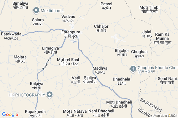
Vangad Map
EDIT Map
Add Your House
 ..
..
Current Corona Virus Infected Patients Count in Dohad District
| City Name | District Name | Total Covid cases |
|---|
Locality Name :
Vangad
( વાંગડ )
Taluka Name : Fatepura
District : Dohad
State : Gujarat
Language : Gujarati and Hindi
Current Time 01:02 AM
Date: Sunday , May 04,2025 (IST)
Time zone: IST (UTC+5:30)
Elevation / Altitude: 345 meters. Above Seal level
Telephone Code / Std Code: 02675
Assembly constituency : Fatepura assembly constituency
Assembly MLA : Katara Rameshbhai Bhurabhai
Lok Sabha constituency : Dahod parliamentary constituency
Parliament MP : JASHVANTSINH SUMANBHAI BHABHOR
Serpanch Name :
Pin Code : 389172
Post Office Name : Fatepura (Dahod)
Commodities Prices : Jhalod Market / Mandi
Vangad Live Weather
Temperature: 28.9 °C
clear sky
Humidity: 50%
Wind : 6.94 mt/sec towards SW
StationName : "KushÄ\u0081lgarh"
observed on 16 Mins Back
Temperature: 28.9 °C
clear sky
Humidity: 50%
Wind : 6.94 mt/sec towards SW
StationName : "KushÄ\u0081lgarh"
observed on 16 Mins Back
Vangad Weather Forecast for Next 5 days
04-05-2025
28.1°C to 29.2°C
clear sky
28.1°C to 29.2°C
clear sky
05-05-2025
25.8°C to 37.9°C
few clouds, overcast clouds, broken clouds, light rain, moderate rain
25.8°C to 37.9°C
few clouds, overcast clouds, broken clouds, light rain, moderate rain
06-05-2025
25.9°C to 38.6°C
overcast clouds, scattered clouds, light rain, clear sky
25.9°C to 38.6°C
overcast clouds, scattered clouds, light rain, clear sky
07-05-2025
22.0°C to 34.9°C
clear sky, light rain, moderate rain, overcast clouds
22.0°C to 34.9°C
clear sky, light rain, moderate rain, overcast clouds
08-05-2025
21.9°C to 29.6°C
overcast clouds, light rain
21.9°C to 29.6°C
overcast clouds, light rain
Rivers Near Vangad
Pat
Machhan
Pat
Machhan
About Vangad
Correct below Info and add more info about VangadVangad is a Village in Fatepura Taluka in Dohad District of Gujarat State, India. It is located 57 KM towards North from District head quarters Dahod. 3 KM from Fatepura. 168 KM from State capital Gandhinagar
Vangad Pin code is 389172 and postal head office is Fatepura (Dahod).
Madhva ( 2 KM ) , Pipliya ( 2 KM ) , Motirel (east) ( 2 KM ) , Dungra ( 3 KM ) , Karmel ( 3 KM ) are the nearby Villages to Vangad. Vangad is surrounded by Anandpuri Taluka towards North , Santrampur Taluka towards west , Bagidora Taluka towards East , Jhalod Taluka towards South .
Lunawada , Dahod , Sagwara , Banswara are the near by Cities to Vangad.
This Place is in the border of the Dohad District and Banswara District. Banswara District Anandpuri is North towards this place . Also it is in the Border of other district Panch Mahals . It is near to the Rajasthan State Border.
Vangad 2011 Census Details
Vangad Local Language is Gujarati. Vangad Village Total population is 4834 and number of houses are 803. Female Population is 49.1%. Village literacy rate is 54.3% and the Female Literacy rate is 22.5%.
Population
| Census Parameter | Census Data |
| Total Population | 4834 |
| Total No of Houses | 803 |
| Female Population % | 49.1 % ( 2372) |
| Total Literacy rate % | 54.3 % ( 2625) |
| Female Literacy rate | 22.5 % ( 1088) |
| Scheduled Tribes Population % | 98.1 % ( 4742) |
| Scheduled Caste Population % | 1.5 % ( 73) |
| Working Population % | 50.0 % |
| Child(0 -6) Population by 2011 | 873 |
| Girl Child(0 -6) Population % by 2011 | 47.9 % ( 418) |
Vangad Census More Deatils.
Politics in Vangad
Bharatiya Janata Party , BJP , INC are the major political parties in this area.Polling Stations /Booths near Vangad
1)Moli-22)Motirelpurva-5
3)Vandariyapurva
4)Vangad-2
5)Vangad-1
HOW TO REACH Vangad
By Rail
There is no railway station near to Vangad in less than 10 km.Colleges near Vangad
P.t.c College Of Sanjeli
Address :
Govt. Engineering College, Dahod
Address : Opp. Navjivan Arts And Science College,
zalod Raod, Dahod
Arts Commence College Zalod
Address :
Government Engineering College, Dahod
Address : Opp. Navjivan Science Collegedahod-zalod Road,daho
J & R B. Ed. College
Address : Navjeevan Arts & Commerce College Campus, Jhalod R
Schools in Vangad
Butela Faliya
Address : vangad , fatepura , dohad , Gujarat . PIN- 389172 , Post - Fatepura (Dahod)
Garadiya F.varg
Address : vangad , fatepura , dohad , Gujarat . PIN- 389172 , Post - Fatepura (Dahod)
Sukhdev Ashramshala
Address : vangad , fatepura , dohad , Gujarat . PIN- 389172 , Post - Fatepura (Dahod)
Vangad Pr.shala
Address : vangad , fatepura , dohad , Gujarat . PIN- 389180 , Post - Limdi
Govt Health Centers near Vangad
1) Madhva , Madhva , Zalod raod , near primary school2) Ghughas , Ghughas primary Health center , Talgam faliya , Mukhya shala
3) Balaiya , Balaiya Primary Health Center , Fatepura road , Near Nadi
Sub Villages in Vangad
Hospitals in Vangad,Fatepura
Fatehpura Referal Hospital & Primery Health Center
Valundi; Fatehpura; Gujarat 389172; India
3.8 KM distance Detail
more ..
Colleges in Vangad,Fatepura
GIA PVT; INDUSTRIAL TRAINING INSTITUTE. SUKHSAR
Ahmedabad - Zalod Hwy; Sukhsar; Gujarat 389190; India
11.2 KM distance Detail
more ..
Schools in Vangad,Fatepura
Government Higher Secondary School; Fatepura; Science Stream
Karodiya; Gujarat 389172; India
3.4 KM distance Detail
Electronic Shops in Vangad,Fatepura
Navajivan Macinari
Fatepura Rd To Naka Rd; Valundi; Jhalod; Gujarat 389170; India
3.8 KM distance Detail
Local Parks in Vangad,Fatepura
Prabhuta party plot
NR-Agrawal Society; GJ SH 58; Agrawal Society; Jhalod; Gujarat 389170; India
20.4 KM distance Detail
Police Stations near Vangad,Fatepura
Sukhsar Police Station
Ahmedabad - Zalod Hwy; Sukhsar; Gujarat 389190; India
11.2 KM distance Detail
Governement Offices near Vangad,Fatepura
Mamalatdar & Executive Magistrate Kacheri
Valundi; Fatehpura; Gujarat 389172; India
3.6 KM distance Detail
About Vangad &
History
How to reach Vangad
Tourist Places Near By Vangad
Schools in Vangad
Colleges in Vangad
Temperature & weather of Vangad
places in Vangad
Vangad photos
More Information
How to reach Vangad
Tourist Places Near By Vangad
Schools in Vangad
Colleges in Vangad
Temperature & weather of Vangad
places in Vangad
Vangad photos
More Information
Village Talk
Post News or Events about this Village
Near Cities
Lunawada 51 KM near
Dahod 53 KM near
Sagwara 55 KM near
Banswara 58 KM near
Lunawada 51 KM near
Dahod 53 KM near
Sagwara 55 KM near
Banswara 58 KM near
Near By Taluks
Fatepura 3 KM near
Anandpuri 20 KM near
Santrampur 21 KM near
Bagidora 23 KM near
Fatepura 3 KM near
Anandpuri 20 KM near
Santrampur 21 KM near
Bagidora 23 KM near
Near By Air Ports
Vadodara Airport 148 KM near
Ahmedabad Airport 165 KM near
Dabok Airport 174 KM near
Indore Airport 210 KM near
Vadodara Airport 148 KM near
Ahmedabad Airport 165 KM near
Dabok Airport 174 KM near
Indore Airport 210 KM near
Near By Tourist Places
Dahod 50 KM near
Banswara 58 KM near
Dungarpur 85 KM near
Champaner 110 KM near
Pavagadh 114 KM near
Dahod 50 KM near
Banswara 58 KM near
Dungarpur 85 KM near
Champaner 110 KM near
Pavagadh 114 KM near
Near By Districts
Dohad 55 KM near
Banswara 60 KM near
Panch Mahals 75 KM near
Jhabua 84 KM near
Dohad 55 KM near
Banswara 60 KM near
Panch Mahals 75 KM near
Jhabua 84 KM near
Near By RailWay Station
Dahod Rail Way Station 52 KM near
Meghnagar Rail Way Station 68 KM near
Dahod Rail Way Station 52 KM near
Meghnagar Rail Way Station 68 KM near