| Home | City Bus | Maps | Villages | Cities | Rail | Tourist Places | School | College | Pin Codes | Corona Cases Count |
| Distance Calculator Bus Services IFSC Codes Trace Mobile Number Weather Search Place Trace IP Available Cash ATM/Banks Locate Polling Booth Report an Error contact People |
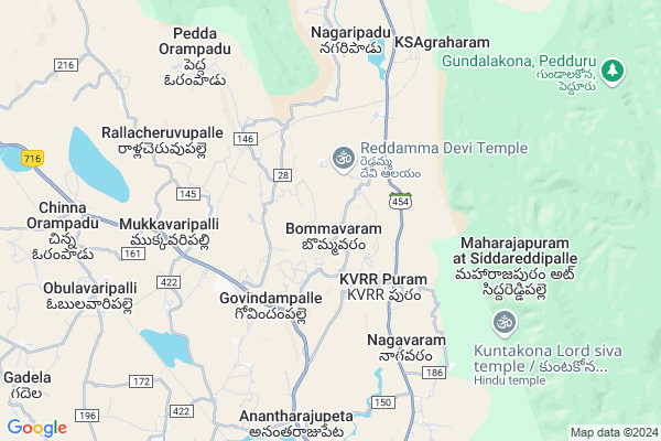
Kalva Hw
Kalva Hw Map
EDIT Map
Add Your House
 ..
..
Current Corona Virus Infected Patients Count in Cuddapah District
| City Name | District Name | Total Covid cases |
|---|
Locality Name :
Kalva Hw
( కాల్వ Hw )
Mandal Name : Obulavaripalle
District : Cuddapah
State : Andhra Pradesh
Region : Rayalaseema
Language : Telugu and Urdu
Current Time 02:09 PM
Date: Friday , May 02,2025 (IST)
Time zone: IST (UTC+5:30)
Elevation / Altitude: 191 meters. Above Seal level
Telephone Code / Std Code: 08621
Assembly constituency : assembly constituency
Assembly MLA :
Lok Sabha constituency : parliamentary constituency
Parliament MP : P.V.MIDHUN REDDY
Serpanch Name :
Pin Code : 516110
Post Office Name : Peddarachapalli
Main Village Name : Bommavaram
Commodities Prices : Tirupati Market / Mandi
Rivers Near Kalva Hw
Cheyyeru
Mandavi River
Cheyyeru
Mandavi River
About Kalva Hw
Correct below Info and add more info about Kalva HwKalva Hw is a small Village/hamlet in Obulavaripalle Mandal in Cuddapah District of Andhra Pradesh State, India. It comes under Bommavaram Panchayath. It belongs to Rayalaseema region . It is located 83 KM towards East from District head quarters Kadapa. 6 KM from Obulavaripalli. 446 KM from State capital Hyderabad
Kalva Hw Pin code is 516110 and postal head office is Peddarachapalli .
Kalva Hw is surrounded by Kodur Mandal towards South , Chitvel Mandal towards North , Pullampeta Mandal towards west , Dakkili Mandal towards East .
Venkatagiri , Tirupati , Renigunta , Srikalahasti are the near by Cities to Kalva Hw.
Demographics of Kalva Hw
Telugu is the Local Language here. Total population of Kalva Hw is 4871 .Males are 2499 and Females are 2,372 living in 1117 Houses. Total area of Kalva Hw is 1626 hectares.HOW TO REACH Kalva Hw
By Road
Cuddapah is the Nearest Town to Kalva Hw. Cuddapah is 81 km from Kalva Hw. Road connectivity is there from Cuddapah to Kalva Hw.By Rail
Anantarajupet Rail Way Station , Obulavaripalli Rail Way Station are the very nearby railway stations to Kalva Hw. Also you can consider railway Stations from Near By town Cuddapah. Kadapa Rail Way Station , Krishnapuram Rail Way Station are the railway Stations near to Cuddapah. You can reach from Cuddapah to Kalva Hw by road after .By Bus
Koduru APSRTC Bus Station , Rajampet Bypass APSRTC Bus Station , Rajampet APSRTC Bus Station are the nearby by Bus Stations to Kalva Hw .APSRTC runs Number of busses from major cities to here.Colleges near Kalva Hw
Palakondraya Degree College
Address :
Govt.junior College
Address :
Schools in Kalva Hw
Zphs Bommavaram
Address : bommavaram , obulavaripalli , cuddapah , Andhra Pradesh . PIN- 516110 , Post - Peddarachapalli
Zphs Rachapalli (bp)
Address : bommavaram , obulavaripalli , cuddapah , Andhra Pradesh . PIN- 516110 , Post - Peddarachapalli
Govt Health Centers near Kalva Hw
1) Thummakonda , , ,2) Nagavaram , , Panthagani HW , Sreeramulu temple
3) B.P.Rachapalli , , 1ST STREET , BESIDE PANCHAYATH
Hospitals in Kalva Hw,Obulavaripalle
Govt. Veterinary Hostipal
Koduru;; Jagadampalli; Koduru; Andhra Pradesh 516101; India
12.8 KM distance Detail
Vishnu Nursing home; Railway Koduru
10/182; Kadapa - Tirupati Rd; Sodisetti nagar; Jagadampalli; Koduru; Andhra Pradesh 516101; India
12.8 KM distance Detail
Renigunta Hospital
Sodisetti nagar; Jagadampalli; Koduru; Andhra Pradesh 516101; India
12.8 KM distance Detail
more ..
Petrol Bunks in Kalva Hw,Obulavaripalle
HP Petrol Pump
Village Raghavrajapuram ON Kodur-kadapa sh-31) RLY Town; Kodur Rd; Kadapa; Andhra Pradesh 516101; India
11.5 KM distance Detail
more ..
Colleges in Kalva Hw,Obulavaripalle
Horticulture College and Research Institurte
Kadapa - Tirupati Rd; Anantharajupeta; Andhra Pradesh 516105; India
8.3 KM distance Detail
Govt. Horticulture College
Horticultural College Rd; Anantharajupeta; Andhra Pradesh 516105; India
8.3 KM distance Detail
Academic block; College of Horticulture
Anantharajupeta; Andhra Pradesh 516105; India
8.3 KM distance Detail
more ..
Schools in Kalva Hw,Obulavaripalle
Elementry school chinnaracha palli
B.P.Rachapalli Kothapalli Rd; B P Rachapalli Kothapalli; Andhra Pradesh 516110; India
2.0 KM distance Detail
Electronic Shops in Kalva Hw,Obulavaripalle
SRI VENKATESWARA A/C MART
10/362; MG Rd; Jagadampalli; Koduru; Andhra Pradesh 516101; India
12.8 KM distance Detail
Police Stations near Kalva Hw,Obulavaripalle
Police Station
9/63; Kadapa - Tirupati Rd; Jagadampalli; Koduru; Andhra Pradesh 516101; India
13.6 KM distance Detail
Governement Offices near Kalva Hw,Obulavaripalle
MEESEVA CENTER
Beside Aronodaya School; Venkatarajupalli; Chitvel; Y S R Kadapa; Venkataraju Palli; Andhra Pradesh 516110; India
6.1 KM distance Detail
MeeSeva Center
H No.8/128;Y Kota X Road;Anantarajupeta ; Rly Kodur ;Y S R Kadapa.; Andhra Pradesh 516105; India
8.0 KM distance Detail
About Kalva Hw &
History
How to reach Kalva Hw
Tourist Places Near By Kalva Hw
Schools in Kalva Hw
Colleges in Kalva Hw
Temperature & weather of Kalva Hw
places in Kalva Hw
Kalva Hw photos
More Information
How to reach Kalva Hw
Tourist Places Near By Kalva Hw
Schools in Kalva Hw
Colleges in Kalva Hw
Temperature & weather of Kalva Hw
places in Kalva Hw
Kalva Hw photos
More Information
Village Talk
Post News or Events about this Village
Near Cities
Venkatagiri 31 KM near
Tirupati 52 KM near
Renigunta 56 KM near
Srikalahasti 58 KM near
Venkatagiri 31 KM near
Tirupati 52 KM near
Renigunta 56 KM near
Srikalahasti 58 KM near
Near By Taluks
Obulavaripalle 6 KM near
Kodur 12 KM near
Chitvel 14 KM near
Pullampeta 17 KM near
Obulavaripalle 6 KM near
Kodur 12 KM near
Chitvel 14 KM near
Pullampeta 17 KM near
Near By Air Ports
Tirupati Airport 58 KM near
Chennai Airport 167 KM near
Bengaluru International Airport 225 KM near
Salem Airport 332 KM near
Tirupati Airport 58 KM near
Chennai Airport 167 KM near
Bengaluru International Airport 225 KM near
Salem Airport 332 KM near
Near By Tourist Places
Tirupati 54 KM near
Srikalahasti 57 KM near
Kadapa 80 KM near
Nellore 89 KM near
Chittoor 108 KM near
Tirupati 54 KM near
Srikalahasti 57 KM near
Kadapa 80 KM near
Nellore 89 KM near
Chittoor 108 KM near
Near By Districts
Cuddapah 79 KM near
Spsr Nellore 89 KM near
Chittoor 110 KM near
Thiruvallur 132 KM near
Cuddapah 79 KM near
Spsr Nellore 89 KM near
Chittoor 110 KM near
Thiruvallur 132 KM near
Near By RailWay Station
Anantarajupet Rail Way Station 9.1 KM near
Koduru Rail Way Station 13 KM near
Razampeta Rail Way Station 27 KM near
Anantarajupet Rail Way Station 9.1 KM near
Koduru Rail Way Station 13 KM near
Razampeta Rail Way Station 27 KM near