| Home | City Bus | Maps | Villages | Cities | Rail | Tourist Places | School | College | Pin Codes | Corona Cases Count |
| Distance Calculator Bus Services IFSC Codes Trace Mobile Number Weather Search Place Trace IP Available Cash ATM/Banks Locate Polling Booth Report an Error contact People |
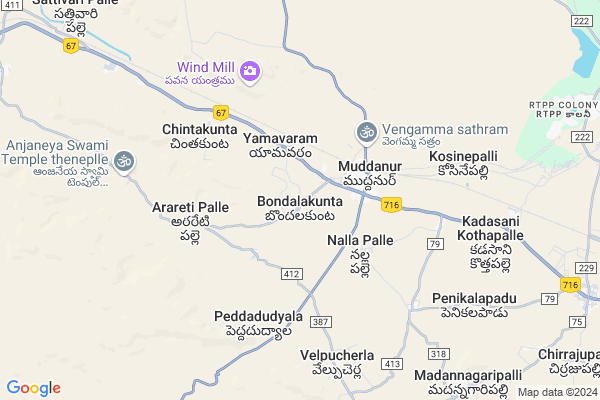
Uppalur
Uppalur Map
EDIT Map
Add Your House
 ..
..
Current Corona Virus Infected Patients Count in Cuddapah District
| City Name | District Name | Total Covid cases |
|---|
Locality Name :
Uppalur
( ఉప్పలూర్ )
Mandal Name : Muddanur
District : Cuddapah
State : Andhra Pradesh
Region : Rayalaseema
Language : Telugu and Urdu
Current Time 08:21 PM
Date: Thursday , May 01,2025 (IST)
Time zone: IST (UTC+5:30)
Elevation / Altitude: 194 meters. Above Seal level
Telephone Code / Std Code: 08560
Assembly constituency : assembly constituency
Assembly MLA : Mule Sudheer Reddy
Lok Sabha constituency : parliamentary constituency
Parliament MP : Y.S.Avinash Reddy
Serpanch Name :
Pin Code : 516380
Post Office Name : Muddanur
Alternate Village Name : Uppalur Pedduru, Uppalur Thogata
Commodities Prices : Cuddapah Market / Mandi
Uppalur Live Weather
Temperature: 33.8 °C
broken clouds
Humidity: 34%
Wind : 5.47 mt/sec towards E
StationName : "Jammalamadugu"
observed on 45 Mins Back
Temperature: 33.8 °C
broken clouds
Humidity: 34%
Wind : 5.47 mt/sec towards E
StationName : "Jammalamadugu"
observed on 45 Mins Back
Uppalur Weather Forecast for Next 5 days
02-05-2025
31.0°C to 32.1°C
broken clouds
31.0°C to 32.1°C
broken clouds
03-05-2025
30.0°C to 40.9°C
broken clouds, scattered clouds, few clouds, clear sky
30.0°C to 40.9°C
broken clouds, scattered clouds, few clouds, clear sky
04-05-2025
31.5°C to 41.4°C
broken clouds, clear sky, few clouds, light rain, overcast clouds
31.5°C to 41.4°C
broken clouds, clear sky, few clouds, light rain, overcast clouds
05-05-2025
29.7°C to 41.4°C
overcast clouds, broken clouds, few clouds, scattered clouds
29.7°C to 41.4°C
overcast clouds, broken clouds, few clouds, scattered clouds
06-05-2025
30.7°C to 41.7°C
few clouds, clear sky, scattered clouds, broken clouds
30.7°C to 41.7°C
few clouds, clear sky, scattered clouds, broken clouds
Edit below overview about Uppalur
Edit below overview about Uppalur
OverView of Uppalur
In Uppalur there are so many weavers are there.
It is a one of big,developed village in muddanur mandal.
temples like Rama, chowdeswary Devi, hanuman, Shiva located in Uppalur.
Uppalur is the combination of two parts called Pedduru and Thogatapeta.
There is good bus facility from Uppalur to Proddatur, Muddanur.
In olden days there is a cinema hall in Uppalur.
The total Population of Uppalur approximately 5000.
Uppalur is the major Panchayath in Muddanur mandal.
In Uppalur Panchayath villages like Chinnakattera palli, Akuthota palli are under Uppalur village.
Z.P.H.School, M.P.P.School, Anganwadi school, are there in Uppalur.
Edit below overview about Uppalur
National Highways Reachable To Uppalur
Nationa High Way :NH67
Nationa High Way :NH167B
Nationa High Way :NH67
Nationa High Way :NH167B
Rivers Near Uppalur
Pinākinī :Penna :ಪೆನ್ನಾ :పెన్నా
Pinākinī :Penna :ಪೆನ್ನಾ :పెన్నా
Pinākinī :Penna :ಪೆನ್ನಾ :పెన్నా
Pinākinī :Penna :ಪೆನ್ನಾ :పెన్నా
About Uppalur
Uppalur is a Village in Muddanur Mandal in Cuddapah District of Andhra Pradesh State, India. It belongs to Rayalaseema region . It is located 64 KM towards west from District head quarters Kadapa. 352 KM from State capital Hyderabad
Uppalur Pin code is 516380 and postal head office is Muddanur .
Uppalur is surrounded by Jammalamadugu Mandal towards North , Yerraguntla Mandal towards East , Simhadripuram Mandal towards west , Thondur Mandal towards South .
Jammalamadugu , Proddatur , Yerraguntla , Tadpatri are the near by Cities to Uppalur.
Uppalur 2011 Census Details
Uppalur Local Language is Telugu. Uppalur Village Total population is 3317 and number of houses are 822. Female Population is 49.4%. Village literacy rate is 55.6% and the Female Literacy rate is 22.4%.
Population
| Census Parameter | Census Data |
| Total Population | 3317 |
| Total No of Houses | 822 |
| Female Population % | 49.4 % ( 1637) |
| Total Literacy rate % | 55.6 % ( 1844) |
| Female Literacy rate | 22.4 % ( 742) |
| Scheduled Tribes Population % | 0.3 % ( 9) |
| Scheduled Caste Population % | 3.7 % ( 122) |
| Working Population % | 60.4 % |
| Child(0 -6) Population by 2011 | 387 |
| Girl Child(0 -6) Population % by 2011 | 47.3 % ( 183) |
Uppalur Census More Deatils.
HOW TO REACH Uppalur
By Road
Proddatur is the Nearest Town to Uppalur. Road connectivity is there from Proddatur to Uppalur.By Rail
Muddanuru Rail Way Station is the very nearby railway stations to Uppalur.By Bus
Muddanur APSRTC Bus Station , Chilamkur APSRTC Bus Station , Mallela APSRTC Bus Station are the nearby by Bus Stations to Uppalur .APSRTC runs Number of busses from major cities to here.Colleges near Uppalur
Sri Vivekavardhani Jr Coll,muddanur
Address : Muddanur
Schools in Uppalur
Zphs Uppalur
Address : uppalur , muddanur , cuddapah , Andhra Pradesh . PIN- 516380 , Post - Muddanur
Govt Health Centers near Uppalur
1) Yaamavaram , 3-116 , YAMAVARAM MAIN ROAD , NEAR TEMPLE2) Muddanur - 1 , 1-117 , Venkata Reddy colony , Near Masid
3) Muddanur - 2 , 5-175 , AMMAVARISALA BACK SIDE , Near Masid
Sub Villages in Uppalur
Hospitals in Uppalur,Muddanur
Pullareddy Hospital
Jammalamadugu - Muddanur Rd; Muddanur; Andhra Pradesh 516380; India
3.1 KM distance Detail
muddanur govrnment hospital
Jammalamadugu - Muddanur Rd; Muddanur; Andhra Pradesh 516380; India
3.2 KM distance Detail
Mandal Primary Health Centre
Kadapa; SH-28; Jammalamadugu Muddanur Road; Muddanur; Muddanur; Andhra Pradesh 516380; India
3.2 KM distance Detail
more ..
Petrol Bunks in Uppalur,Muddanur
HP PETROL PUMP - SAI SUDHA FILLING STATION
Hpcl Dealers Bondalakunta Village Muddanur; Kadapa; Andhra Pradesh 516380; India
1.9 KM distance Detail
more ..
Colleges in Uppalur,Muddanur
Vantigari Palli Village
Vantigari palli; Main Rd; Uppalur; Andhra Pradesh 516339; India
14.6 KM distance Detail
more ..
Super Markets in Uppalur,Muddanur
Sree Provisanal Stores Chelamkur Icl
Chilamakuru; Andhra Pradesh 516311; India
11.9 KM distance Detail
Local Parks in Uppalur,Muddanur
Occ Grounds
V V Reddy Colony - RTPP Staff Quarters; RTPP Colony; Andhra Pradesh 516312; India
12.1 KM distance Detail
RTPP Childrens Park
V V Reddy Colony - RTPP Staff Quarters; RTPP Colony; Andhra Pradesh 516310; India
12.4 KM distance Detail
Governement Offices near Uppalur,Muddanur
EXCISE AND PROBISINARY OFFICE MUDDANUR
Muddanur; Andhra Pradesh 516380; India
3.4 KM distance Detail
About Uppalur &
History
How to reach Uppalur
Tourist Places Near By Uppalur
Schools in Uppalur
Colleges in Uppalur
Temperature & weather of Uppalur
places in Uppalur
Uppalur photos
More Information
How to reach Uppalur
Tourist Places Near By Uppalur
Schools in Uppalur
Colleges in Uppalur
Temperature & weather of Uppalur
places in Uppalur
Uppalur photos
More Information
Village Talk
Post News or Events about this Village
Near Cities
Jammalamadugu 20 KM near
Proddatur 20 KM near
Yerraguntla 21 KM near
Tadpatri 51 KM near
Jammalamadugu 20 KM near
Proddatur 20 KM near
Yerraguntla 21 KM near
Tadpatri 51 KM near
Near By Taluks
Muddanur 0 KM near
Jammalamadugu 16 KM near
Yerraguntla 16 KM near
Thondur 22 KM near
Muddanur 0 KM near
Jammalamadugu 16 KM near
Yerraguntla 16 KM near
Thondur 22 KM near
Near By Air Ports
Tirupati Airport 192 KM near
Bengaluru International Airport 201 KM near
Chennai Airport 302 KM near
Rajiv Gandhi International Airport 318 KM near
Tirupati Airport 192 KM near
Bengaluru International Airport 201 KM near
Chennai Airport 302 KM near
Rajiv Gandhi International Airport 318 KM near
Near By Tourist Places
Kadapa 60 KM near
Puttaparthi 94 KM near
Horsley Hills 128 KM near
Lepakshi 142 KM near
Kurnool 146 KM near
Kadapa 60 KM near
Puttaparthi 94 KM near
Horsley Hills 128 KM near
Lepakshi 142 KM near
Kurnool 146 KM near
Near By Districts
Cuddapah 61 KM near
Anantapur 93 KM near
Kurnool 146 KM near
Chikballapur 174 KM near
Cuddapah 61 KM near
Anantapur 93 KM near
Kurnool 146 KM near
Chikballapur 174 KM near
Near By RailWay Station
Muddanuru Rail Way Station 3.5 KM near
Yerraguntla Junction Rail Way Station 20 KM near
Muddanuru Rail Way Station 3.5 KM near
Yerraguntla Junction Rail Way Station 20 KM near