| Home | City Bus | Maps | Villages | Cities | Rail | Tourist Places | School | College | Pin Codes | Corona Cases Count |
| Distance Calculator Bus Services IFSC Codes Trace Mobile Number Weather Search Place Trace IP Available Cash ATM/Banks Locate Polling Booth Report an Error contact People |
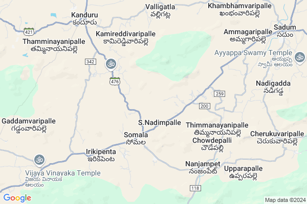
Vootupalle
Vootupalle Map
EDIT Map
Add Your House
 ..
..
Current Corona Virus Infected Patients Count in Chittoor District
| City Name | District Name | Total Covid cases |
|---|---|---|
| Chittoor District | Chittoor | 59 |
| Thyagaraja Nagar,Tirupathi | Chittoor | 3 |
| Srikalahasti | Chittoor | 3 |
| Nagiri | Chittoor | 2 |
| Chinna Masjid | Chittoor | 1 |
| Keelapattu nagari | Chittoor | 1 |
| Renigunta | Chittoor | 1 |
| Vadamalapeta | Chittoor | 1 |
| Tirupati | Chittoor | 1 |
| Nindra | Chittoor | 1 |
Locality Name :
Vootupalle
( ఊటుపల్లె )
Mandal Name : Somala
District : Chittoor
State : Andhra Pradesh
Region : Rayalaseema
Language : Telugu and Urdu
Current Time 11:19 PM
Date: Friday , May 02,2025 (IST)
Time zone: IST (UTC+5:30)
Elevation / Altitude: 537 meters. Above Seal level
Telephone Code / Std Code: 08583
Assembly constituency : assembly constituency
Assembly MLA : PEDDIREDDI RAMACHANDRA REDDY
Lok Sabha constituency : parliamentary constituency
Parliament MP : P.V.MIDHUN REDDY
Serpanch Name :
Main Village Name : Mittapalle
Commodities Prices : Kalikiri Market / Mandi
Vootupalle Live Weather
Temperature: 25.8 °C
broken clouds
Humidity: 48%
Wind : 1.41 mt/sec towards SE
StationName : "Punganūru"
observed on 1 Hours Back
Temperature: 25.8 °C
broken clouds
Humidity: 48%
Wind : 1.41 mt/sec towards SE
StationName : "Punganūru"
observed on 1 Hours Back
Vootupalle Weather Forecast for Next 5 days
03-05-2025
24.9°C to 26.5°C
light rain, broken clouds
24.9°C to 26.5°C
light rain, broken clouds
04-05-2025
23.9°C to 38.2°C
overcast clouds, few clouds, clear sky, broken clouds, scattered clouds, light rain
23.9°C to 38.2°C
overcast clouds, few clouds, clear sky, broken clouds, scattered clouds, light rain
05-05-2025
25.4°C to 32.8°C
overcast clouds, light rain
25.4°C to 32.8°C
overcast clouds, light rain
06-05-2025
24.3°C to 38.3°C
broken clouds, clear sky, few clouds, overcast clouds
24.3°C to 38.3°C
broken clouds, clear sky, few clouds, overcast clouds
07-05-2025
26.0°C to 38.7°C
overcast clouds, broken clouds, few clouds
26.0°C to 38.7°C
overcast clouds, broken clouds, few clouds
National Highways Reachable To Vootupalle
Nationa High Way :NH140
Nationa High Way :NH71
Nationa High Way :NH140
Nationa High Way :NH71
Rivers Near Vootupalle
Swarnamukhi
Cheyyeru River
Swarnamukhi
Cheyyeru River
About Vootupalle
Correct below Info and add more info about VootupalleVootupalle is a small Village/hamlet in Somala Mandal in Chittoor District of Andhra Pradesh State, India. It comes under Mittapalle Panchayath. It belongs to Rayalaseema region . It is located 51 KM towards North from District head quarters Chittoor. 506 KM from State capital Hyderabad
Vootupalle is surrounded by Sodam Mandal towards East , Chowdepalle Mandal towards west , Nimmanapalle Mandal towards west , Valmikipuram Mandal towards North .
Punganur , Madanapalle , Chittoor , Mulbagal are the near by Cities to Vootupalle.
Demographics of Vootupalle
Telugu is the Local Language here. Total population of Vootupalle is 1078 .Males are 535 and Females are 543 living in 262 Houses. Total area of Vootupalle is 1019 hectares.HOW TO REACH Vootupalle
By Road
Madanapalle is the Nearest Town to Vootupalle. Madanapalle is 25 km from Vootupalle. Road connectivity is there from Madanapalle to Vootupalle.By Rail
There is no railway station near to Vootupalle in less than 10 km.By Bus
Somala APSRTC Bus Station , Kanduru APSRTC Bus Station , Choudpally APSRTC Bus Station are the nearby by Bus Stations to Vootupalle .APSRTC runs Number of busses from major cities to here.Pincodes near Vootupalle
517257 ( Chowdepalle ) , 517234 ( Kalikiri ) , 517123 ( Sodam )Colleges near Vootupalle
S K V N Govt Junior Col Somala
Address : S K V N Govt Junior Col Somala
Schools in Vootupalle
Mpps Mittapalle
Address : mittapalle , somala , chittoor , Andhra Pradesh . PIN- 517234 , Post - Kalikiri
Govt Health Centers near Vootupalle
1) NELLIMANDA , , , bus stop road2) Somala , , Nanjampeta Road , OPP ZPHS.Somala
3) SOMLA , , Nanjampeta Road , near phcsomala
Schools in Vootupalle,Somala
Electronic Shops in Vootupalle,Somala
Super Markets in Vootupalle,Somala
Local Parks in Vootupalle,Somala
Police Stations near Vootupalle,Somala
Governement Offices near Vootupalle,Somala
About Vootupalle &
History
How to reach Vootupalle
Tourist Places Near By Vootupalle
Schools in Vootupalle
Colleges in Vootupalle
Temperature & weather of Vootupalle
places in Vootupalle
Vootupalle photos
More Information
How to reach Vootupalle
Tourist Places Near By Vootupalle
Schools in Vootupalle
Colleges in Vootupalle
Temperature & weather of Vootupalle
places in Vootupalle
Vootupalle photos
More Information
Village Talk
Post News or Events about this Village
Near Cities
Punganur 34 KM near
Madanapalle 39 KM near
Chittoor 47 KM near
Mulbagal 66 KM near
Punganur 34 KM near
Madanapalle 39 KM near
Chittoor 47 KM near
Mulbagal 66 KM near
Near By Taluks
Somala 0 KM near
Sodam 11 KM near
Chowdepalle 18 KM near
Nimmanapalle 20 KM near
Somala 0 KM near
Sodam 11 KM near
Chowdepalle 18 KM near
Nimmanapalle 20 KM near
Near By Air Ports
Tirupati Airport 89 KM near
Bengaluru International Airport 140 KM near
Chennai Airport 175 KM near
Salem Airport 243 KM near
Tirupati Airport 89 KM near
Bengaluru International Airport 140 KM near
Chennai Airport 175 KM near
Salem Airport 243 KM near
Near By Tourist Places
Chittoor 48 KM near
Horsley Hills 54 KM near
Tirupati 74 KM near
vellore 81 KM near
Thiruthani 104 KM near
Chittoor 48 KM near
Horsley Hills 54 KM near
Tirupati 74 KM near
vellore 81 KM near
Thiruthani 104 KM near
Near By Districts
Chittoor 48 KM near
Vellore 82 KM near
Kolar 94 KM near
Cuddapah 119 KM near
Chittoor 48 KM near
Vellore 82 KM near
Kolar 94 KM near
Cuddapah 119 KM near
Near By RailWay Station
Piler Rail Way Station 23 KM near
Pakala Junction Rail Way Station 36 KM near
Piler Rail Way Station 23 KM near
Pakala Junction Rail Way Station 36 KM near