| Home | City Bus | Maps | Villages | Cities | Rail | Tourist Places | School | College | Pin Codes | Corona Cases Count |
| Distance Calculator Bus Services IFSC Codes Trace Mobile Number Weather Search Place Trace IP Available Cash ATM/Banks Locate Polling Booth Report an Error contact People |
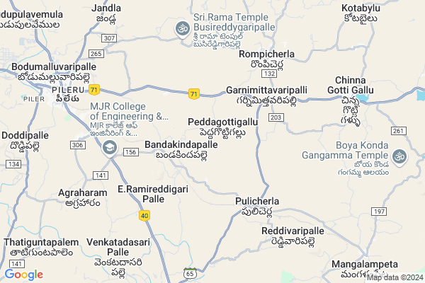
Padamata Hw
Padamata Hw Map
EDIT Map
Add Your House
 ..
..
Current Corona Virus Infected Patients Count in Chittoor District
| City Name | District Name | Total Covid cases |
|---|---|---|
| Chittoor District | Chittoor | 59 |
| Thyagaraja Nagar,Tirupathi | Chittoor | 3 |
| Srikalahasti | Chittoor | 3 |
| Nagiri | Chittoor | 2 |
| Chinna Masjid | Chittoor | 1 |
| Keelapattu nagari | Chittoor | 1 |
| Renigunta | Chittoor | 1 |
| Vadamalapeta | Chittoor | 1 |
| Tirupati | Chittoor | 1 |
| Nindra | Chittoor | 1 |
Locality Name :
Padamata Hw
( పడమట Hw )
Mandal Name : Rompicherla
District : Chittoor
State : Andhra Pradesh
Region : Rayalaseema
Language : Telugu and Urdu
Current Time 02:51 AM
Date: Saturday , May 03,2025 (IST)
Time zone: IST (UTC+5:30)
Elevation / Altitude: 528 meters. Above Seal level
Telephone Code / Std Code: 08584
Assembly constituency : assembly constituency
Assembly MLA : PEDDIREDDI RAMACHANDRA REDDY
Lok Sabha constituency : parliamentary constituency
Parliament MP : P.V.MIDHUN REDDY
Serpanch Name :
Pin Code : 517192
Post Office Name : Rompicherla (Chittoor)
Main Village Name : Peddagottigallu
Commodities Prices : Piler Market / Mandi
Padamata Hw Live Weather
Temperature: 26.0 °C
broken clouds
Humidity: 74%
Wind : 3.35 mt/sec towards SE
StationName : "PÄ\u0081kÄ\u0081la"
observed on 2 Hours Back
Temperature: 26.0 °C
broken clouds
Humidity: 74%
Wind : 3.35 mt/sec towards SE
StationName : "PÄ\u0081kÄ\u0081la"
observed on 2 Hours Back
Padamata Hw Weather Forecast for Next 5 days
03-05-2025
25.3°C to 25.9°C
broken clouds
25.3°C to 25.9°C
broken clouds
04-05-2025
24.4°C to 38.2°C
broken clouds, clear sky, scattered clouds, light rain
24.4°C to 38.2°C
broken clouds, clear sky, scattered clouds, light rain
05-05-2025
24.6°C to 36.1°C
overcast clouds, broken clouds, light rain, moderate rain
24.6°C to 36.1°C
overcast clouds, broken clouds, light rain, moderate rain
06-05-2025
24.5°C to 38.7°C
overcast clouds, few clouds, scattered clouds, broken clouds
24.5°C to 38.7°C
overcast clouds, few clouds, scattered clouds, broken clouds
07-05-2025
26.8°C to 38.1°C
overcast clouds, scattered clouds, light rain
26.8°C to 38.1°C
overcast clouds, scattered clouds, light rain
National Highways Reachable To Padamata Hw
Nationa High Way :NH140
Nationa High Way :NH71
Nationa High Way :NH140
Nationa High Way :NH71
Rivers Near Padamata Hw
Cheyyeru River
Swarnamukhi
Cheyyeru River
Swarnamukhi
About Padamata Hw
Correct below Info and add more info about Padamata HwPadamata Hw is a small Village/hamlet in Rompicherla Mandal in Chittoor District of Andhra Pradesh State, India. It comes under Peddagottigallu Panchayath. It belongs to Rayalaseema region . It is located 55 KM towards North from District head quarters Chittoor. 3 KM from Rompicherla. 493 KM from State capital Hyderabad
Padamata Hw Pin code is 517192 and postal head office is Rompicherla (Chittoor).
Padamata Hw is surrounded by Pulicherla H/O Reddivaripalle Mandal towards South , Piler Mandal towards west , Chinnagottigallu Mandal towards East , Sodam Mandal towards west .
Tirupati , Chittoor , Renigunta , Rayachoti are the near by Cities to Padamata Hw.
Demographics of Padamata Hw
Telugu is the Local Language here. Total population of Padamata Hw is 1329 .Males are 668 and Females are 661 living in 351 Houses. Total area of Padamata Hw is 842 hectares.HOW TO REACH Padamata Hw
By Road
Tirupati is the Nearest Town to Padamata Hw. Tirupati is 45 km from Padamata Hw. Road connectivity is there from Tirupati to Padamata Hw.By Rail
Pulicherla Rail Way Station , Mangalampeta Rail Way Station are the very nearby railway stations to Padamata Hw. Also you can consider railway Stations from Near By town Tirupati. Tirupati Main Rail Way Station , Tirupati West Halt Rail Way Station are the railway Stations near to Tirupati. You can reach from Tirupati to Padamata Hw by road after .By Bus
Rompicherla X Rd APSRTC Bus Station , Piler APSRTC Bus Station , Damalchervu APSRTC Bus Station are the nearby by Bus Stations to Padamata Hw .APSRTC runs Number of busses from major cities to here.Colleges near Padamata Hw
Sri Sai Jr Coll(incentive),rompicherla X Rd
Address : Rompicherla X Rd
Sri Sai Dwaraka Degree College
Address : Rompicherla ?x? Road, Chittoor.
Schools in Padamata Hw
Mpps Mittameedapalle
Address : peddagottigallu , rompicherla , chittoor , Andhra Pradesh . PIN- 517192 , Post - Rompicherla (Chittoor)
Mpps Kondareddipalle
Address : peddagottigallu , rompicherla , chittoor , Andhra Pradesh . PIN- 517192 , Post - Rompicherla (Chittoor)
Mpps Pedddagottogallu
Address : peddagottigallu , rompicherla , chittoor , Andhra Pradesh . PIN- 517192 , Post - Rompicherla (Chittoor)
Govt Health Centers near Padamata Hw
1) PEDDAGOTTIGALLU , , , OHSR2) DEVALAMPETA , - , - , Near Temple
3) MANGALAMPETA , - , Sasthri Colony , Near APSPDCL Sub-Station
Hospitals in Padamata Hw,Rompicherla
Sindhuri convention / gardens bakarapeta
Chennai - Anantapur Hwy; Chittecherla; Andhra Pradesh 517194; India
18.3 KM distance Detail
Sindhuri Gardens Bakarapeta
Chennai - Anantapur Highway; Chittecherla; Andhra Pradesh 517194; India
18.3 KM distance Detail
more ..
Petrol Bunks in Padamata Hw,Rompicherla
Bakhrapeta Petrol Pump
National Highway 205; Bhakarapeta; Andhra Pradesh 517194; India
16.9 KM distance Detail
HP PETROL PUMP - RATNAM PETROLUEM AGENCY
Hpcl Dealers Near Narayana Swamy School; Bakrapet Post; Chinna Gottigallu Mandal; Andhra Pradesh 517194; India
16.9 KM distance Detail
more ..
Schools in Padamata Hw,Rompicherla
M P P School
Poolakuntapalli;Chinnagottigallu(M);Chittoor(D);A.P.; Andhra Pradesh; India
16.1 KM distance Detail
Electronic Shops in Padamata Hw,Rompicherla
Vidyasree xerox ; internet; Books & Western Union Money transfer
Bazar Street; opp state bank of india; Bhakarapeta; Andhra Pradesh 517194; India
17.7 KM distance Detail
Local Parks in Padamata Hw,Rompicherla
Vankireddy & Vayalapati Mango Gardens
Ganugachintha; Andhra Pradesh 517194; India
17.9 KM distance Detail
Kothapalle and Kambham Vari Gardens
Ganugachintha; Andhra Pradesh 517214; India
18.2 KM distance Detail
Governement Offices near Padamata Hw,Rompicherla
MeeSeva Center
1-157; E-Seva Building; Bustand; Yerravaripalem; Yerravaripalem(V); Yerravaripalem(M); Chittoor(D);517194; Andhra Pradesh 517194; India
17.5 KM distance Detail
About Padamata Hw &
History
How to reach Padamata Hw
Tourist Places Near By Padamata Hw
Schools in Padamata Hw
Colleges in Padamata Hw
Temperature & weather of Padamata Hw
places in Padamata Hw
Padamata Hw photos
More Information
How to reach Padamata Hw
Tourist Places Near By Padamata Hw
Schools in Padamata Hw
Colleges in Padamata Hw
Temperature & weather of Padamata Hw
places in Padamata Hw
Padamata Hw photos
More Information
Village Talk
Post News or Events about this Village
Near Cities
Tirupati 47 KM near
Chittoor 52 KM near
Renigunta 59 KM near
Rayachoti 63 KM near
Tirupati 47 KM near
Chittoor 52 KM near
Renigunta 59 KM near
Rayachoti 63 KM near
Near By Taluks
Rompicherla 3 KM near
Pulicherla H/O Reddivaripalle 10 KM near
Piler 11 KM near
Chinnagottigallu 13 KM near
Rompicherla 3 KM near
Pulicherla H/O Reddivaripalle 10 KM near
Piler 11 KM near
Chinnagottigallu 13 KM near
Near By Air Ports
Tirupati Airport 63 KM near
Chennai Airport 160 KM near
Bengaluru International Airport 168 KM near
Salem Airport 267 KM near
Tirupati Airport 63 KM near
Chennai Airport 160 KM near
Bengaluru International Airport 168 KM near
Salem Airport 267 KM near
Near By Tourist Places
Tirupati 48 KM near
Chittoor 52 KM near
Horsley Hills 75 KM near
Srikalahasti 83 KM near
vellore 89 KM near
Tirupati 48 KM near
Chittoor 52 KM near
Horsley Hills 75 KM near
Srikalahasti 83 KM near
vellore 89 KM near
Near By Districts
Chittoor 53 KM near
Vellore 90 KM near
Cuddapah 106 KM near
Thiruvallur 123 KM near
Chittoor 53 KM near
Vellore 90 KM near
Cuddapah 106 KM near
Thiruvallur 123 KM near
Near By RailWay Station
Pulicherla Rail Way Station 4.8 KM near
Piler Rail Way Station 11 KM near
Pakala Junction Rail Way Station 25 KM near
Pulicherla Rail Way Station 4.8 KM near
Piler Rail Way Station 11 KM near
Pakala Junction Rail Way Station 25 KM near