| Home | City Bus | Maps | Villages | Cities | Rail | Tourist Places | School | College | Pin Codes | Corona Cases Count |
| Distance Calculator Bus Services IFSC Codes Trace Mobile Number Weather Search Place Trace IP Available Cash ATM/Banks Locate Polling Booth Report an Error contact People |
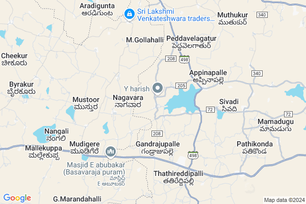
Sankarayalapeta
Sankarayalapeta Map
EDIT Map
Add Your House
 ..
..
Current Corona Virus Infected Patients Count in Chittoor District
| City Name | District Name | Total Covid cases |
|---|---|---|
| Chittoor District | Chittoor | 59 |
| Thyagaraja Nagar,Tirupathi | Chittoor | 3 |
| Srikalahasti | Chittoor | 3 |
| Nagiri | Chittoor | 2 |
| Chinna Masjid | Chittoor | 1 |
| Keelapattu nagari | Chittoor | 1 |
| Renigunta | Chittoor | 1 |
| Vadamalapeta | Chittoor | 1 |
| Tirupati | Chittoor | 1 |
| Nindra | Chittoor | 1 |
Locality Name :
Sankarayalapeta
( సంకరాయలపేట )
Mandal Name : Peddapanjani
District : Chittoor
State : Andhra Pradesh
Region : Rayalaseema
Language : Telugu and Urdu
Current Time 10:46 PM
Date: Saturday , May 03,2025 (IST)
Time zone: IST (UTC+5:30)
Elevation / Altitude: 596 meters. Above Seal level
Telephone Code / Std Code: 08579
Assembly constituency : assembly constituency
Assembly MLA : N VENKATE GOWDA
Lok Sabha constituency : parliamentary constituency
Parliament MP :
Serpanch Name :
Pin Code : 517432
Post Office Name : Kolamasanapalle
Commodities Prices : Mulabagilu Market / Mandi
Sankarayalapeta Live Weather
Temperature: 31.5 °C
overcast clouds
Humidity: 32%
Wind : 1.76 mt/sec towards E
StationName : "Palmaner"
observed on 2 Hours Back
Temperature: 31.5 °C
overcast clouds
Humidity: 32%
Wind : 1.76 mt/sec towards E
StationName : "Palmaner"
observed on 2 Hours Back
Sankarayalapeta Weather Forecast for Next 5 days
04-05-2025
25.6°C to 30.7°C
overcast clouds, moderate rain
25.6°C to 30.7°C
overcast clouds, moderate rain
05-05-2025
24.1°C to 30.7°C
moderate rain, light rain, overcast clouds, broken clouds, scattered clouds
24.1°C to 30.7°C
moderate rain, light rain, overcast clouds, broken clouds, scattered clouds
06-05-2025
23.2°C to 35.3°C
scattered clouds, clear sky, few clouds, light rain, overcast clouds
23.2°C to 35.3°C
scattered clouds, clear sky, few clouds, light rain, overcast clouds
07-05-2025
24.4°C to 35.8°C
scattered clouds, few clouds, broken clouds, overcast clouds
24.4°C to 35.8°C
scattered clouds, few clouds, broken clouds, overcast clouds
08-05-2025
24.3°C to 36.2°C
broken clouds, scattered clouds, few clouds, overcast clouds
24.3°C to 36.2°C
broken clouds, scattered clouds, few clouds, overcast clouds
National Highways Reachable To Sankarayalapeta
Nationa High Way :NH42;NH69
Nationa High Way :NH69
Nationa High Way :NH42;NH69
Nationa High Way :NH69
Rivers Near Sankarayalapeta
Pedda Vanka
Goddu Vanka
Pedda Vanka
Goddu Vanka
About Sankarayalapeta
Correct below Info and add more info about SankarayalapetaSankarayalapeta is a Village in Peddapanjani Mandal in Chittoor District of Andhra Pradesh State, India. It belongs to Rayalaseema region . It is located 64 KM towards west from District head quarters Chittoor. 15 KM from Peddapanjani. 540 KM from State capital Hyderabad
Sankarayalapeta Pin code is 517432 and postal head office is Kolamasanapalle .
Pasupathuru ( 1 KM ) , Gandrajupalle ( 3 KM ) , Sivadi ( 6 KM ) , Peddavelagatur ( 6 KM ) , Keelapalle ( 6 KM ) are the nearby Villages to Sankarayalapeta. Sankarayalapeta is surrounded by Peddapanjani Mandal towards East , Baireddipalle Mandal towards South , Punganur Mandal towards North , Mulbagal Mandal towards west .
Punganur , Mulbagal , Pernampattu , Madanapalle are the near by Cities to Sankarayalapeta.
Sankarayalapeta 2011 Census Details
Sankarayalapeta Local Language is Telugu. Sankarayalapeta Village Total population is 1236 and number of houses are 299. Female Population is 48.8%. Village literacy rate is 74.2% and the Female Literacy rate is 33.9%.
Population
| Census Parameter | Census Data |
| Total Population | 1236 |
| Total No of Houses | 299 |
| Female Population % | 48.8 % ( 603) |
| Total Literacy rate % | 74.2 % ( 917) |
| Female Literacy rate | 33.9 % ( 419) |
| Scheduled Tribes Population % | 0.0 % ( 0) |
| Scheduled Caste Population % | 0.2 % ( 3) |
| Working Population % | 42.2 % |
| Child(0 -6) Population by 2011 | 133 |
| Girl Child(0 -6) Population % by 2011 | 49.6 % ( 66) |
Sankarayalapeta Census More Deatils.
HOW TO REACH Sankarayalapeta
By Road
Punganur is the Nearest Town to Sankarayalapeta. Punganur is 18 km from Sankarayalapeta. Road connectivity is there from Punganur to Sankarayalapeta.By Rail
There is no railway station near to Sankarayalapeta in less than 10 km.By Bus
Punganur APSRTC Bus Station , Bai Reddy Pally APSRTC Bus Station , Bireddypally APSRTC Bus Station are the nearby by Bus Stations to Sankarayalapeta .APSRTC runs Number of busses from major cities to here.Colleges near Sankarayalapeta
Vani Jr College V.kota Chittoor
Address : Behind Mpdo Office
durga Nagar V.kota
Sri Muninarayana Junior College
Address :
Sree Vidya Arts & Science Degree College.
Address :
Priyadarshini
Address :
Amaravathi Degree College. Ramasamudram
Address : Amaravathi Degree College Ramasamudram
Schools in Sankarayalapeta
Jmj.school Guttur
Address : sankarayalapeta , peddapanjani , chittoor , Andhra Pradesh . PIN- 517432 , Post - Kolamasanapalle
Zphs Srpeta
Address : sankarayalapeta , peddapanjani , chittoor , Andhra Pradesh . PIN- 517432 , Post - Kolamasanapalle
Govt Health Centers near Sankarayalapeta
1) GUNDUGALLU , , ,2) GANDRAJUPALLI , , , Bangalore Road
3) NIDIGUNTA , , , OPP to AWW center
Sub Villages in Sankarayalapeta
Petrol Bunks in Sankarayalapeta,Peddapanjani
Indian Oil Petrol Pump Karnataka
Bengaluru - Tirupati Highway; Venkatapura; Karnataka 563132; India
8.2 KM distance Detail
Sri Munivel Filling Station.IOCL BUNK
Karasanapalle; Andhra Pradesh 517247; India
9.4 KM distance Detail
more ..
Colleges in Sankarayalapeta,Peddapanjani
LRS Palamaner AH Polytechnic College
Krishnagiri-Palamaner Hwy; Andhra Pradesh 517432; India
16.0 KM distance Detail
more ..
Schools in Sankarayalapeta,Peddapanjani
Sai English medium School
4th Cross Rd; Swarna Nagar; Kolar Gold Fields; Karnataka 563122; India
6.4 KM distance Detail
Super Markets in Sankarayalapeta,Peddapanjani
Areppa reddy mango farms
Bommanapalli; Gundugallu; Andhra Pradesh 517432; India
2.3 KM distance Detail
Police Stations near Sankarayalapeta,Peddapanjani
Police Station Peddapanjani
Panjani; Chittoor; NH-219; Madanapalli Palamaner Road; Palamaner; Palamaner; Andhra Pradesh 517408; India
15.8 KM distance Detail
Governement Offices near Sankarayalapeta,Peddapanjani
MeeSeva Center
1-25; Sreedurga Horticulture; Sankarayalapeta; Sankarayalapeta; Sankarayalapeta(V); Pedda Panjani(M); Chittoor(D);517432; Andhra Pradesh 517432; India
4.4 KM distance Detail
Thathireddipalli
sandeep bredar forms; thathireddipalli(village); Gandrajupalli(post) Baireddipalli;; Chittoor; Andhra Pradesh; India
5.8 KM distance Detail
About Sankarayalapeta &
History
How to reach Sankarayalapeta
Tourist Places Near By Sankarayalapeta
Schools in Sankarayalapeta
Colleges in Sankarayalapeta
Temperature & weather of Sankarayalapeta
places in Sankarayalapeta
Sankarayalapeta photos
More Information
How to reach Sankarayalapeta
Tourist Places Near By Sankarayalapeta
Schools in Sankarayalapeta
Colleges in Sankarayalapeta
Temperature & weather of Sankarayalapeta
places in Sankarayalapeta
Sankarayalapeta photos
More Information
Village Talk
Post News or Events about this Village
Near Cities
Punganur 17 KM near
Mulbagal 24 KM near
Pernampattu 40 KM near
Madanapalle 41 KM near
Punganur 17 KM near
Mulbagal 24 KM near
Pernampattu 40 KM near
Madanapalle 41 KM near
Near By Taluks
Gangavaram 14 KM near
Peddapanjani 14 KM near
Punganur 16 KM near
Baireddipalle 16 KM near
Gangavaram 14 KM near
Peddapanjani 14 KM near
Punganur 16 KM near
Baireddipalle 16 KM near
Near By Air Ports
Bengaluru International Airport 106 KM near
Tirupati Airport 127 KM near
Chennai Airport 194 KM near
Salem Airport 203 KM near
Bengaluru International Airport 106 KM near
Tirupati Airport 127 KM near
Chennai Airport 194 KM near
Salem Airport 203 KM near
Near By Tourist Places
Horsley Hills 56 KM near
Chittoor 63 KM near
vellore 77 KM near
Yelagiri 82 KM near
Nandi Hills 111 KM near
Horsley Hills 56 KM near
Chittoor 63 KM near
vellore 77 KM near
Yelagiri 82 KM near
Nandi Hills 111 KM near
Near By Districts
Kolar 55 KM near
Chittoor 61 KM near
Vellore 77 KM near
Krishnagiri 97 KM near
Kolar 55 KM near
Chittoor 61 KM near
Vellore 77 KM near
Krishnagiri 97 KM near
Near By RailWay Station
Madanapalle Road Rail Way Station 51 KM near
Gudiyattam Rail Way Station 53 KM near
Madanapalle Road Rail Way Station 51 KM near
Gudiyattam Rail Way Station 53 KM near