| Home | City Bus | Maps | Villages | Cities | Rail | Tourist Places | School | College | Pin Codes | Corona Cases Count |
| Distance Calculator Bus Services IFSC Codes Trace Mobile Number Weather Search Place Trace IP Available Cash ATM/Banks Locate Polling Booth Report an Error contact People |
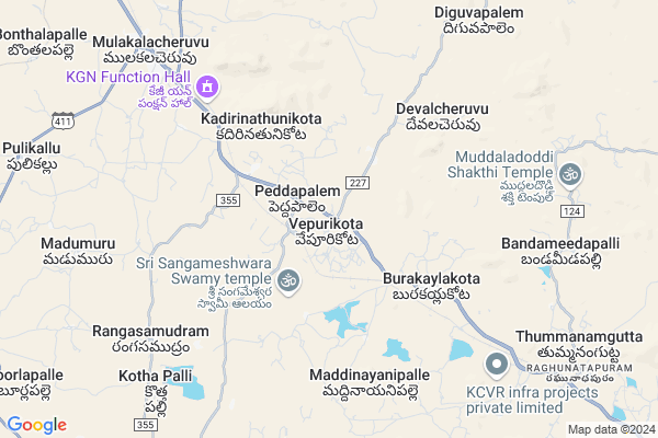
Umasankar Colony
Umasankar Colony Map
EDIT Map
Add Your House
 ..
..
Current Corona Virus Infected Patients Count in Chittoor District
| City Name | District Name | Total Covid cases |
|---|---|---|
| Chittoor District | Chittoor | 59 |
| Thyagaraja Nagar,Tirupathi | Chittoor | 3 |
| Srikalahasti | Chittoor | 3 |
| Nagiri | Chittoor | 2 |
| Chinna Masjid | Chittoor | 1 |
| Keelapattu nagari | Chittoor | 1 |
| Renigunta | Chittoor | 1 |
| Vadamalapeta | Chittoor | 1 |
| Tirupati | Chittoor | 1 |
| Nindra | Chittoor | 1 |
Locality Name :
Umasankar Colony
( ఉమాశంకర్ కాలనీ )
Mandal Name : Mulakalacheruvu
District : Chittoor
State : Andhra Pradesh
Region : Rayalaseema
Language : Telugu and Urdu
Current Time 03:01 AM
Date: Sunday , May 04,2025 (IST)
Time zone: IST (UTC+5:30)
Elevation / Altitude: 594 meters. Above Seal level
Telephone Code / Std Code: 08582
Assembly constituency : assembly constituency
Assembly MLA : PEDDIREDDY DWARAKANATHA REDDY
Lok Sabha constituency : parliamentary constituency
Parliament MP : P.V.MIDHUN REDDY
Serpanch Name :
Pin Code : 517351
Post Office Name : Burakayalakota
Main Village Name : Vepurikota
Commodities Prices : Mulakalacheruvu Market / Mandi
Umasankar Colony Live Weather
Temperature: 29.4 °C
overcast clouds
Humidity: 44%
Wind : 1.37 mt/sec towards NW
StationName : "Madanapalle"
observed on 1 Hours Back
Temperature: 29.4 °C
overcast clouds
Humidity: 44%
Wind : 1.37 mt/sec towards NW
StationName : "Madanapalle"
observed on 1 Hours Back
Umasankar Colony Weather Forecast for Next 5 days
04-05-2025
28.9°C to 28.9°C
light rain
28.9°C to 28.9°C
light rain
05-05-2025
26.0°C to 36.4°C
light rain, overcast clouds, broken clouds
26.0°C to 36.4°C
light rain, overcast clouds, broken clouds
06-05-2025
25.7°C to 37.8°C
scattered clouds, clear sky, few clouds, broken clouds
25.7°C to 37.8°C
scattered clouds, clear sky, few clouds, broken clouds
07-05-2025
25.8°C to 37.8°C
overcast clouds, broken clouds, few clouds, scattered clouds
25.8°C to 37.8°C
overcast clouds, broken clouds, few clouds, scattered clouds
08-05-2025
26.2°C to 36.6°C
overcast clouds, light rain, scattered clouds, clear sky, few clouds
26.2°C to 36.6°C
overcast clouds, light rain, scattered clouds, clear sky, few clouds
National Highways Reachable To Umasankar Colony
Nationa High Way :NH44
Nationa High Way :NH42
Nationa High Way :NH44
Nationa High Way :NH42
Rivers Near Umasankar Colony
Papagni :ಪಾಪಾಗ್ನಿ :పాపాగ్ని
Kushavati :ಕುಶಾವತಿ
Papagni :ಪಾಪಾಗ್ನಿ :పాపాగ్ని
Kushavati :ಕುಶಾವತಿ
About Umasankar Colony
Correct below Info and add more info about Umasankar ColonyUmasankar Colony is a small Village/hamlet in Mulakalacheruvu Mandal in Chittoor District of Andhra Pradesh State, India. It comes under Vepurikota Panchayath. It belongs to Rayalaseema region . It is located 119 KM towards west from District head quarters Chittoor. 1 KM from Molakalacheruvu. 473 KM from State capital Hyderabad
Umasankar Colony Pin code is 517351 and postal head office is Burakayalakota .
Umasankar Colony is surrounded by B.Kothakota Mandal towards South , Peddathippasamudram Mandal towards west , Thamballapalle Mandal towards East , Kurabalakota Mandal towards East .
Madanapalle , Kadiri , Srinivaspur , Chintamani are the near by Cities to Umasankar Colony.
This Place is in the border of the Chittoor District and Anantapur District. Anantapur District Tanakal is North towards this place .
Demographics of Umasankar Colony
Telugu is the Local Language here. Total population of Umasankar Colony is 2614 .Males are 1325 and Females are 1,289 living in 601 Houses. Total area of Umasankar Colony is 1062 hectares.HOW TO REACH Umasankar Colony
By Road
Madanapalle is the Nearest Town to Umasankar Colony. Madanapalle is 33 km from Umasankar Colony. Road connectivity is there from Madanapalle to Umasankar Colony.By Rail
Battulapuram Rail Way Station , Tummanamgutta Rail Way Station are the very nearby railway stations to Umasankar Colony.By Bus
Burakayala Kota APSRTC Bus Station , Molakala Cheruvu APSRTC Bus Station , Angallo APSRTC Bus Station are the nearby by Bus Stations to Umasankar Colony .APSRTC runs Number of busses from major cities to here.Colleges near Umasankar Colony
Vani Jr College V.kota Chittoor
Address : Behind Mpdo Office
durga Nagar V.kota
Sri Muninarayana Junior College
Address :
Sree Vidya Arts & Science Degree College.
Address :
Priyadarshini
Address :
Amaravathi Degree College. Ramasamudram
Address : Amaravathi Degree College Ramasamudram
Schools in Umasankar Colony
Sri Venkateswara U P Scho
Address : vepurikota , molakachervu , chittoor , Andhra Pradesh . PIN- 517351 , Post - Burakayalakota
Mpups Vepurikota
Address : vepurikota , molakachervu , chittoor , Andhra Pradesh . PIN- 517351 , Post - Burakayalakota
Govt Health Centers near Umasankar Colony
1) VEPURIKOTA , , VEPURI KOTA MAIN , BESIDE VETERINARY HOSPITAL2) PEDDAPALAM , , CHURCH AREA , THUNGA PALLE ROAD
3) BURAKAILAKOTA , , MPL ROAD , NEAR CHECK POST
Hospitals in Umasankar Colony,Mulakalacheruvu
Vepurikota Sub-centre
Medical Sub-centre; Vepurikota; Andhra Pradesh 517351; India
0.5 KM distance Detail
Angan wadi centre
Madanapalli Road; Mulakalacheruvu-B Kothakota Rd; Andhra Pradesh; India
0.9 KM distance Detail
more ..
Super Markets in Umasankar Colony,Mulakalacheruvu
Cvv General Store
517370 near indian bank; Madanapalle - B Kothakota Rd; B.Kothakota; Andhra Pradesh 517370; India
13.9 KM distance Detail
Local Parks in Umasankar Colony,Mulakalacheruvu
NRF MANGO GARDEN
Horsley Hills Rd; Horsley Hills; Andhra Pradesh 517352; India
16.7 KM distance Detail
Gangotri seasonal Lake and Freak out point
Horsley Hills Rd; Horsley Hills; Andhra Pradesh 517352; India
17.4 KM distance Detail
Governement Offices near Umasankar Colony,Mulakalacheruvu
MeeSeva Center
Gattu(V); B Kothakota(M); Chittoor(D);517370; Gattu village; Andhra Pradesh 517352; India
11.7 KM distance Detail
About Umasankar Colony &
History
How to reach Umasankar Colony
Tourist Places Near By Umasankar Colony
Schools in Umasankar Colony
Colleges in Umasankar Colony
Temperature & weather of Umasankar Colony
places in Umasankar Colony
Umasankar Colony photos
More Information
How to reach Umasankar Colony
Tourist Places Near By Umasankar Colony
Schools in Umasankar Colony
Colleges in Umasankar Colony
Temperature & weather of Umasankar Colony
places in Umasankar Colony
Umasankar Colony photos
More Information
Village Talk
Post News or Events about this Village
Near Cities
Madanapalle 32 KM near
Kadiri 49 KM near
Srinivaspur 53 KM near
Chintamani 53 KM near
Madanapalle 32 KM near
Kadiri 49 KM near
Srinivaspur 53 KM near
Chintamani 53 KM near
Near By Taluks
Mulakalacheruvu 1 KM near
B.Kothakota 9 KM near
Peddathippasamudram 13 KM near
Thamballapalle 17 KM near
Mulakalacheruvu 1 KM near
B.Kothakota 9 KM near
Peddathippasamudram 13 KM near
Thamballapalle 17 KM near
Near By Air Ports
Bengaluru International Airport 101 KM near
Tirupati Airport 148 KM near
Chennai Airport 242 KM near
Salem Airport 262 KM near
Bengaluru International Airport 101 KM near
Tirupati Airport 148 KM near
Chennai Airport 242 KM near
Salem Airport 262 KM near
Near By Tourist Places
Horsley Hills 15 KM near
Puttaparthi 82 KM near
Lepakshi 86 KM near
Nandi Hills 91 KM near
Kadapa 108 KM near
Horsley Hills 15 KM near
Puttaparthi 82 KM near
Lepakshi 86 KM near
Nandi Hills 91 KM near
Kadapa 108 KM near
Near By Districts
Kolar 79 KM near
Chikballapur 82 KM near
Bangalore Rural 96 KM near
Cuddapah 107 KM near
Kolar 79 KM near
Chikballapur 82 KM near
Bangalore Rural 96 KM near
Cuddapah 107 KM near
Near By RailWay Station
Battulapuram Rail Way Station 1.8 KM near
Madanapalle Road Rail Way Station 31 KM near
Kadiri Rail Way Station 49 KM near
Battulapuram Rail Way Station 1.8 KM near
Madanapalle Road Rail Way Station 31 KM near
Kadiri Rail Way Station 49 KM near