| Home | City Bus | Maps | Villages | Cities | Rail | Tourist Places | School | College | Pin Codes | Corona Cases Count |
| Distance Calculator Bus Services IFSC Codes Trace Mobile Number Weather Search Place Trace IP Available Cash ATM/Banks Locate Polling Booth Report an Error contact People |
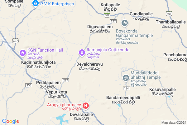
Pathikota
Pathikota Map
EDIT Map
Add Your House
 ..
..
Current Corona Virus Infected Patients Count in Chittoor District
| City Name | District Name | Total Covid cases |
|---|---|---|
| Chittoor District | Chittoor | 59 |
| Thyagaraja Nagar,Tirupathi | Chittoor | 3 |
| Srikalahasti | Chittoor | 3 |
| Nagiri | Chittoor | 2 |
| Chinna Masjid | Chittoor | 1 |
| Keelapattu nagari | Chittoor | 1 |
| Renigunta | Chittoor | 1 |
| Vadamalapeta | Chittoor | 1 |
| Tirupati | Chittoor | 1 |
| Nindra | Chittoor | 1 |
Locality Name :
Pathikota
( పాతికోట )
Mandal Name : Mulakalacheruvu
District : Chittoor
State : Andhra Pradesh
Region : Rayalaseema
Language : Telugu and Urdu
Current Time 01:05 AM
Date: Saturday , May 03,2025 (IST)
Time zone: IST (UTC+5:30)
Elevation / Altitude: 594 meters. Above Seal level
Telephone Code / Std Code: 08582
Assembly constituency : assembly constituency
Assembly MLA : PEDDIREDDY DWARAKANATHA REDDY
Lok Sabha constituency : parliamentary constituency
Parliament MP : P.V.MIDHUN REDDY
Serpanch Name :
Pin Code : 517351
Post Office Name : Burakayalakota
Main Village Name : Devalcheruvu
Commodities Prices : Mulakalacheruvu Market / Mandi
Pathikota Live Weather
Temperature: 28.7 °C
broken clouds
Humidity: 47%
Wind : 2.43 mt/sec towards E
StationName : "Madanapalle"
observed on 1 Hours Back
Temperature: 28.7 °C
broken clouds
Humidity: 47%
Wind : 2.43 mt/sec towards E
StationName : "Madanapalle"
observed on 1 Hours Back
Pathikota Weather Forecast for Next 5 days
03-05-2025
28.1°C to 28.7°C
light rain, broken clouds
28.1°C to 28.7°C
light rain, broken clouds
04-05-2025
26.9°C to 38.7°C
broken clouds, scattered clouds, few clouds, overcast clouds
26.9°C to 38.7°C
broken clouds, scattered clouds, few clouds, overcast clouds
05-05-2025
27.3°C to 35.9°C
broken clouds, scattered clouds, light rain, overcast clouds
27.3°C to 35.9°C
broken clouds, scattered clouds, light rain, overcast clouds
06-05-2025
26.1°C to 38.9°C
few clouds, clear sky, scattered clouds, broken clouds
26.1°C to 38.9°C
few clouds, clear sky, scattered clouds, broken clouds
07-05-2025
27.7°C to 38.9°C
broken clouds, overcast clouds, few clouds, scattered clouds
27.7°C to 38.9°C
broken clouds, overcast clouds, few clouds, scattered clouds
National Highways Reachable To Pathikota
Nationa High Way :NH44
Nationa High Way :NH42
Nationa High Way :NH44
Nationa High Way :NH42
Rivers Near Pathikota
Papagni :ಪಾಪಾಗ್ನಿ :పాపాగ్ని
Kushavati :ಕುಶಾವತಿ
Papagni :ಪಾಪಾಗ್ನಿ :పాపాగ్ని
Kushavati :ಕುಶಾವತಿ
About Pathikota
Correct below Info and add more info about PathikotaPathikota is a small Village/hamlet in Mulakalacheruvu Mandal in Chittoor District of Andhra Pradesh State, India. It comes under Devalcheruvu Panchayath. It belongs to Rayalaseema region . It is located 119 KM towards west from District head quarters Chittoor. 6 KM from Molakalacheruvu. 469 KM from State capital Hyderabad
Pathikota Pin code is 517351 and postal head office is Burakayalakota .
Pathikota is surrounded by Thamballapalle Mandal towards East , B.Kothakota Mandal towards South , Peddathippasamudram Mandal towards west , Kurabalakota Mandal towards East .
Madanapalle , Kadiri , Punganur , Rayachoti are the near by Cities to Pathikota.
This Place is in the border of the Chittoor District and Anantapur District. Anantapur District Tanakal is west towards this place .
Demographics of Pathikota
Telugu is the Local Language here. Total population of Pathikota is 4412 .Males are 2203 and Females are 2,209 living in 1033 Houses. Total area of Pathikota is 2603 hectares.HOW TO REACH Pathikota
By Road
Madanapalle is the Nearest Town to Pathikota. Madanapalle is 36 km from Pathikota. Road connectivity is there from Madanapalle to Pathikota.By Rail
Battulapuram Rail Way Station , Tummanamgutta Rail Way Station are the very nearby railway stations to Pathikota.By Bus
Burakayala Kota APSRTC Bus Station , Molakala Cheruvu APSRTC Bus Station , Angallo APSRTC Bus Station are the nearby by Bus Stations to Pathikota .APSRTC runs Number of busses from major cities to here.Colleges near Pathikota
Vani Jr College V.kota Chittoor
Address : Behind Mpdo Office
durga Nagar V.kota
Sri Muninarayana Junior College
Address :
Sree Vidya Arts & Science Degree College.
Address :
Priyadarshini
Address :
Amaravathi Degree College. Ramasamudram
Address : Amaravathi Degree College Ramasamudram
Schools in Pathikota
Zphs Devalacheruvu
Address : devalcheruvu , molakachervu , chittoor , Andhra Pradesh . PIN- 517351 , Post - Burakayalakota
Govt Health Centers near Pathikota
1) DEVALCHERUVU , , BUS STAND CIRCLE , CHAKALI DODDI2) VEPURIKOTA , , VEPURI KOTA MAIN , BESIDE VETERINARY HOSPITAL
3) PEDDAPALAM , , CHURCH AREA , THUNGA PALLE ROAD
Hospitals in Pathikota,Mulakalacheruvu
Vepurikota Sub-centre
Medical Sub-centre; Vepurikota; Andhra Pradesh 517351; India
6.6 KM distance Detail
more ..
Colleges in Pathikota,Mulakalacheruvu
Bescom Ground;
near to Govt ITI college; Thamballapalle; Andhra Pradesh; India
12.8 KM distance Detail
more ..
Super Markets in Pathikota,Mulakalacheruvu
Cvv General Store
517370 near indian bank; Madanapalle - B Kothakota Rd; B.Kothakota; Andhra Pradesh 517370; India
19.9 KM distance Detail
Local Parks in Pathikota,Mulakalacheruvu
NRF MANGO GARDEN
Horsley Hills Rd; Horsley Hills; Andhra Pradesh 517352; India
16.8 KM distance Detail
Governement Offices near Pathikota,Mulakalacheruvu
MeeSeva Center
Gattu(V); B Kothakota(M); Chittoor(D);517370; Gattu village; Andhra Pradesh 517352; India
15.8 KM distance Detail
About Pathikota &
History
How to reach Pathikota
Tourist Places Near By Pathikota
Schools in Pathikota
Colleges in Pathikota
Temperature & weather of Pathikota
places in Pathikota
Pathikota photos
More Information
How to reach Pathikota
Tourist Places Near By Pathikota
Schools in Pathikota
Colleges in Pathikota
Temperature & weather of Pathikota
places in Pathikota
Pathikota photos
More Information
Village Talk
Post News or Events about this Village
Near Cities
Madanapalle 32 KM near
Kadiri 48 KM near
Punganur 57 KM near
Rayachoti 57 KM near
Madanapalle 32 KM near
Kadiri 48 KM near
Punganur 57 KM near
Rayachoti 57 KM near
Near By Taluks
Mulakalacheruvu 6 KM near
Thamballapalle 12 KM near
B.Kothakota 14 KM near
Peddathippasamudram 19 KM near
Mulakalacheruvu 6 KM near
Thamballapalle 12 KM near
B.Kothakota 14 KM near
Peddathippasamudram 19 KM near
Near By Air Ports
Bengaluru International Airport 107 KM near
Tirupati Airport 144 KM near
Chennai Airport 240 KM near
Salem Airport 266 KM near
Bengaluru International Airport 107 KM near
Tirupati Airport 144 KM near
Chennai Airport 240 KM near
Salem Airport 266 KM near
Near By Tourist Places
Horsley Hills 16 KM near
Puttaparthi 84 KM near
Lepakshi 90 KM near
Nandi Hills 97 KM near
Kadapa 102 KM near
Horsley Hills 16 KM near
Puttaparthi 84 KM near
Lepakshi 90 KM near
Nandi Hills 97 KM near
Kadapa 102 KM near
Near By Districts
Kolar 84 KM near
Chikballapur 88 KM near
Cuddapah 102 KM near
Bangalore Rural 102 KM near
Kolar 84 KM near
Chikballapur 88 KM near
Cuddapah 102 KM near
Bangalore Rural 102 KM near
Near By RailWay Station
Battulapuram Rail Way Station 8.0 KM near
Madanapalle Road Rail Way Station 28 KM near
Kadiri Rail Way Station 47 KM near
Battulapuram Rail Way Station 8.0 KM near
Madanapalle Road Rail Way Station 28 KM near
Kadiri Rail Way Station 47 KM near