| Home | City Bus | Maps | Villages | Cities | Rail | Tourist Places | School | College | Pin Codes | Corona Cases Count |
| Distance Calculator Bus Services IFSC Codes Trace Mobile Number Weather Search Place Trace IP Available Cash ATM/Banks Locate Polling Booth Report an Error contact People |
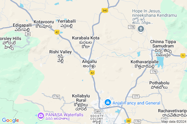
Vankagadda Hw
Vankagadda Hw Map
EDIT Map
Add Your House
 ..
..
Current Corona Virus Infected Patients Count in Chittoor District
| City Name | District Name | Total Covid cases |
|---|---|---|
| Chittoor District | Chittoor | 59 |
| Thyagaraja Nagar,Tirupathi | Chittoor | 3 |
| Srikalahasti | Chittoor | 3 |
| Nagiri | Chittoor | 2 |
| Chinna Masjid | Chittoor | 1 |
| Keelapattu nagari | Chittoor | 1 |
| Renigunta | Chittoor | 1 |
| Vadamalapeta | Chittoor | 1 |
| Tirupati | Chittoor | 1 |
| Nindra | Chittoor | 1 |
Locality Name :
Vankagadda Hw
( వంకాగాడా Hw )
Mandal Name : Kurabalakota
District : Chittoor
State : Andhra Pradesh
Region : Rayalaseema
Language : Telugu and Urdu
Current Time 03:40 PM
Date: Saturday , May 03,2025 (IST)
Time zone: IST (UTC+5:30)
Elevation / Altitude: 686 meters. Above Seal level
Telephone Code / Std Code: 08571
Assembly constituency : assembly constituency
Assembly MLA : PEDDIREDDY DWARAKANATHA REDDY
Lok Sabha constituency : parliamentary constituency
Parliament MP : P.V.MIDHUN REDDY
Serpanch Name :
Pin Code : 517325
Post Office Name : Madanapalle
Main Village Name : Angallu
Commodities Prices : Vayalapadu Market / Mandi
Vankagadda Hw Live Weather
Temperature: 36.5 °C
clear sky
Humidity: 23%
Wind : 2.97 mt/sec towards NE
StationName : "Madanapalle"
observed on 2 Hours Back
Temperature: 36.5 °C
clear sky
Humidity: 23%
Wind : 2.97 mt/sec towards NE
StationName : "Madanapalle"
observed on 2 Hours Back
Vankagadda Hw Weather Forecast for Next 5 days
04-05-2025
27.6°C to 37.5°C
clear sky, few clouds, light rain, overcast clouds, broken clouds
27.6°C to 37.5°C
clear sky, few clouds, light rain, overcast clouds, broken clouds
05-05-2025
24.8°C to 32.9°C
light rain, overcast clouds, broken clouds, scattered clouds
24.8°C to 32.9°C
light rain, overcast clouds, broken clouds, scattered clouds
06-05-2025
24.1°C to 37.5°C
scattered clouds, few clouds, overcast clouds
24.1°C to 37.5°C
scattered clouds, few clouds, overcast clouds
07-05-2025
25.2°C to 37.5°C
overcast clouds, broken clouds, scattered clouds
25.2°C to 37.5°C
overcast clouds, broken clouds, scattered clouds
08-05-2025
25.2°C to 37.2°C
overcast clouds, broken clouds, few clouds, scattered clouds, light rain
25.2°C to 37.2°C
overcast clouds, broken clouds, few clouds, scattered clouds, light rain
National Highways Reachable To Vankagadda Hw
Nationa High Way :NH42
Nationa High Way :NH340
Nationa High Way :NH42
Nationa High Way :NH340
Rivers Near Vankagadda Hw
Papagni :ಪಾಪಾಗ್ನಿ :పాపాగ్ని
Cheyyeru River
Papagni :ಪಾಪಾಗ್ನಿ :పాపాగ్ని
Cheyyeru River
About Vankagadda Hw
Correct below Info and add more info about Vankagadda HwVankagadda Hw is a small Village/hamlet in Kurabalakota Mandal in Chittoor District of Andhra Pradesh State, India. It comes under Angallu Panchayath. It belongs to Rayalaseema region . It is located 93 KM towards west from District head quarters Chittoor. 5 KM from Kurabalakota. 488 KM from State capital Hyderabad
Vankagadda Hw Pin code is 517325 and postal head office is Madanapalle .
Vankagadda Hw is surrounded by Madanapalle Mandal towards South , Thamballapalle Mandal towards North , B.Kothakota Mandal towards west , Gurramkonda Mandal towards North .
Madanapalle , Punganur , Srinivaspur , Mulbagal are the near by Cities to Vankagadda Hw.
Demographics of Vankagadda Hw
Telugu is the Local Language here. Total population of Vankagadda Hw is 6603 .Males are 3320 and Females are 3,283 living in 1495 Houses. Total area of Vankagadda Hw is 1798 hectares.HOW TO REACH Vankagadda Hw
By Road
Madanapalle is the Nearest Town to Vankagadda Hw. Madanapalle is 10 km from Vankagadda Hw. Road connectivity is there from Madanapalle to Vankagadda Hw.By Rail
Kurabalakota Rail Way Station , Madanapalle Road Rail Way Station are the very nearby railway stations to Vankagadda Hw.By Bus
Angallo APSRTC Bus Station , Madanapally APSRTC Bus Station , Burakayala Kota APSRTC Bus Station are the nearby by Bus Stations to Vankagadda Hw .APSRTC runs Number of busses from major cities to here.Colleges near Vankagadda Hw
Gvic
Address :
S V Junior College, Angallu
Address : Angallu
Sri Sai Siddhartha Jr College Madanapalle
Address : Sri Sai Siddhartha Jr College Madanapalle
Sri Ranganatha Jr College Kurabalakota
Address : Sri Ranganatha Jr College Kurabalakota
Viswam Degree College
Address : Angallu (p), Kurabalakota (m), Madanapally, Chitt
Schools in Vankagadda Hw
Goldenvally Hs
Address : angallu , kurabalakota , chittoor , Andhra Pradesh . PIN- 517327
Viswam High School
Address : angallu , kurabalakota , chittoor , Andhra Pradesh . PIN- 517325 , Post - Madanapalle
Zphs Poreddivaripalle
Address : angallu , kurabalakota , chittoor , Andhra Pradesh . PIN- 517325 , Post - Madanapalle
Mpups Nandireddigaripalle
Address : angallu , kurabalakota , chittoor , Andhra Pradesh . PIN- 517327
Govt Health Centers near Vankagadda Hw
1) ANGALLU , , Poreddyvaripalli , Near Vetanari Hospital2) ENUMALAVARIPALLE , , ENUMALAVARIPALLE , Near MPPS School
3) KURABALAKOTA , , Vyashaveedi , Beside the post office
Hospitals in Vankagadda Hw,Kurabalakota
Rural Government Health Centre.Kurabalakota
8/3; Chennai - Nagapattinam Highway; Neravy; 609602; India
2.2 KM distance Detail
Sri Venkateswara Clinic
Balasamudram-Pedaballe Rd; Andhra Pradesh 517350; India
7.9 KM distance Detail
more ..
Schools in Vankagadda Hw,Kurabalakota
Artios Sunrise E. M. U. P. School
Poreddivaripalle; Angallu; Andhra Pradesh 517325; India
0.9 KM distance Detail
Electronic Shops in Vankagadda Hw,Kurabalakota
Bavaji Welding Work's
Opposite Outpost Police station; Angallu; Andhra Pradesh; India
0.6 KM distance Detail
Super Markets in Vankagadda Hw,Kurabalakota
New Tomota Market Yard;Angallu
6; Road Number 2; Seetharampalya; Hoodi; Bengaluru; India
1.1 KM distance Detail
Local Parks in Vankagadda Hw,Kurabalakota
BlackBerry Garden
KurabalaKota Rd; Kurabala Kota; Andhra Pradesh 517350; India
2.3 KM distance Detail
Police Stations near Vankagadda Hw,Kurabalakota
Traffic Controll Police Station
Patel Rd; Neerugattupalle; Madanapalle; Andhra Pradesh 517325; India
7.8 KM distance Detail
Governement Offices near Vankagadda Hw,Kurabalakota
Mee Seva Center
Maseed Coplex; Mbt Road; Near Maseed; Angallu(V); Kurabalakota(M); Chittoor(D);517325; National Highway 205; Angallu; Andhra Pradesh 517325; India
0.8 KM distance Detail
SREE HASTHAKALA JYOTHI WELFARE ASSOCIATION
C/O. SIVA ARTS; D NO. 4-65A; MANDEMVARI PALLIRishi Valley; Andhra Pradesh 517352; India
6.1 KM distance Detail
About Vankagadda Hw &
History
How to reach Vankagadda Hw
Tourist Places Near By Vankagadda Hw
Schools in Vankagadda Hw
Colleges in Vankagadda Hw
Temperature & weather of Vankagadda Hw
places in Vankagadda Hw
Vankagadda Hw photos
More Information
How to reach Vankagadda Hw
Tourist Places Near By Vankagadda Hw
Schools in Vankagadda Hw
Colleges in Vankagadda Hw
Temperature & weather of Vankagadda Hw
places in Vankagadda Hw
Vankagadda Hw photos
More Information
Village Talk
Post News or Events about this Village
Near Cities
Madanapalle 9 KM near
Punganur 34 KM near
Srinivaspur 48 KM near
Mulbagal 58 KM near
Madanapalle 9 KM near
Punganur 34 KM near
Srinivaspur 48 KM near
Mulbagal 58 KM near
Near By Taluks
Kurabalakota 5 KM near
Madanapalle 10 KM near
Thamballapalle 21 KM near
Gurramkonda 21 KM near
Kurabalakota 5 KM near
Madanapalle 10 KM near
Thamballapalle 21 KM near
Gurramkonda 21 KM near
Near By Air Ports
Bengaluru International Airport 109 KM near
Tirupati Airport 127 KM near
Chennai Airport 218 KM near
Salem Airport 249 KM near
Bengaluru International Airport 109 KM near
Tirupati Airport 127 KM near
Chennai Airport 218 KM near
Salem Airport 249 KM near
Near By Tourist Places
Horsley Hills 11 KM near
Chittoor 90 KM near
Nandi Hills 104 KM near
Puttaparthi 108 KM near
Lepakshi 108 KM near
Horsley Hills 11 KM near
Chittoor 90 KM near
Nandi Hills 104 KM near
Puttaparthi 108 KM near
Lepakshi 108 KM near
Near By Districts
Kolar 75 KM near
Chittoor 89 KM near
Chikballapur 95 KM near
Bangalore Rural 105 KM near
Kolar 75 KM near
Chittoor 89 KM near
Chikballapur 95 KM near
Bangalore Rural 105 KM near
Near By RailWay Station
Kurabalakota Rail Way Station 4.8 KM near
Madanapalle Road Rail Way Station 8.3 KM near
Piler Rail Way Station 53 KM near
Kurabalakota Rail Way Station 4.8 KM near
Madanapalle Road Rail Way Station 8.3 KM near
Piler Rail Way Station 53 KM near