| Home | City Bus | Maps | Villages | Cities | Rail | Tourist Places | School | College | Pin Codes | Corona Cases Count |
| Distance Calculator Bus Services IFSC Codes Trace Mobile Number Weather Search Place Trace IP Available Cash ATM/Banks Locate Polling Booth Report an Error contact People |
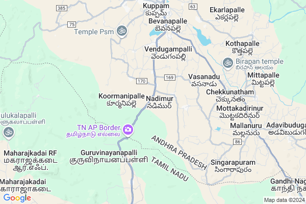
Ramabadranooru Part Ii
Ramabadranooru Part Ii Map
EDIT Map
Add Your House
 ..
..
Current Corona Virus Infected Patients Count in Chittoor District
| City Name | District Name | Total Covid cases |
|---|---|---|
| Chittoor District | Chittoor | 59 |
| Thyagaraja Nagar,Tirupathi | Chittoor | 3 |
| Srikalahasti | Chittoor | 3 |
| Nagiri | Chittoor | 2 |
| Chinna Masjid | Chittoor | 1 |
| Keelapattu nagari | Chittoor | 1 |
| Renigunta | Chittoor | 1 |
| Vadamalapeta | Chittoor | 1 |
| Tirupati | Chittoor | 1 |
| Nindra | Chittoor | 1 |
Locality Name :
Ramabadranooru Part Ii
( రామభద్రనూరు పార్ట్ ఇఇ )
Mandal Name : Kuppam
District : Chittoor
State : Andhra Pradesh
Region : Rayalaseema
Language : Telugu and Urdu
Current Time 08:00 AM
Date: Saturday , May 03,2025 (IST)
Time zone: IST (UTC+5:30)
Elevation / Altitude: 688 meters. Above Seal level
Telephone Code / Std Code: 08570
Assembly constituency : assembly constituency
Assembly MLA : Nara Chandra Babu Naidu
Lok Sabha constituency : parliamentary constituency
Parliament MP :
Serpanch Name :
Pin Code : 517425
Post Office Name : Kuppam
Main Village Name : Nadimur
Commodities Prices : Bangarpet Market / Mandi
Ramabadranooru Part Ii Live Weather
Temperature: 24.3 °C
overcast clouds
Humidity: 79%
Wind : 1.09 mt/sec towards S
StationName : "Kuppam"
observed on 2 Hours Back
Temperature: 24.3 °C
overcast clouds
Humidity: 79%
Wind : 1.09 mt/sec towards S
StationName : "Kuppam"
observed on 2 Hours Back
Ramabadranooru Part Ii Weather Forecast for Next 5 days
04-05-2025
24.5°C to 35.1°C
light rain, broken clouds, scattered clouds, overcast clouds
24.5°C to 35.1°C
light rain, broken clouds, scattered clouds, overcast clouds
05-05-2025
24.6°C to 35.6°C
overcast clouds, broken clouds, light rain
24.6°C to 35.6°C
overcast clouds, broken clouds, light rain
06-05-2025
23.9°C to 35.4°C
overcast clouds, clear sky, light rain, broken clouds
23.9°C to 35.4°C
overcast clouds, clear sky, light rain, broken clouds
07-05-2025
23.8°C to 35.6°C
overcast clouds, broken clouds
23.8°C to 35.6°C
overcast clouds, broken clouds
National Highways Reachable To Ramabadranooru Part Ii
Nationa High Way :NH844
Nationa High Way :NH44;NH48
Nationa High Way :NH844
Nationa High Way :NH44;NH48
Rivers Near Ramabadranooru Part Ii
Dakshina Pinakini :ದಕ್ಷಿಣ ಪಿನಾಕಿನಿ :தென்பெண்ணை
Dakshina Pinakini :ದಕ್ಷಿಣ ಪಿನಾಕಿನಿ :தென்பெண்ணை
Dakshina Pinakini :ದಕ್ಷಿಣ ಪಿನಾಕಿನಿ :தென்பெண்ணை
Dakshina Pinakini :ದಕ್ಷಿಣ ಪಿನಾಕಿನಿ :தென்பெண்ணை
About Ramabadranooru Part Ii
Correct below Info and add more info about Ramabadranooru Part IiRamabadranooru Part Ii is a small Village/hamlet in Kuppam Mandal in Chittoor District of Andhra Pradesh State, India. It comes under Nadimur Panchayath. It belongs to Rayalaseema region . It is located 116 KM towards west from District head quarters Chittoor. 6 KM from Kuppam (Major Pts). 612 KM from State capital Hyderabad
Ramabadranooru Part Ii Pin code is 517425 and postal head office is Kuppam .
Ramabadranooru Part Ii is surrounded by Gudupalle Mandal towards North , Bargur Mandal towards South , Veppanapalli Mandal towards west , Santhipuram Ho Arimuthanapalle Mandal towards North .
Vaniyambadi , Robertson Pet , Tirupathur , Pernampattu are the near by Cities to Ramabadranooru Part Ii.
This Place is in the border of the Chittoor District and Krishnagiri District. Krishnagiri District Veppanapalli is west towards this place . It is near to the Tamil Nadu State Border.
Demographics of Ramabadranooru Part Ii
Telugu is the Local Language here. Total population of Ramabadranooru Part Ii is 1448 .Males are 721 and Females are 727 living in 293 Houses. Total area of Ramabadranooru Part Ii is 972 hectares.HOW TO REACH Ramabadranooru Part Ii
By Road
Punganur is the Nearest Town to Ramabadranooru Part Ii. Punganur is 59 km from Ramabadranooru Part Ii. Road connectivity is there from Punganur to Ramabadranooru Part Ii.By Rail
Mulanur Rail Way Station , Kuppam Rail Way Station are the very nearby railway stations to Ramabadranooru Part Ii.By Bus
Kuppam APSRTC Bus Station , Krishna Giri APSRTC Bus Station , Santhi Puram APSRTC Bus Station are the nearby by Bus Stations to Ramabadranooru Part Ii .APSRTC runs Number of busses from major cities to here.Colleges near Ramabadranooru Part Ii
M F C Govt Junior College Kuppam
Address : M F C Govt Junior College Kuppam
Schools in Ramabadranooru Part Ii
Zphs Nadimur
Address : nadimur , kuppam , chittoor , Andhra Pradesh . PIN- 517425 , Post - Kuppam
Govt Health Centers near Ramabadranooru Part Ii
1) Paipalyam , , paipalem , paipalem2) PAIPALAM , , paipalyam , paipalyam
3) VASANADU , , Main Road vasanadu , Main Road vasanadu
Petrol Bunks in Ramabadranooru Part Ii,Kuppam
Sri Lakshmi Narayana Filling Station (INDIAN OIL)
NH219;KRISHNAGIRI HIGHWAY;KUPPAM;517425;CHITROR DIST;A.P; India
6.2 KM distance Detail
more ..
Colleges in Ramabadranooru Part Ii,Kuppam
Kuppam Engineering College
KES Nagar; Kuppam; Chittoor Dist; Andhra Pradesh 517425; India
6.0 KM distance Detail
Government Arts College
Guruvinayanapalli; Krishnagiri; NH-219; NH Service Road; Krishnagiri; Krishnagiri; Tamilnadu 605001; India
7.2 KM distance Detail
more ..
Schools in Ramabadranooru Part Ii,Kuppam
Goverment Middle School
Thangedi Kuppam Rd; Paipalyam; Andhra Pradesh 517425; India
2.0 KM distance Detail
Police Stations near Ramabadranooru Part Ii,Kuppam
Prohibition and Excise Station
Ramachandra Rd; RS Pet; Kuppam; Andhra Pradesh 517425; India
9.0 KM distance Detail
Governement Offices near Ramabadranooru Part Ii,Kuppam
Office of The Deputy Executive Engineer R and B
Chittoor; NH-219; Krishnagiri Palamaner Highway; Chittoor; Chittoor; Andhra Pradesh 517425; India
8.6 KM distance Detail
MeeSeva Center
Brd Street; Naidu Lay-Out;Tb Road; 8-194; Kuppam; Andhra Pradesh 517425; India
8.7 KM distance Detail
Office of the Tehsildar
Chittoor; NH-219; Krishnagiri Palamaner Highway; Chittoor; Chittoor; Andhra Pradesh 517425; India
8.7 KM distance Detail
About Ramabadranooru Part Ii &
History
How to reach Ramabadranooru Part Ii
Tourist Places Near By Ramabadranooru Part Ii
Schools in Ramabadranooru Part Ii
Colleges in Ramabadranooru Part Ii
Temperature & weather of Ramabadranooru Part Ii
places in Ramabadranooru Part Ii
Ramabadranooru Part Ii photos
More Information
How to reach Ramabadranooru Part Ii
Tourist Places Near By Ramabadranooru Part Ii
Schools in Ramabadranooru Part Ii
Colleges in Ramabadranooru Part Ii
Temperature & weather of Ramabadranooru Part Ii
places in Ramabadranooru Part Ii
Ramabadranooru Part Ii photos
More Information
Village Talk
Post News or Events about this Village
Near Cities
Vaniyambadi 32 KM near
Robertson Pet 35 KM near
Tirupathur 38 KM near
Pernampattu 57 KM near
Vaniyambadi 32 KM near
Robertson Pet 35 KM near
Tirupathur 38 KM near
Pernampattu 57 KM near
Near By Taluks
Kuppam 6 KM near
Gudupalle 14 KM near
Bargur 18 KM near
Veppanapalli 22 KM near
Kuppam 6 KM near
Gudupalle 14 KM near
Bargur 18 KM near
Veppanapalli 22 KM near
Near By Air Ports
Bengaluru International Airport 100 KM near
Salem Airport 129 KM near
Tirupati Airport 188 KM near
Mysore Airport 210 KM near
Bengaluru International Airport 100 KM near
Salem Airport 129 KM near
Tirupati Airport 188 KM near
Mysore Airport 210 KM near
Near By Tourist Places
Yelagiri 39 KM near
Bangalore 97 KM near
Hogenakkal 97 KM near
vellore 100 KM near
Thiruvannamalai 106 KM near
Yelagiri 39 KM near
Bangalore 97 KM near
Hogenakkal 97 KM near
vellore 100 KM near
Thiruvannamalai 106 KM near
Near By Districts
Krishnagiri 23 KM near
Kolar 62 KM near
Dharmapuri 72 KM near
Bangalore 96 KM near
Krishnagiri 23 KM near
Kolar 62 KM near
Dharmapuri 72 KM near
Bangalore 96 KM near
Near By RailWay Station
Kuppam Rail Way Station 8.7 KM near
Mulanur Rail Way Station 8.9 KM near
Jolarpettai Junction Rail Way Station 32 KM near
Kuppam Rail Way Station 8.7 KM near
Mulanur Rail Way Station 8.9 KM near
Jolarpettai Junction Rail Way Station 32 KM near