| Home | City Bus | Maps | Villages | Cities | Rail | Tourist Places | School | College | Pin Codes | Corona Cases Count |
| Distance Calculator Bus Services IFSC Codes Trace Mobile Number Weather Search Place Trace IP Available Cash ATM/Banks Locate Polling Booth Report an Error contact People |
Kuravapalle
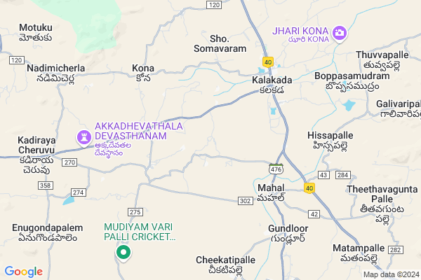
Kuravapalle Map
EDIT Map
Add Your House
 ..
..
Current Corona Virus Infected Patients Count in Chittoor District
| City Name | District Name | Total Covid cases |
|---|---|---|
| Chittoor District | Chittoor | 59 |
| Thyagaraja Nagar,Tirupathi | Chittoor | 3 |
| Srikalahasti | Chittoor | 3 |
| Nagiri | Chittoor | 2 |
| Chinna Masjid | Chittoor | 1 |
| Keelapattu nagari | Chittoor | 1 |
| Renigunta | Chittoor | 1 |
| Vadamalapeta | Chittoor | 1 |
| Tirupati | Chittoor | 1 |
| Nindra | Chittoor | 1 |
Locality Name :
Kuravapalle
( కురవపల్లె )
Mandal Name : Kalakada
District : Chittoor
State : Andhra Pradesh
Region : Rayalaseema
Language : Telugu and Urdu
Current Time 07:47 PM
Date: Saturday , May 03,2025 (IST)
Time zone: IST (UTC+5:30)
Elevation / Altitude: 537 meters. Above Seal level
Telephone Code / Std Code: 08586
Assembly constituency : assembly constituency
Assembly MLA : CHINTHALA RAMACHANDRA REDDY
Lok Sabha constituency : parliamentary constituency
Parliament MP : P.V.MIDHUN REDDY
Serpanch Name :
Pin Code : 517235
Post Office Name : Mahal (Chittoor)
Main Village Name : Gangapuram
Commodities Prices : Kalikiri Market / Mandi
Kuravapalle Live Weather
Temperature: 31.6 °C
broken clouds
Humidity: 37%
Wind : 1.58 mt/sec towards SE
StationName : "Rayachoti"
observed on 40 Mins Back
Temperature: 31.6 °C
broken clouds
Humidity: 37%
Wind : 1.58 mt/sec towards SE
StationName : "Rayachoti"
observed on 40 Mins Back
Kuravapalle Weather Forecast for Next 5 days
04-05-2025
27.9°C to 31.3°C
broken clouds, light rain
27.9°C to 31.3°C
broken clouds, light rain
05-05-2025
25.8°C to 34.4°C
light rain, overcast clouds, broken clouds
25.8°C to 34.4°C
light rain, overcast clouds, broken clouds
06-05-2025
25.3°C to 38.4°C
broken clouds, few clouds, clear sky, scattered clouds
25.3°C to 38.4°C
broken clouds, few clouds, clear sky, scattered clouds
07-05-2025
26.0°C to 38.9°C
scattered clouds, few clouds, overcast clouds
26.0°C to 38.9°C
scattered clouds, few clouds, overcast clouds
08-05-2025
26.2°C to 38.1°C
broken clouds, few clouds, scattered clouds, overcast clouds, clear sky
26.2°C to 38.1°C
broken clouds, few clouds, scattered clouds, overcast clouds, clear sky
National Highways Reachable To Kuravapalle
Nationa High Way :NH42
Nationa High Way :NH42
Rivers Near Kuravapalle
Cheyyeru River
Papagni :ಪಾಪಾಗ್ನಿ :పాపాగ్ని
Cheyyeru River
Papagni :ಪಾಪಾಗ್ನಿ :పాపాగ్ని
About Kuravapalle
Correct below Info and add more info about KuravapalleKuravapalle is a small Village/hamlet in Kalakada Mandal in Chittoor District of Andhra Pradesh State, India. It comes under Gangapuram Panchayath. It belongs to Rayalaseema region . It is located 87 KM towards North from District head quarters Chittoor. 4 KM from Kalakada. 467 KM from State capital Hyderabad
Kuravapalle Pin code is 517235 and postal head office is Mahal (Chittoor).
Kuravapalle is surrounded by Kalikiri Mandal towards South , Kambhamvaripalle Mandal towards East , Vayalpad Mandal towards South , Sambepalle Mandal towards North .
Rayachoti , Madanapalle , Punganur , Tirupati are the near by Cities to Kuravapalle.
This Place is in the border of the Chittoor District and Cuddapah District. Cuddapah District Sambepalle is North towards this place .
Demographics of Kuravapalle
Telugu is the Local Language here. Total population of Kuravapalle is 1465 .Males are 737 and Females are 728 living in 342 Houses. Total area of Kuravapalle is 1304 hectares.HOW TO REACH Kuravapalle
By Road
Tirupati is the Nearest Town to Kuravapalle. Tirupati is 95 km from Kuravapalle. Road connectivity is there from Tirupati to Kuravapalle.By Rail
There is no railway station near to Kuravapalle in less than 10 km. How ever there are railway Stations from Near By town Tirupati. are the railway Stations near to Tirupati. You can reach from Tirupati to Kuravapalle by road after .By Bus
Kalakada APSRTC Bus Station , Kalikiri APSRTC Bus Station , Chinthaparthi APSRTC Bus Station are the nearby by Bus Stations to Kuravapalle .APSRTC runs Number of busses from major cities to here.Colleges near Kuravapalle
Govt Junior College Kalakada
Address : Govt Junior College Kalakada
Schools in Kuravapalle
Mpups Gangapuram
Address : gangapuram , kalakada , chittoor , Andhra Pradesh . PIN- 517236 , Post - Kalakada
Govt Health Centers near Kuravapalle
1) K DODDIPALLI , 0 , K Doddipalli , Beside School2) ERRAKOTAPALLI , 0 , Papireddygaripoalli , PHC Road
3) Errakotapalli , 0 , Papireddygaripalli , PHC Road
Petrol Bunks in Kuravapalle,Kalakada
HP PETROL PUMP - SRI SAI GANESH FILLING STATION
Hpcl Dealers Rayachoty-madanapalle Road Chinnamandem; Kadapa; Andhra Pradesh 516214; India
22.2 KM distance Detail
more ..
Schools in Kuravapalle,Kalakada
reddyvari palli govt up school
devaptla; Reddy Vari Palli; Andhra Pradesh; India
13.6 KM distance Detail
Super Markets in Kuravapalle,Kalakada
Ameen Mango Farm
Devapatla mitta; Sambepalli mandal; Andhra Pradesh 516215; India
16.8 KM distance Detail
Governement Offices near Kuravapalle,Kalakada
MeeSeva Center
H No.4/74;Main Road; Devapatla;Sambepallil; Y S R Kadapa.; Devapatla; Andhra Pradesh 516215; India
14.4 KM distance Detail
Tehsildar and Mandal Executive Magistrate
Sambepalli; Kadapa; NH-18; Kurnool Chittoor Highway; Kadapa; Kadapa; Andhra Pradesh 516215; India
20.1 KM distance Detail
About Kuravapalle &
History
How to reach Kuravapalle
Tourist Places Near By Kuravapalle
Schools in Kuravapalle
Colleges in Kuravapalle
Temperature & weather of Kuravapalle
places in Kuravapalle
Kuravapalle photos
More Information
How to reach Kuravapalle
Tourist Places Near By Kuravapalle
Schools in Kuravapalle
Colleges in Kuravapalle
Temperature & weather of Kuravapalle
places in Kuravapalle
Kuravapalle photos
More Information
Village Talk
Post News or Events about this Village
Near Cities
Rayachoti 32 KM near
Madanapalle 43 KM near
Punganur 58 KM near
Tirupati 81 KM near
Rayachoti 32 KM near
Madanapalle 43 KM near
Punganur 58 KM near
Tirupati 81 KM near
Near By Taluks
Kalakada 4 KM near
Kalikiri 13 KM near
Kambhamvaripalle 16 KM near
Vayalpad 18 KM near
Kalakada 4 KM near
Kalikiri 13 KM near
Kambhamvaripalle 16 KM near
Vayalpad 18 KM near
Near By Air Ports
Tirupati Airport 96 KM near
Bengaluru International Airport 148 KM near
Chennai Airport 198 KM near
Salem Airport 277 KM near
Tirupati Airport 96 KM near
Bengaluru International Airport 148 KM near
Chennai Airport 198 KM near
Salem Airport 277 KM near
Near By Tourist Places
Horsley Hills 47 KM near
Tirupati 82 KM near
Kadapa 83 KM near
Chittoor 83 KM near
Srikalahasti 113 KM near
Horsley Hills 47 KM near
Tirupati 82 KM near
Kadapa 83 KM near
Chittoor 83 KM near
Srikalahasti 113 KM near
Near By Districts
Cuddapah 82 KM near
Chittoor 83 KM near
Kolar 112 KM near
Vellore 119 KM near
Cuddapah 82 KM near
Chittoor 83 KM near
Kolar 112 KM near
Vellore 119 KM near
Near By RailWay Station
Piler Rail Way Station 26 KM near
Madanapalle Road Rail Way Station 31 KM near
Piler Rail Way Station 26 KM near
Madanapalle Road Rail Way Station 31 KM near