| Home | City Bus | Maps | Villages | Cities | Rail | Tourist Places | School | College | Pin Codes | Corona Cases Count |
| Distance Calculator Bus Services IFSC Codes Trace Mobile Number Weather Search Place Trace IP Available Cash ATM/Banks Locate Polling Booth Report an Error contact People |
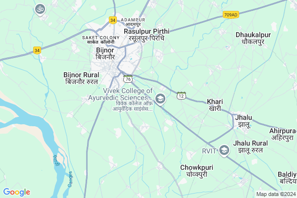
Islampur Neemdas
Islampur Neemdas Map
EDIT Map
Add Your House
 ..
..
Current Corona Virus Infected Patients Count in Bijnor District
| City Name | District Name | Total Covid cases |
|---|---|---|
| Bijnor District | Bijnor | 28 |
Locality Name :
Islampur Neemdas
( इस्लामपुर नीमदास )
Block Name : Haldaur(khari Jhalu)
District : Bijnor
State : Uttar Pradesh
Division : Moradabad
Language : Hindi and Urdu
Current Time 02:53 AM
Date: Sunday , May 04,2025 (IST)
Time zone: IST (UTC+5:30)
Elevation / Altitude: 236 meters. Above Seal level
Telephone Code / Std Code: 01345
Assembly constituency : Bijnor assembly constituency
Assembly MLA : Suchi
Lok Sabha constituency : Bijnor parliamentary constituency
Parliament MP : MALOOK NAGAR
Serpanch Name :
Pin Code : 246701
Post Office Name : Bijnor
Commodities Prices : Bijnaur Market / Mandi
National Highways Reachable To Islampur Neemdas
Nationa High Way :NH709AD
Nationa High Way :NH709AD
Rivers Near Islampur Neemdas
Ramganga
Phica
Ramganga
Phica
About Islampur Neemdas
Correct below Info and add more info about Islampur NeemdasIslampur Neemdas is a Village in Haldaur(khari Jhalu) Block in Bijnor District of Uttar Pradesh State, India. It belongs to Moradabad Division . It is located 4 KM towards East from District head quarters Bijnor. 10 KM from Haldaur(Khari Jhalu). 456 KM from State capital Lucknow
Islampur Neemdas Pin code is 246701 and postal head office is Bijnor .
Bharaira ( 2 KM ) , Rampur Bakli ( 2 KM ) , Shadmapur Khema ( 3 KM ) , Ladapura ( 3 KM ) , Taupri ( 3 KM ) are the nearby Villages to Islampur Neemdas. Islampur Neemdas is surrounded by Haldaur(Khari Jhalu) Block towards East , Mohammedpur Deomal Block towards North , Kiratpur Block towards North , Nehtaur Block towards East .
Bijnaur , Nehtaur , Nagina , Hastinapur are the near by Cities to Islampur Neemdas.
Islampur Neemdas 2011 Census Details
Islampur Neemdas Local Language is Hindi. Islampur Neemdas Village Total population is 723 and number of houses are 135. Female Population is 44.0%. Village literacy rate is 74.0% and the Female Literacy rate is 28.4%.
Population
| Census Parameter | Census Data |
| Total Population | 723 |
| Total No of Houses | 135 |
| Female Population % | 44.0 % ( 318) |
| Total Literacy rate % | 74.0 % ( 535) |
| Female Literacy rate | 28.4 % ( 205) |
| Scheduled Tribes Population % | 0.0 % ( 0) |
| Scheduled Caste Population % | 3.6 % ( 26) |
| Working Population % | 29.0 % |
| Child(0 -6) Population by 2011 | 68 |
| Girl Child(0 -6) Population % by 2011 | 44.1 % ( 30) |
Islampur Neemdas Census More Deatils.
Politics in Islampur Neemdas
BJP , nCP , SP , BSP are the major political parties in this area.Polling Stations /Booths near Islampur Neemdas
1)P.v.karipur Bamnoli2)P.v.khabhoor Room 1
3)P.v.shikandrabad
4)P.v.amirpurdash Urf Dharmnagari Room 2
5)P.v. Ratanpur Riyaya
HOW TO REACH Islampur Neemdas
By Rail
Bijnor Rail Way Station , Khari Jhalu Rail Way Station are the very nearby railway stations to Islampur Neemdas.Colleges near Islampur Neemdas
Haffiz Mohammad Ibrahim Inter College
Address :
Rajkiya Balika Inter College
Address :
Balram Kunwar Saraswati Vidya Mandir
Address :
Government Inter College
Address :
Syam Narayan Singh Smarak Inter College
Address :
Schools near Islampur Neemdas
Hardaynand I.collage Jhalu
Address : jhalu , haldour(khari-jhalu) , bijnor , Uttar Pradesh . PIN- 246701 , Post - Bijnor
Rajkeeya Garls High Sc.jhalu
Address : jhalu , haldour(khari-jhalu) , bijnor , Uttar Pradesh . PIN- 246701 , Post - Bijnor
Ups Khari
Address : khari , haldour(khari-jhalu) , bijnor , Uttar Pradesh . PIN- 246728 , Post - Jhalu
Jhs Pawati
Address : pawti , haldour(khari-jhalu) , bijnor , Uttar Pradesh . PIN- 246726 , Post - Haldaur
Govt Health Centers near Islampur Neemdas
1) Dhan Saini , Health Sub Center Bulding , Village Dhan Saini ,2) Kalhedi , Health Sub Center Bulding , Village Kalhedi ,
3) Kalhedi , Health Sub Center Bulding , Village Kalhedi ,
Schools in Islampur Neemdas,Haldaur(khari Jhalu)
Electronic Shops in Islampur Neemdas,Haldaur(khari Jhalu)
Super Markets in Islampur Neemdas,Haldaur(khari Jhalu)
Local Parks in Islampur Neemdas,Haldaur(khari Jhalu)
Police Stations near Islampur Neemdas,Haldaur(khari Jhalu)
Governement Offices near Islampur Neemdas,Haldaur(khari Jhalu)
About Islampur Neemdas &
History
How to reach Islampur Neemdas
Tourist Places Near By Islampur Neemdas
Schools in Islampur Neemdas
Colleges in Islampur Neemdas
Temperature & weather of Islampur Neemdas
places in Islampur Neemdas
Islampur Neemdas photos
More Information
How to reach Islampur Neemdas
Tourist Places Near By Islampur Neemdas
Schools in Islampur Neemdas
Colleges in Islampur Neemdas
Temperature & weather of Islampur Neemdas
places in Islampur Neemdas
Islampur Neemdas photos
More Information
Village Talk
Post News or Events about this Village
Near Cities
Bijnaur 4 KM near
Nehtaur 25 KM near
Nagina 30 KM near
Hastinapur 32 KM near
Bijnaur 4 KM near
Nehtaur 25 KM near
Nagina 30 KM near
Hastinapur 32 KM near
Near By Taluks
Bijnor 3 KM near
Haldaur(Khari Jhalu) 10 KM near
Mohammedpur Deomal 12 KM near
Kiratpur 21 KM near
Bijnor 3 KM near
Haldaur(Khari Jhalu) 10 KM near
Mohammedpur Deomal 12 KM near
Kiratpur 21 KM near
Near By Air Ports
Muzaffarnagar Airport 54 KM near
Dehra Dun Airport 121 KM near
Pantnagar Airport 148 KM near
Indira Gandhi International Airport 151 KM near
Muzaffarnagar Airport 54 KM near
Dehra Dun Airport 121 KM near
Pantnagar Airport 148 KM near
Indira Gandhi International Airport 151 KM near
Near By Tourist Places
Hastinapur 29 KM near
Meerut 67 KM near
Roorkee 71 KM near
Haridwar 74 KM near
Lansdowne 82 KM near
Hastinapur 29 KM near
Meerut 67 KM near
Roorkee 71 KM near
Haridwar 74 KM near
Lansdowne 82 KM near
Near By Districts
Bijnor 4 KM near
Muzaffarnagar 52 KM near
Jyotiba Phule Nagar 65 KM near
Meerut 68 KM near
Bijnor 4 KM near
Muzaffarnagar 52 KM near
Jyotiba Phule Nagar 65 KM near
Meerut 68 KM near
Near By RailWay Station
Bijnor Rail Way Station 4.9 KM near
Khari Jhalu Rail Way Station 6.9 KM near
Muazzampur Narayan Junction Rail Way Station 29 KM near
Nagina Rail Way Station 30 KM near
Bijnor Rail Way Station 4.9 KM near
Khari Jhalu Rail Way Station 6.9 KM near
Muazzampur Narayan Junction Rail Way Station 29 KM near
Nagina Rail Way Station 30 KM near