| Home | City Bus | Maps | Villages | Cities | Rail | Tourist Places | School | College | Pin Codes | Corona Cases Count |
| Distance Calculator Bus Services IFSC Codes Trace Mobile Number Weather Search Place Trace IP Available Cash ATM/Banks Locate Polling Booth Report an Error contact People |
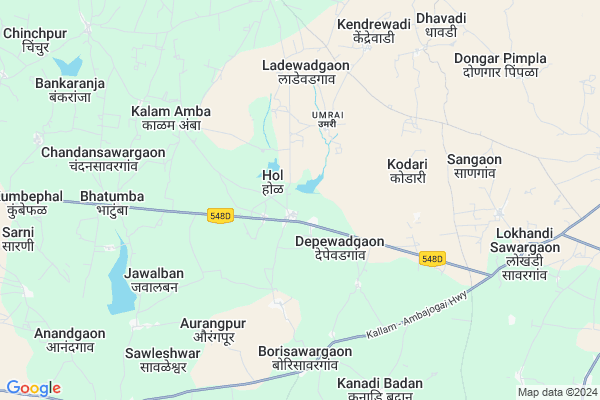
Hoal
Hoal Map
EDIT Map
Add Your House
 ..
..
Current Corona Virus Infected Patients Count in Beed District
| City Name | District Name | Total Covid cases |
|---|
Locality Name :
Hoal
( हॉल )
Taluka Name : Kaij
District : Beed
State : Maharashtra
Region : Marathwada
Division : Aurangabad
Language : English and Hindi, Marathi
Current Time 03:29 PM
Date: Thursday , May 01,2025 (IST)
Time zone: IST (UTC+5:30)
Elevation / Altitude: 674 meters. Above Seal level
Telephone Code / Std Code: 02445
Assembly constituency : Kaij assembly constituency
Assembly MLA : Namita Akshay Mundada
Lok Sabha constituency : Beed parliamentary constituency
Parliament MP : Pritam Gopinathrao Munde
Serpanch Name :
Pin Code : 431517
Post Office Name : YCC
Alternate Village Name : Hol
Commodities Prices : Ambejaogai Market / Mandi
Hoal Live Weather
Temperature: 39.5 °C
clear sky
Humidity: 10%
Wind : 5.43 mt/sec towards N
StationName : "DhÄ\u0081rÅ«r"
observed on Now
Temperature: 39.5 °C
clear sky
Humidity: 10%
Wind : 5.43 mt/sec towards N
StationName : "DhÄ\u0081rÅ«r"
observed on Now
Hoal Weather Forecast for Next 5 days
02-05-2025
30.2°C to 39.3°C
clear sky
30.2°C to 39.3°C
clear sky
03-05-2025
28.0°C to 39.9°C
clear sky
28.0°C to 39.9°C
clear sky
04-05-2025
27.8°C to 39.9°C
few clouds, broken clouds, scattered clouds, clear sky, light rain
27.8°C to 39.9°C
few clouds, broken clouds, scattered clouds, clear sky, light rain
05-05-2025
25.8°C to 38.5°C
clear sky, scattered clouds
25.8°C to 38.5°C
clear sky, scattered clouds
06-05-2025
24.9°C to 38.4°C
clear sky, scattered clouds, broken clouds
24.9°C to 38.4°C
clear sky, scattered clouds, broken clouds
Edit below overview about Hoal
Edit below overview about Hoal
OverView of Hoal
hoal is the largest village in kaij taluka and centre point of kaij,ambajogai and dharur and politically very sensitive place and having many schools and a college and village is historic having historic chhatrapati shivaji maharaj pravesh dwar and shivaji maharaj chowk.Edit below overview about Hoal
Rivers Near Hoal
Bhabti
Manjira :ಮಂಜೀರ :ಮಂಜೀರ
Bhabti
Manjira :ಮಂಜೀರ :ಮಂಜೀರ
About Hoal
Hoal is a Village in Kaij Taluka in Beed District of Maharashtra State, India. It belongs to Marathwada region . It belongs to Aurangabad Division . It is located 69 KM towards East from District head quarters Beed. 20 KM from Kaij. 418 KM from State capital Mumbai
Hoal Pin code is 431517 and postal head office is YCC .
Dipewadgaon ( 3 KM ) , Mulegaon ( 6 KM ) , Borisawargaon ( 6 KM ) , Jawalban ( 6 KM ) , Kalamamba ( 6 KM ) are the nearby Villages to Hoal. Hoal is surrounded by Ambajogai Taluka towards East , Dharur Taluka towards North , Parali V . Taluka towards East , Kalamb Taluka towards west .
Parli , Manjlegaon , Latur , Osmanabad are the near by Cities to Hoal.
This Place is in the border of the Beed District and Osmanabad District. Osmanabad District Kalamb is west towards this place .
Hol 2011 Census Details
Hoal Local Language is English. Hol Village Total population is 5593 and number of houses are 1136. Female Population is 46.8%. Village literacy rate is 68.2% and the Female Literacy rate is 29.0%.
Population
| Census Parameter | Census Data |
| Total Population | 5593 |
| Total No of Houses | 1136 |
| Female Population % | 46.8 % ( 2615) |
| Total Literacy rate % | 68.2 % ( 3813) |
| Female Literacy rate | 29.0 % ( 1621) |
| Scheduled Tribes Population % | 0.1 % ( 6) |
| Scheduled Caste Population % | 16.4 % ( 918) |
| Working Population % | 50.9 % |
| Child(0 -6) Population by 2011 | 674 |
| Girl Child(0 -6) Population % by 2011 | 40.7 % ( 274) |
Hol Census More Deatils.
Politics in Hoal
Bharatiya Janata Party , BJP , NCP are the major political parties in this area.Polling Stations /Booths near Hoal
1)Hivrakurda2)Hoal
3)Hoal
4)Hoal
5)Motegaon
HOW TO REACH Hoal
By Rail
There is no railway station near to Hoal in less than 10 km. are the Rail way stations reachable from near by towns.By Road
Dharur , Ambejogai , Bid are the nearby by towns to Hoal having road connectivity to HoalColleges near Hoal
Shree Hoaleshwar Junior Collage Hoal
Address :
Schools in Hoal
Hol High School Hol
Address : hol , kaij , bid , Maharashtra . PIN- 431123 , Post - Kaij
Swami Vivekanand Vid Hol
Address : hol , kaij , bid , Maharashtra . PIN- 431123 , Post - Kaij
Govt Health Centers near Hoal
1) Ladewadgaon , sub Centre Ladewadgaon , ,2) Apegaon , PHC Apegaon , ,
3) Civil Dispensary Ambejogai , Juna Bazaar Ambajogai , Juna Bazaar Ambajogai , Jogai Temple
Hospitals in Hoal,Kaij
Tulsi Arogya Pratishthan
Dindrud - Bansarola Rd; Hol; Maharashtra 431517; India
0.8 KM distance Detail
Joshi Madam Hospital
Dindrud - Hol - Bansarola - Ranjani Rd; Hol; Maharashtra 431517; India
1.0 KM distance Detail
more ..
Petrol Bunks in Hoal,Kaij
Hindustan Petroleum
Lokhandi Sawargaon; Bid; SH-144; Parli Ambajogai Ahemadpur Road; Beed; Beed; Maharashtra 431517; India
9.4 KM distance Detail
more ..
Colleges in Hoal,Kaij
Shri. Chatrapari Shivaji Science College; Adas
Adas; Maharashtra 431517; India
9.1 KM distance Detail
more ..
Schools in Hoal,Kaij
ZP School
Dindrud - Hol - Bansarola - Ranjani Rd; Depewadgaon; Maharashtra 431518; India
4.1 KM distance Detail
Z P School Palaskheda
Dindrud - Hol - Bansarola - Ranjani Rd; Palaskhed; Maharashtra 431518; India
5.9 KM distance Detail
Lal Bahadur Shastri School; Chandansavargao
savargao; Chandansawargaon; Maharashtra 431123; India
7.5 KM distance Detail
Electronic Shops in Hoal,Kaij
Mane Elecatranics &furnitures Adas
Adas - Ambajogai Rd; Kekanwadi; Maharashtra 431517; India
8.8 KM distance Detail
Local Parks in Hoal,Kaij
Punyashlok Ahilyadeo Chowk Bansarola Bus Stop
Taluka Kaij; Bansarola; Maharashtra 431518; India
11.4 KM distance Detail
Sawaleshwar Bus Stop
Swaleshwar;Taluka Kaij;District 431518; India; Kallam - Ambajogai Hwy; Kallam; Maharashtra; India
11.5 KM distance Detail
Police Stations near Hoal,Kaij
Police Station Gramin Ambajogai
Ganesh Nagar; Ambajogai; Maharashtra 431517; India
17.4 KM distance Detail
Governement Offices near Hoal,Kaij
Panchayat Ofiice Kumbephal
At Post- Kumbephal; Tq - Kaij ; Dist - Beed; Kaij - Ambajogai Rd; Kumbephal; Maharashtra 431123; India
13.0 KM distance Detail
About Hoal &
History
How to reach Hoal
Tourist Places Near By Hoal
Schools in Hoal
Colleges in Hoal
Temperature & weather of Hoal
places in Hoal
Hoal photos
More Information
How to reach Hoal
Tourist Places Near By Hoal
Schools in Hoal
Colleges in Hoal
Temperature & weather of Hoal
places in Hoal
Hoal photos
More Information
Village Talk
Post News or Events about this Village
Near Cities
Parli 38 KM near
Manjlegaon 54 KM near
Latur 57 KM near
Osmanabad 70 KM near
Parli 38 KM near
Manjlegaon 54 KM near
Latur 57 KM near
Osmanabad 70 KM near
Near By Taluks
Kaij 19 KM near
Ambajogai 21 KM near
Dharur 24 KM near
Parali V . 35 KM near
Kaij 19 KM near
Ambajogai 21 KM near
Dharur 24 KM near
Parali V . 35 KM near
Near By Air Ports
Latur Airport 45 KM near
Sholapur Airport 138 KM near
Nanded Airport 139 KM near
Chikkalthana Airport 174 KM near
Latur Airport 45 KM near
Sholapur Airport 138 KM near
Nanded Airport 139 KM near
Chikkalthana Airport 174 KM near
Near By Tourist Places
Tuljapur 89 KM near
Solapur 133 KM near
Hingoli 165 KM near
Pandharpur 168 KM near
Aurangabad 181 KM near
Tuljapur 89 KM near
Solapur 133 KM near
Hingoli 165 KM near
Pandharpur 168 KM near
Aurangabad 181 KM near
Near By Districts
Latur 55 KM near
Beed 66 KM near
Osmanabad 67 KM near
Parbhani 94 KM near
Latur 55 KM near
Beed 66 KM near
Osmanabad 67 KM near
Parbhani 94 KM near
Near By RailWay Station
Parli Vaijnath Rail Way Station 37 KM near
Latur Rail Way Station 51 KM near
Parli Vaijnath Rail Way Station 37 KM near
Latur Rail Way Station 51 KM near