| Home | City Bus | Maps | Villages | Cities | Rail | Tourist Places | School | College | Pin Codes | Corona Cases Count |
| Distance Calculator Bus Services IFSC Codes Trace Mobile Number Weather Search Place Trace IP Available Cash ATM/Banks Locate Polling Booth Report an Error contact People |
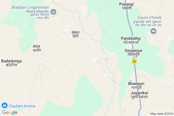
Banchapai
Banchapai Map
EDIT Map
Add Your House
 ..
..
Current Corona Virus Infected Patients Count in Bastar District
| City Name | District Name | Total Covid cases |
|---|
Locality Name :
Banchapai
( बंचपई )
Tehsil Name : Pharasgaon
District : Bastar
State : Chattisgarh
Language : Oriya and Hindi
Current Time 12:45 AM
Date: Saturday , May 03,2025 (IST)
Time zone: IST (UTC+5:30)
Elevation / Altitude: 325 meters. Above Seal level
Telephone Code / Std Code: 07784
Assembly constituency : Keshkal assembly constituency
Assembly MLA : Neelkanth Tekam
Lok Sabha constituency : Kanker parliamentary constituency
Parliament MP : MOHAN MANDAVI
Serpanch Name :
Commodities Prices : Pharasgaon Market / Mandi
Banchapai Live Weather
Temperature: 24.8 °C
clear sky
Humidity: 60%
Wind : 2.32 mt/sec towards S
StationName : "Kondagaon"
observed on 30 Mins Back
Temperature: 24.8 °C
clear sky
Humidity: 60%
Wind : 2.32 mt/sec towards S
StationName : "Kondagaon"
observed on 30 Mins Back
Banchapai Weather Forecast for Next 5 days
03-05-2025
24.0°C to 24.5°C
clear sky
24.0°C to 24.5°C
clear sky
04-05-2025
23.0°C to 36.5°C
clear sky, overcast clouds, light rain, scattered clouds, broken clouds
23.0°C to 36.5°C
clear sky, overcast clouds, light rain, scattered clouds, broken clouds
05-05-2025
23.2°C to 36.8°C
broken clouds, few clouds, overcast clouds, light rain
23.2°C to 36.8°C
broken clouds, few clouds, overcast clouds, light rain
06-05-2025
22.8°C to 39.0°C
scattered clouds, clear sky, few clouds, broken clouds, light rain
22.8°C to 39.0°C
scattered clouds, clear sky, few clouds, broken clouds, light rain
07-05-2025
24.1°C to 38.0°C
clear sky, light rain, broken clouds, few clouds
24.1°C to 38.0°C
clear sky, light rain, broken clouds, few clouds
Rivers Near Banchapai
Narangi
Boroda
Narangi
Boroda
About Banchapai
Correct below Info and add more info about BanchapaiBanchapai is a Village in Pharasgaon Tehsil in Bastar District of Chattisgarh State, India. It is located 87 KM towards North from District head quarters Jagdalpur. 189 KM from State capital Raipur
Banchapai is surrounded by Keshkal Tehsil towards North , Narayanpur Tehsil towards west , Kondagaon Tehsil towards South , Baderajpur Tehsil towards North .
Kondagaon , Kanker , Umarkote , Jagdalpur are the near by Cities to Banchapai.
Banchapai 2011 Census Details
Banchapai Local Language is Oriya. Banchapai Village Total population is 1169 and number of houses are 214. Female Population is 51.1%. Village literacy rate is 26.2% and the Female Literacy rate is 9.7%.
Population
| Census Parameter | Census Data |
| Total Population | 1169 |
| Total No of Houses | 214 |
| Female Population % | 51.1 % ( 597) |
| Total Literacy rate % | 26.2 % ( 306) |
| Female Literacy rate | 9.7 % ( 113) |
| Scheduled Tribes Population % | 95.1 % ( 1112) |
| Scheduled Caste Population % | 0.2 % ( 2) |
| Working Population % | 66.6 % |
| Child(0 -6) Population by 2011 | 286 |
| Girl Child(0 -6) Population % by 2011 | 50.7 % ( 145) |
Banchapai Census More Deatils.
Politics in Banchapai
INC , Bharatiya Janata Party , BJP , BJP , INC are the major political parties in this area.Polling Stations /Booths near Banchapai
1)Hatma2)Bhogapal
3)Farasagaon - 1
4)Modega
5)Dhodrepal
HOW TO REACH Banchapai
By Rail
There is no railway station near to Banchapai in less than 10 km.Pincodes near Banchapai
494228 ( Pharasgaon ) , 494230 ( Piprabahigaon ) , 494229 ( Pharasgaon Camp )Colleges near Banchapai
Govt College Bhanpuri Besoli
Address :
Bastar Medical College Of Alternative Medicines (bmcam)
Address :
Bastar College
Address :
Late Shri Baliram Kashyap Memorial Govt.medical College Jagdalpur
Address : Dimrapal Campus Jagdalpur Pin -494001
Higher Secondary School Gamhari
Address : Gamhari .kondagaon Road
Schools near Banchapai
Govt Ms Bhandaripara (ssa)
Address : bade dongar , farasgaon , baster , Chattisgarh . PIN- 494228 , Post - Pharasgaon
Ups Bhattipara
Address : bangoli , farasgaon , baster , Chattisgarh . PIN- 494228 , Post - Pharasgaon
Ssa Ms Ghodsodapara
Address : alor , farasgaon , baster , Chattisgarh . PIN- 494228 , Post - Pharasgaon
Ms Govt, Belpan
Address : kondapakhna , farasgaon , baster , Chattisgarh . PIN- 494230 , Post - Piprabahigaon
Govt Health Centers near Banchapai
1) Bhumka , Sub Health Centre , Badedongar ,2) Bhandarwandi , Sub Health Centre , pharasgaon ,
3) Bade Dongar , Sub Health Centre , Badedongar ,
Schools in Banchapai,Pharasgaon
DAV Mukhyamantri Public School
Bade Dongar; pharashgoun dist. kondagoun; Chhattisgarh 494228; India
3.9 KM distance Detail
Saraswati Shishu Mandir Vidyalay Badedongar
Badedongar; Chhattisgarh 494228; India
7.1 KM distance Detail
Electronic Shops in Banchapai,Pharasgaon
OMPRAKASH Bicycle &General Stors
Pharasgaon-Makri Rd; Fupgaon; Chhattisgarh 494228; India
2.7 KM distance Detail
Local Parks in Banchapai,Pharasgaon
Barkai Nala Bridge Garden
Pharasgaon-Makri Rd; Barkai; Chhattisgarh 494228; India
13.2 KM distance Detail
About Banchapai &
History
How to reach Banchapai
Tourist Places Near By Banchapai
Schools in Banchapai
Colleges in Banchapai
Temperature & weather of Banchapai
places in Banchapai
Banchapai photos
More Information
How to reach Banchapai
Tourist Places Near By Banchapai
Schools in Banchapai
Colleges in Banchapai
Temperature & weather of Banchapai
places in Banchapai
Banchapai photos
More Information
Village Talk
Post News or Events about this Village
Near Cities
Kondagaon 27 KM near
Kanker 59 KM near
Umarkote 74 KM near
Jagdalpur 103 KM near
Kondagaon 27 KM near
Kanker 59 KM near
Umarkote 74 KM near
Jagdalpur 103 KM near
Near By Taluks
Pharasgaon 0 KM near
Keshkal 27 KM near
Narayanpur 33 KM near
Kondagaon 35 KM near
Pharasgaon 0 KM near
Keshkal 27 KM near
Narayanpur 33 KM near
Kondagaon 35 KM near
Near By Air Ports
Raipur Airport 173 KM near
Vishakhapatnam Airport 322 KM near
Rajahmundry Airport 336 KM near
Sonegaon Airport 336 KM near
Raipur Airport 173 KM near
Vishakhapatnam Airport 322 KM near
Rajahmundry Airport 336 KM near
Sonegaon Airport 336 KM near
Near By Tourist Places
Kanker 59 KM near
Bastar 98 KM near
Jagdalpur 102 KM near
Dhamtari 113 KM near
Dantewada 116 KM near
Kanker 59 KM near
Bastar 98 KM near
Jagdalpur 102 KM near
Dhamtari 113 KM near
Dantewada 116 KM near
Near By Districts
Narayanpur 39 KM near
Kanker 59 KM near
Bastar 84 KM near
Dhamtari 111 KM near
Narayanpur 39 KM near
Kanker 59 KM near
Bastar 84 KM near
Dhamtari 111 KM near
Near By RailWay Station
Mahasamund Rail Way Station 174 KM near
Raj Nandgaon Rail Way Station 174 KM near
Mahasamund Rail Way Station 174 KM near
Raj Nandgaon Rail Way Station 174 KM near