| Home | City Bus | Maps | Villages | Cities | Rail | Tourist Places | School | College | Pin Codes | Corona Cases Count |
| Distance Calculator Bus Services IFSC Codes Trace Mobile Number Weather Search Place Trace IP Available Cash ATM/Banks Locate Polling Booth Report an Error contact People |
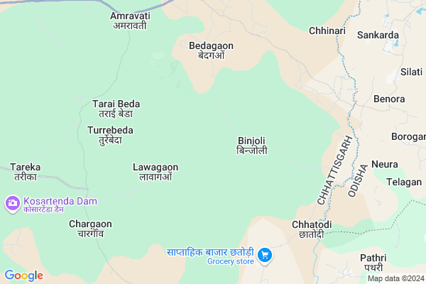
Tumbeda
Tumbeda Map
EDIT Map
Add Your House
 ..
..
Current Corona Virus Infected Patients Count in Bastar District
| City Name | District Name | Total Covid cases |
|---|
Locality Name :
Tumbeda
( तुम्बड़ा )
Tehsil Name : Makdi
District : Bastar
State : Chattisgarh
Language : Oriya and Hindi
Current Time 01:02 PM
Date: Saturday , May 03,2025 (IST)
Time zone: IST (UTC+5:30)
Elevation / Altitude: 569 meters. Above Seal level
Telephone Code / Std Code: 07784
Assembly constituency : Kondagaon assembly constituency
Assembly MLA : Lata Usendi
Lok Sabha constituency : Bastar parliamentary constituency
Parliament MP : DEEPAK BAIJ
Serpanch Name :
Pin Code : 494224
Post Office Name : Bhanpuri
Main Village Name : Amrawati
Commodities Prices : Chhinari Market / Mandi
Rivers Near Tumbeda
Narangi
Boroda
Narangi
Boroda
About Tumbeda
Correct below Info and add more info about TumbedaTumbeda is a small Village/hamlet in Makdi Tehsil in Bastar District of Chattisgarh State, India. It comes under Amrawati Panchayath. It is located 45 KM towards North from District head quarters Jagdalpur. 26 KM from Makdi. 225 KM from State capital Raipur
Tumbeda Pin code is 494224 and postal head office is Bhanpuri .
Bijapur ( 11 KM ) , Garenga ( 12 KM ) , Malgaon ( 14 KM ) , Pathri ( 14 KM ) , Jaibel ( 14 KM ) are the nearby Villages to Tumbeda. Tumbeda is surrounded by Umerkote Tehsil towards East , Kondagaon Tehsil towards west , Bakawand Tehsil towards South , Bastar Tehsil towards South .
Umarkote , Kondagaon , Jagdalpur , Nabarangapur are the near by Cities to Tumbeda.
Tum Beda 2011 Census Details
Tumbeda Local Language is Oriya. Tum Beda Village Total population is and number of houses are . Female Population is -1.0%. Village literacy rate is -1.0% and the Female Literacy rate is -1.0%.
Population
| Census Parameter | Census Data |
| Total Population | |
| Total No of Houses | |
| Female Population % | -1.0 % ( ) |
| Total Literacy rate % | -1.0 % ( ) |
| Female Literacy rate | -1.0 % ( ) |
| Scheduled Tribes Population % | -1.0 % ( ) |
| Scheduled Caste Population % | -1.0 % ( ) |
| Working Population % | -1.0 % |
| Child(0 -6) Population by 2011 | |
| Girl Child(0 -6) Population % by 2011 | -1.0 % ( ) |
Tum Beda Census More Deatils.
Politics in Tumbeda
Indian National Congress , BJP , INC are the major political parties in this area.Polling Stations /Booths near Tumbeda
1)Bade Bendri 22)Bijapur
3)Bade Kanera 4
4)Chaudhag
5)Bedagaon
HOW TO REACH Tumbeda
By Rail
There is no railway station near to Tumbeda in less than 10 km.Colleges near Tumbeda
Govt College Bhanpuri Besoli
Address :
Bastar Medical College Of Alternative Medicines (bmcam)
Address :
Bastar College
Address :
Late Shri Baliram Kashyap Memorial Govt.medical College Jagdalpur
Address : Dimrapal Campus Jagdalpur Pin -494001
Higher Secondary School Gamhari
Address : Gamhari .kondagaon Road
Schools near Tumbeda
Govt.ms Torandi
Address : torandi , makadi , baster , Chattisgarh . PIN- 494226 , Post - Kondagaon
Ups Diharipara Makadi
Address : maakdi , makadi , baster , Chattisgarh . PIN- 494228 , Post - Pharasgaon
Govt.ups Hirrapara
Address : mageda , makadi , baster , Chattisgarh . PIN- 494237
Govt. Ups Patelpara Ulera
Address : patelpara , makadi , baster , Chattisgarh . PIN- 494228 , Post - Pharasgaon
Govt Health Centers near Tumbeda
1) Shamtapur , SUB HEALTH CENTRE SHAMPTAPUR , ANATPUR ,2) Bedagaon , SUB HEALTH CENTRE MAKDI BEDAGAON , ANATPUR ,
3) SHC Mohlai , SUB HEALTH CENTRE MOHLAI , VILLAGE MOHLAI PANCHAYAT- MOHLAI ,
Hospitals in Tumbeda,Makdi
PHC hospital Anantpur
Umarkote - Kondagaon Rd; Anantpur; Chhattisgarh 494224; India
12.0 KM distance Detail
Sub health center Bade Kanera
Bade; Kanera Road; Kondagaon; Chhattisgarh 494226; India
22.2 KM distance Detail
more ..
Schools in Tumbeda,Makdi
Primary School Pujari Para Kamela
Kondagaon Rd; Kamela; Chhattisgarh 494224; India
17.1 KM distance Detail
sarsvati shishu mandir hight school jaibel
Dimrapal; Chhattisgarh 494224; India
17.4 KM distance Detail
Police Stations near Tumbeda,Makdi
Governement Offices near Tumbeda,Makdi
About Tumbeda &
History
How to reach Tumbeda
Tourist Places Near By Tumbeda
Schools in Tumbeda
Colleges in Tumbeda
Temperature & weather of Tumbeda
places in Tumbeda
Tumbeda photos
More Information
How to reach Tumbeda
Tourist Places Near By Tumbeda
Schools in Tumbeda
Colleges in Tumbeda
Temperature & weather of Tumbeda
places in Tumbeda
Tumbeda photos
More Information
Village Talk
Post News or Events about this Village
Near Cities
Umarkote 30 KM near
Kondagaon 35 KM near
Jagdalpur 58 KM near
Nabarangapur 77 KM near
Umarkote 30 KM near
Kondagaon 35 KM near
Jagdalpur 58 KM near
Nabarangapur 77 KM near
Near By Taluks
Umerkote 25 KM near
Makdi 25 KM near
Kondagaon 31 KM near
Bakawand 38 KM near
Umerkote 25 KM near
Makdi 25 KM near
Kondagaon 31 KM near
Bakawand 38 KM near
Near By Air Ports
Raipur Airport 205 KM near
Vishakhapatnam Airport 270 KM near
Rajahmundry Airport 304 KM near
Sonegaon Airport 391 KM near
Raipur Airport 205 KM near
Vishakhapatnam Airport 270 KM near
Rajahmundry Airport 304 KM near
Sonegaon Airport 391 KM near
Near By Tourist Places
Bastar 56 KM near
Jagdalpur 58 KM near
Kanker 105 KM near
Jeypore 109 KM near
Dantewada 110 KM near
Bastar 56 KM near
Jagdalpur 58 KM near
Kanker 105 KM near
Jeypore 109 KM near
Dantewada 110 KM near
Near By Districts
Bastar 43 KM near
Nabarangpur 78 KM near
Narayanpur 86 KM near
Kanker 106 KM near
Bastar 43 KM near
Nabarangpur 78 KM near
Narayanpur 86 KM near
Kanker 106 KM near
Near By RailWay Station
Koraput Junction Rail Way Station 128 KM near
Kantabanji Rail Way Station 158 KM near
Koraput Junction Rail Way Station 128 KM near
Kantabanji Rail Way Station 158 KM near