| Home | City Bus | Maps | Villages | Cities | Rail | Tourist Places | School | College | Pin Codes | Corona Cases Count |
| Distance Calculator Bus Services IFSC Codes Trace Mobile Number Weather Search Place Trace IP Available Cash ATM/Banks Locate Polling Booth Report an Error contact People |
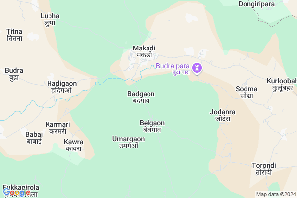
Pidapal
Pidapal Map
EDIT Map
Add Your House
 ..
..
Current Corona Virus Infected Patients Count in Bastar District
| City Name | District Name | Total Covid cases |
|---|
Locality Name :
Pidapal
( पीढ़ापाल )
Tehsil Name : Makdi
District : Bastar
State : Chattisgarh
Language : Oriya and Hindi
Current Time 12:02 AM
Date: Sunday , May 04,2025 (IST)
Time zone: IST (UTC+5:30)
Elevation / Altitude: 569 meters. Above Seal level
Telephone Code / Std Code: 07784
Assembly constituency : Kondagaon assembly constituency
Assembly MLA : Lata Usendi
Lok Sabha constituency : Bastar parliamentary constituency
Parliament MP : DEEPAK BAIJ
Serpanch Name :
Alternate Village Name : Pidhapal
Commodities Prices : Makdi Market / Mandi
Pidapal Live Weather
Temperature: 24.1 °C
scattered clouds
Humidity: 62%
Wind : 2.39 mt/sec towards SE
StationName : "Kondagaon"
observed on 1 Hours Back
Temperature: 24.1 °C
scattered clouds
Humidity: 62%
Wind : 2.39 mt/sec towards SE
StationName : "Kondagaon"
observed on 1 Hours Back
Pidapal Weather Forecast for Next 5 days
04-05-2025
23.0°C to 23.7°C
scattered clouds
23.0°C to 23.7°C
scattered clouds
05-05-2025
22.8°C to 35.9°C
scattered clouds, clear sky, few clouds, light rain, broken clouds
22.8°C to 35.9°C
scattered clouds, clear sky, few clouds, light rain, broken clouds
06-05-2025
23.0°C to 36.1°C
scattered clouds, few clouds, light rain
23.0°C to 36.1°C
scattered clouds, few clouds, light rain
07-05-2025
23.2°C to 36.8°C
clear sky, broken clouds, overcast clouds
23.2°C to 36.8°C
clear sky, broken clouds, overcast clouds
08-05-2025
23.8°C to 37.1°C
light rain, overcast clouds, clear sky, scattered clouds, broken clouds
23.8°C to 37.1°C
light rain, overcast clouds, clear sky, scattered clouds, broken clouds
Rivers Near Pidapal
Narangi
Boroda
Narangi
Boroda
About Pidapal
Correct below Info and add more info about PidapalPidapal is a Village in Makdi Tehsil in Bastar District of Chattisgarh State, India. It is located 70 KM towards North from District head quarters Jagdalpur. 198 KM from State capital Raipur
Pidapal is surrounded by Raighar Tehsil towards North , Umerkote Tehsil towards East , Kondagaon Tehsil towards South , Pharasgaon Tehsil towards west .
Kondagaon , Umarkote , Kanker , Jagdalpur are the near by Cities to Pidapal.
Pidhapal 2011 Census Details
Pidapal Local Language is Oriya. Pidhapal Village Total population is 1121 and number of houses are 202. Female Population is 52.1%. Village literacy rate is 50.5% and the Female Literacy rate is 20.6%.
Population
| Census Parameter | Census Data |
| Total Population | 1121 |
| Total No of Houses | 202 |
| Female Population % | 52.1 % ( 584) |
| Total Literacy rate % | 50.5 % ( 566) |
| Female Literacy rate | 20.6 % ( 231) |
| Scheduled Tribes Population % | 89.1 % ( 999) |
| Scheduled Caste Population % | 0.0 % ( 0) |
| Working Population % | 49.7 % |
| Child(0 -6) Population by 2011 | 170 |
| Girl Child(0 -6) Population % by 2011 | 50.0 % ( 85) |
Pidhapal Census More Deatils.
Politics in Pidapal
Indian National Congress , BJP , INC are the major political parties in this area.Polling Stations /Booths near Pidapal
1)Belgaon2)Ulera
3)Makdhi
4)Makdhi
5)Bade Sohanga
HOW TO REACH Pidapal
By Rail
There is no railway station near to Pidapal in less than 10 km.Pincodes near Pidapal
494226 ( Kondagaon ) , 494228 ( Pharasgaon ) , 494224 ( Bhanpuri )Colleges near Pidapal
Govt College Bhanpuri Besoli
Address :
Bastar Medical College Of Alternative Medicines (bmcam)
Address :
Bastar College
Address :
Late Shri Baliram Kashyap Memorial Govt.medical College Jagdalpur
Address : Dimrapal Campus Jagdalpur Pin -494001
Higher Secondary School Gamhari
Address : Gamhari .kondagaon Road
Schools in Pidapal
Ms Pidhapal
Address : pidhapal , makadi , baster , Chattisgarh . PIN- 494226 , Post - Kondagaon
Govt Health Centers near Pidapal
1) Hirapur , SUB HEALTH CENTRE HIRAPUR , MAKDI ,2) Dharli , SUB HEALTH CENTRE DHARLI , MAKDI ,
3) Makdi , COMMUNITY HEALTH CENTER MAKDI , MAKDI , NEAR BUS STAND
Hospitals in Pidapal,Makdi
PHC hospital Anantpur
Umarkote - Kondagaon Rd; Anantpur; Chhattisgarh 494224; India
17.4 KM distance Detail
more ..
Schools in Pidapal,Makdi
Dav Mukhyamantri Public School
Belgaon; Block Makdi; Distt Kondagaon; Chhattisgarh; Kondagaon; Chhattisgarh; India
1.4 KM distance Detail
Police Stations near Pidapal,Makdi
Governement Offices near Pidapal,Makdi
About Pidapal &
History
How to reach Pidapal
Tourist Places Near By Pidapal
Schools in Pidapal
Colleges in Pidapal
Temperature & weather of Pidapal
places in Pidapal
Pidapal photos
More Information
How to reach Pidapal
Tourist Places Near By Pidapal
Schools in Pidapal
Colleges in Pidapal
Temperature & weather of Pidapal
places in Pidapal
Pidapal photos
More Information
Village Talk
Post News or Events about this Village
Near Cities
Kondagaon 33 KM near
Umarkote 36 KM near
Kanker 81 KM near
Jagdalpur 84 KM near
Kondagaon 33 KM near
Umarkote 36 KM near
Kanker 81 KM near
Jagdalpur 84 KM near
Near By Taluks
Makdi 0 KM near
Raighar 25 KM near
Umerkote 32 KM near
Kondagaon 34 KM near
Makdi 0 KM near
Raighar 25 KM near
Umerkote 32 KM near
Kondagaon 34 KM near
Near By Air Ports
Raipur Airport 179 KM near
Vishakhapatnam Airport 295 KM near
Rajahmundry Airport 328 KM near
Sonegaon Airport 372 KM near
Raipur Airport 179 KM near
Vishakhapatnam Airport 295 KM near
Rajahmundry Airport 328 KM near
Sonegaon Airport 372 KM near
Near By Tourist Places
Kanker 80 KM near
Bastar 81 KM near
Jagdalpur 84 KM near
Dantewada 125 KM near
Dhamtari 126 KM near
Kanker 80 KM near
Bastar 81 KM near
Jagdalpur 84 KM near
Dantewada 125 KM near
Dhamtari 126 KM near
Near By Districts
Bastar 68 KM near
Narayanpur 75 KM near
Kanker 81 KM near
Nabarangpur 99 KM near
Bastar 68 KM near
Narayanpur 75 KM near
Kanker 81 KM near
Nabarangpur 99 KM near
Near By RailWay Station
Kantabanji Rail Way Station 147 KM near
Koraput Junction Rail Way Station 152 KM near
Kantabanji Rail Way Station 147 KM near
Koraput Junction Rail Way Station 152 KM near