| Home | City Bus | Maps | Villages | Cities | Rail | Tourist Places | School | College | Pin Codes | Corona Cases Count |
| Distance Calculator Bus Services IFSC Codes Trace Mobile Number Weather Search Place Trace IP Available Cash ATM/Banks Locate Polling Booth Report an Error contact People |
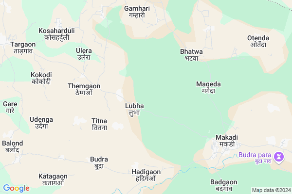
Lubha
Lubha Map
EDIT Map
Add Your House
 ..
..
Current Corona Virus Infected Patients Count in Bastar District
| City Name | District Name | Total Covid cases |
|---|
Locality Name :
Lubha
( लुभा )
Tehsil Name : Makdi
District : Bastar
State : Chattisgarh
Language : Oriya and Hindi
Current Time 11:00 PM
Date: Saturday , May 03,2025 (IST)
Time zone: IST (UTC+5:30)
Elevation / Altitude: 569 meters. Above Seal level
Telephone Code / Std Code: 07784
Assembly constituency : Kondagaon assembly constituency
Assembly MLA : Lata Usendi
Lok Sabha constituency : Bastar parliamentary constituency
Parliament MP : DEEPAK BAIJ
Serpanch Name :
Pin Code : 494228
Post Office Name : Pharasgaon
Commodities Prices : Makdi Market / Mandi
Rivers Near Lubha
Narangi
Boroda
Narangi
Boroda
About Lubha
Correct below Info and add more info about LubhaLubha is a Village in Makdi Tehsil in Bastar District of Chattisgarh State, India. It is located 79 KM towards North from District head quarters Jagdalpur. 10 KM from Makdi. 189 KM from State capital Raipur
Lubha Pin code is 494228 and postal head office is Pharasgaon .
Bagbeda ( 6 KM ) , Ulera ( 6 KM ) , Katagaon ( 8 KM ) , Babai ( 9 KM ) , Balond ( 10 KM ) are the nearby Villages to Lubha. Lubha is surrounded by Raighar Tehsil towards East , Baderajpur Tehsil towards North , Pharasgaon Tehsil towards west , Kondagaon Tehsil towards South .
Kondagaon , Umarkote , Kanker , Jagdalpur are the near by Cities to Lubha.
Lubha 2011 Census Details
Lubha Local Language is Oriya. Lubha Village Total population is 1243 and number of houses are 241. Female Population is 50.4%. Village literacy rate is 54.7% and the Female Literacy rate is 23.3%.
Population
| Census Parameter | Census Data |
| Total Population | 1243 |
| Total No of Houses | 241 |
| Female Population % | 50.4 % ( 626) |
| Total Literacy rate % | 54.7 % ( 680) |
| Female Literacy rate | 23.3 % ( 290) |
| Scheduled Tribes Population % | 73.1 % ( 909) |
| Scheduled Caste Population % | 0.0 % ( 0) |
| Working Population % | 49.8 % |
| Child(0 -6) Population by 2011 | 166 |
| Girl Child(0 -6) Population % by 2011 | 42.8 % ( 71) |
Lubha Census More Deatils.
Politics in Lubha
Indian National Congress , BJP , INC are the major political parties in this area.Polling Stations /Booths near Lubha
1)Labha2)Sitli
3)Themganv
4)Sambalpur 2
5)Kevti
HOW TO REACH Lubha
By Rail
There is no railway station near to Lubha in less than 10 km.Colleges near Lubha
Govt College Bhanpuri Besoli
Address :
Bastar Medical College Of Alternative Medicines (bmcam)
Address :
Bastar College
Address :
Late Shri Baliram Kashyap Memorial Govt.medical College Jagdalpur
Address : Dimrapal Campus Jagdalpur Pin -494001
Higher Secondary School Gamhari
Address : Gamhari .kondagaon Road
Schools in Lubha
Ms Lubh
Address : lubha , makadi , baster , Chattisgarh . PIN- 494228 , Post - Pharasgaon
Govt Health Centers near Lubha
1) Lubha , SUB HEALTH CENTRE LUBHA , LUBHA ,2) Handigaon , SUB HEALTH CENTRE HANDIGAON , SHAMPUR ,
3) Makdi A , SUB HEALTH CENTRE MAKDI , MAKDI ,
Super Markets in Lubha,Makdi
Local Parks in Lubha,Makdi
Barkai Nala Bridge Garden
Pharasgaon-Makri Rd; Barkai; Chhattisgarh 494228; India
21.6 KM distance Detail
Police Stations near Lubha,Makdi
Governement Offices near Lubha,Makdi
About Lubha &
History
How to reach Lubha
Tourist Places Near By Lubha
Schools in Lubha
Colleges in Lubha
Temperature & weather of Lubha
places in Lubha
Lubha photos
More Information
How to reach Lubha
Tourist Places Near By Lubha
Schools in Lubha
Colleges in Lubha
Temperature & weather of Lubha
places in Lubha
Lubha photos
More Information
Village Talk
Post News or Events about this Village
Near Cities
Kondagaon 33 KM near
Umarkote 46 KM near
Kanker 71 KM near
Jagdalpur 93 KM near
Kondagaon 33 KM near
Umarkote 46 KM near
Kanker 71 KM near
Jagdalpur 93 KM near
Near By Taluks
Makdi 10 KM near
Raighar 24 KM near
Baderajpur 27 KM near
Pharasgaon 30 KM near
Makdi 10 KM near
Raighar 24 KM near
Baderajpur 27 KM near
Pharasgaon 30 KM near
Near By Air Ports
Raipur Airport 171 KM near
Vishakhapatnam Airport 305 KM near
Rajahmundry Airport 336 KM near
Sonegaon Airport 362 KM near
Raipur Airport 171 KM near
Vishakhapatnam Airport 305 KM near
Rajahmundry Airport 336 KM near
Sonegaon Airport 362 KM near
Near By Tourist Places
Kanker 70 KM near
Bastar 90 KM near
Jagdalpur 92 KM near
Dhamtari 117 KM near
Dantewada 128 KM near
Kanker 70 KM near
Bastar 90 KM near
Jagdalpur 92 KM near
Dhamtari 117 KM near
Dantewada 128 KM near
Near By Districts
Narayanpur 69 KM near
Kanker 71 KM near
Bastar 76 KM near
Nabarangpur 110 KM near
Narayanpur 69 KM near
Kanker 71 KM near
Bastar 76 KM near
Nabarangpur 110 KM near
Near By RailWay Station
Kantabanji Rail Way Station 148 KM near
Khariar Road Rail Way Station 156 KM near
Kantabanji Rail Way Station 148 KM near
Khariar Road Rail Way Station 156 KM near