| Home | City Bus | Maps | Villages | Cities | Rail | Tourist Places | School | College | Pin Codes | Corona Cases Count |
| Distance Calculator Bus Services IFSC Codes Trace Mobile Number Weather Search Place Trace IP Available Cash ATM/Banks Locate Polling Booth Report an Error contact People |
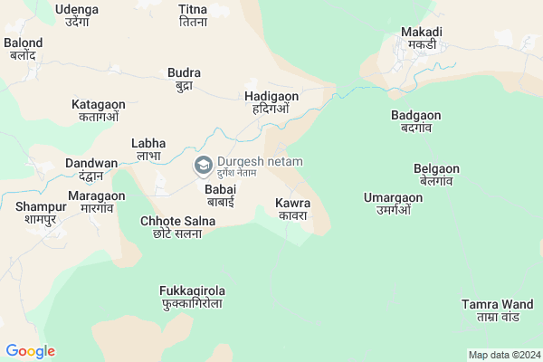
Babai
Babai Map
EDIT Map
Add Your House
 ..
..
Current Corona Virus Infected Patients Count in Bastar District
| City Name | District Name | Total Covid cases |
|---|
Locality Name :
Babai
( बाबई )
Tehsil Name : Makdi
District : Bastar
State : Chattisgarh
Language : Oriya and Hindi
Current Time 05:39 AM
Date: Saturday , May 03,2025 (IST)
Time zone: IST (UTC+5:30)
Elevation / Altitude: 569 meters. Above Seal level
Telephone Code / Std Code: 07784
Assembly constituency : Kondagaon assembly constituency
Assembly MLA : Lata Usendi
Lok Sabha constituency : Bastar parliamentary constituency
Parliament MP : DEEPAK BAIJ
Serpanch Name :
Pin Code : 494226
Post Office Name : Kondagaon
Commodities Prices : Makdi Market / Mandi
Rivers Near Babai
Narangi
Boroda
Narangi
Boroda
About Babai
Correct below Info and add more info about BabaiBabai is a Village in Makdi Tehsil in Bastar District of Chattisgarh State, India. It is located 69 KM towards North from District head quarters Jagdalpur. 7 KM from Makdi. 199 KM from State capital Raipur
Babai Pin code is 494226 and postal head office is Kondagaon .
Maragaon ( 5 KM ) , Katagaon ( 6 KM ) , Lubha ( 9 KM ) , Palli ( 10 KM ) , Balond ( 11 KM ) are the nearby Villages to Babai. Babai is surrounded by Kondagaon Tehsil towards South , Pharasgaon Tehsil towards west , Raighar Tehsil towards North , Baderajpur Tehsil towards North .
Kondagaon , Umarkote , Kanker , Jagdalpur are the near by Cities to Babai.
Babai 2011 Census Details
Babai Local Language is Oriya. Babai Village Total population is 1506 and number of houses are 296. Female Population is 50.1%. Village literacy rate is 39.1% and the Female Literacy rate is 14.1%.
Population
| Census Parameter | Census Data |
| Total Population | 1506 |
| Total No of Houses | 296 |
| Female Population % | 50.1 % ( 755) |
| Total Literacy rate % | 39.1 % ( 589) |
| Female Literacy rate | 14.1 % ( 213) |
| Scheduled Tribes Population % | 62.4 % ( 939) |
| Scheduled Caste Population % | 11.9 % ( 179) |
| Working Population % | 53.9 % |
| Child(0 -6) Population by 2011 | 251 |
| Girl Child(0 -6) Population % by 2011 | 44.6 % ( 112) |
Babai Census More Deatils.
Politics in Babai
Indian National Congress , BJP , INC are the major political parties in this area.Polling Stations /Booths near Babai
1)Kanrji2)Baadra
3)Katagaon
4)Gumadi
5)Targaon
HOW TO REACH Babai
By Rail
There is no railway station near to Babai in less than 10 km.Colleges near Babai
Govt College Bhanpuri Besoli
Address :
Bastar Medical College Of Alternative Medicines (bmcam)
Address :
Bastar College
Address :
Late Shri Baliram Kashyap Memorial Govt.medical College Jagdalpur
Address : Dimrapal Campus Jagdalpur Pin -494001
Higher Secondary School Gamhari
Address : Gamhari .kondagaon Road
Schools in Babai
Ajk Ms Babai
Address : babai , makadi , baster , Chattisgarh . PIN- 494226 , Post - Kondagaon
Govt Health Centers near Babai
1) Babai , SUB HEALTH CENTRE BABAI , SHAMPUR ,2) Handigaon , SUB HEALTH CENTRE HANDIGAON , SHAMPUR ,
3) Katagaon , SUB HEALTH CENTRE KATAGAON , SHAMPUR ,
Hospitals in Babai,Makdi
PHC hospital Anantpur
Umarkote - Kondagaon Rd; Anantpur; Chhattisgarh 494224; India
20.9 KM distance Detail
more ..
Schools in Babai,Makdi
Dav Mukhyamantri Public School
Belgaon; Block Makdi; Distt Kondagaon; Chhattisgarh; Kondagaon; Chhattisgarh; India
7.3 KM distance Detail
Police Stations near Babai,Makdi
Governement Offices near Babai,Makdi
About Babai &
History
How to reach Babai
Tourist Places Near By Babai
Schools in Babai
Colleges in Babai
Temperature & weather of Babai
places in Babai
Babai photos
More Information
How to reach Babai
Tourist Places Near By Babai
Schools in Babai
Colleges in Babai
Temperature & weather of Babai
places in Babai
Babai photos
More Information
Village Talk
Post News or Events about this Village
Near Cities
Kondagaon 25 KM near
Umarkote 43 KM near
Kanker 79 KM near
Jagdalpur 83 KM near
Kondagaon 25 KM near
Umarkote 43 KM near
Kanker 79 KM near
Jagdalpur 83 KM near
Near By Taluks
Makdi 6 KM near
Kondagaon 28 KM near
Pharasgaon 31 KM near
Raighar 31 KM near
Makdi 6 KM near
Kondagaon 28 KM near
Pharasgaon 31 KM near
Raighar 31 KM near
Near By Air Ports
Raipur Airport 181 KM near
Vishakhapatnam Airport 297 KM near
Rajahmundry Airport 326 KM near
Sonegaon Airport 367 KM near
Raipur Airport 181 KM near
Vishakhapatnam Airport 297 KM near
Rajahmundry Airport 326 KM near
Sonegaon Airport 367 KM near
Near By Tourist Places
Kanker 78 KM near
Bastar 80 KM near
Jagdalpur 83 KM near
Dantewada 120 KM near
Dhamtari 126 KM near
Kanker 78 KM near
Bastar 80 KM near
Jagdalpur 83 KM near
Dantewada 120 KM near
Dhamtari 126 KM near
Near By Districts
Bastar 66 KM near
Narayanpur 68 KM near
Kanker 79 KM near
Nabarangpur 103 KM near
Bastar 66 KM near
Narayanpur 68 KM near
Kanker 79 KM near
Nabarangpur 103 KM near
Near By RailWay Station
Kantabanji Rail Way Station 154 KM near
Koraput Junction Rail Way Station 155 KM near
Kantabanji Rail Way Station 154 KM near
Koraput Junction Rail Way Station 155 KM near