| Home | City Bus | Maps | Villages | Cities | Rail | Tourist Places | School | College | Pin Codes | Corona Cases Count |
| Distance Calculator Bus Services IFSC Codes Trace Mobile Number Weather Search Place Trace IP Available Cash ATM/Banks Locate Polling Booth Report an Error contact People |
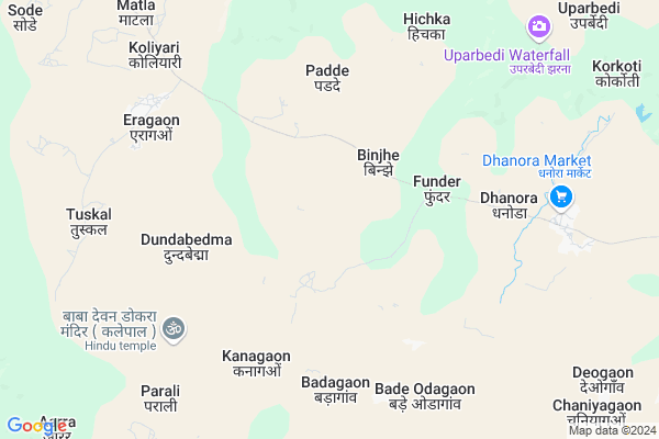
Binjhe
Binjhe Map
EDIT Map
Add Your House
 ..
..
Current Corona Virus Infected Patients Count in Bastar District
| City Name | District Name | Total Covid cases |
|---|
Locality Name :
Binjhe
( बींझे )
Tehsil Name : Keshkal
District : Bastar
State : Chattisgarh
Language : Oriya and Hindi
Current Time 12:13 AM
Date: Saturday , May 03,2025 (IST)
Time zone: IST (UTC+5:30)
Elevation / Altitude: 325 meters. Above Seal level
Telephone Code / Std Code: 07848
Assembly constituency : Keshkal assembly constituency
Assembly MLA : Neelkanth Tekam
Lok Sabha constituency : Kanker parliamentary constituency
Parliament MP : MOHAN MANDAVI
Serpanch Name :
Pin Code : 494230
Post Office Name : Piprabahigaon
Commodities Prices : Dhanora Market / Mandi
Binjhe Live Weather
Temperature: 24.9 °C
clear sky
Humidity: 57%
Wind : 2.41 mt/sec towards SE
StationName : "KÄ\u0081nker"
observed on Now
Temperature: 24.9 °C
clear sky
Humidity: 57%
Wind : 2.41 mt/sec towards SE
StationName : "KÄ\u0081nker"
observed on Now
Binjhe Weather Forecast for Next 5 days
03-05-2025
23.7°C to 24.5°C
clear sky
23.7°C to 24.5°C
clear sky
04-05-2025
23.3°C to 37.5°C
clear sky, overcast clouds, light rain, broken clouds
23.3°C to 37.5°C
clear sky, overcast clouds, light rain, broken clouds
05-05-2025
23.4°C to 37.5°C
broken clouds, scattered clouds, light rain
23.4°C to 37.5°C
broken clouds, scattered clouds, light rain
06-05-2025
23.3°C to 39.1°C
scattered clouds, few clouds, broken clouds, clear sky
23.3°C to 39.1°C
scattered clouds, few clouds, broken clouds, clear sky
07-05-2025
24.0°C to 38.2°C
clear sky, few clouds, scattered clouds, broken clouds, overcast clouds
24.0°C to 38.2°C
clear sky, few clouds, scattered clouds, broken clouds, overcast clouds
Rivers Near Binjhe
Potla
Baordhig
Potla
Baordhig
About Binjhe
Correct below Info and add more info about BinjheBinjhe is a Village in Keshkal Tehsil in Bastar District of Chattisgarh State, India. It is located 121 KM towards North from District head quarters Jagdalpur. 25 KM from Keshkal. 167 KM from State capital Raipur
Binjhe Pin code is 494230 and postal head office is Piprabahigaon .
Chaniyagaon ( 7 KM ) , Eragaon ( 9 KM ) , Dhanora ( 10 KM ) , Deogaon ( 12 KM ) , Kongud ( 13 KM ) are the nearby Villages to Binjhe. Binjhe is surrounded by Antagarh Tehsil towards west , Pharasgaon Tehsil towards East , Kanker Tehsil towards North , Narayanpur Tehsil towards South .
Kanker , Kondagaon , Dalli-Rajhara , Dhamtari are the near by Cities to Binjhe.
Binjhe 2011 Census Details
Binjhe Local Language is Oriya. Binjhe Village Total population is 1400 and number of houses are 275. Female Population is 47.2%. Village literacy rate is 31.5% and the Female Literacy rate is 9.3%.
Population
| Census Parameter | Census Data |
| Total Population | 1400 |
| Total No of Houses | 275 |
| Female Population % | 47.2 % ( 661) |
| Total Literacy rate % | 31.5 % ( 441) |
| Female Literacy rate | 9.3 % ( 130) |
| Scheduled Tribes Population % | 80.4 % ( 1126) |
| Scheduled Caste Population % | 11.4 % ( 159) |
| Working Population % | 58.1 % |
| Child(0 -6) Population by 2011 | 234 |
| Girl Child(0 -6) Population % by 2011 | 45.7 % ( 107) |
Binjhe Census More Deatils.
Politics in Binjhe
INC , Bharatiya Janata Party , BJP , BJP , INC are the major political parties in this area.Polling Stations /Booths near Binjhe
1)Bhumka2)Fufgaon - 1
3)Badedongar - 1
4)Titirvand - 1
5)Arandi - 2
HOW TO REACH Binjhe
By Rail
There is no railway station near to Binjhe in less than 10 km.Colleges near Binjhe
Govt College Bhanpuri Besoli
Address :
Bastar Medical College Of Alternative Medicines (bmcam)
Address :
Bastar College
Address :
Late Shri Baliram Kashyap Memorial Govt.medical College Jagdalpur
Address : Dimrapal Campus Jagdalpur Pin -494001
Higher Secondary School Gamhari
Address : Gamhari .kondagaon Road
Schools near Binjhe
Ms Baniyagaon
Address : baniyagaon , keshkal , baster , Chattisgarh . PIN- 494228 , Post - Pharasgaon
Ups Girgoli
Address : batrali , keshkal , baster , Chattisgarh . PIN- 494230 , Post - Piprabahigaon
Ups Raobedamari
Address : batrali , keshkal , baster , Chattisgarh . PIN- 494230 , Post - Piprabahigaon
Primary School
Address : khetarpal , keshkal , baster , Chattisgarh . PIN- 494230 , Post - Piprabahigaon
Govt Health Centers near Binjhe
1) Korkoti , SUB HEALTH CENTRE KORKOTI , DHANORA ,2) Phunder , Sub Health Centre , Devgaon ,
3) Kanagaon , SUB HEALTH CENTRE KANAGAON , DHANORA ,
Schools in Binjhe,Keshkal
Electronic Shops in Binjhe,Keshkal
Super Markets in Binjhe,Keshkal
Local Parks in Binjhe,Keshkal
Police Stations near Binjhe,Keshkal
Governement Offices near Binjhe,Keshkal
About Binjhe &
History
How to reach Binjhe
Tourist Places Near By Binjhe
Schools in Binjhe
Colleges in Binjhe
Temperature & weather of Binjhe
places in Binjhe
Binjhe photos
More Information
How to reach Binjhe
Tourist Places Near By Binjhe
Schools in Binjhe
Colleges in Binjhe
Temperature & weather of Binjhe
places in Binjhe
Binjhe photos
More Information
Village Talk
Post News or Events about this Village
Near Cities
Kanker 36 KM near
Kondagaon 59 KM near
Dalli-Rajhara 81 KM near
Dhamtari 92 KM near
Kanker 36 KM near
Kondagaon 59 KM near
Dalli-Rajhara 81 KM near
Dhamtari 92 KM near
Near By Taluks
Keshkal 24 KM near
Antagarh 26 KM near
Pharasgaon 33 KM near
Kanker 35 KM near
Keshkal 24 KM near
Antagarh 26 KM near
Pharasgaon 33 KM near
Kanker 35 KM near
Near By Air Ports
Raipur Airport 154 KM near
Sonegaon Airport 304 KM near
Vishakhapatnam Airport 355 KM near
Rajahmundry Airport 362 KM near
Raipur Airport 154 KM near
Sonegaon Airport 304 KM near
Vishakhapatnam Airport 355 KM near
Rajahmundry Airport 362 KM near
Near By Tourist Places
Kanker 36 KM near
Dhamtari 91 KM near
Bhamragarh Wildlife Sanctuary 118 KM near
Bastar 130 KM near
Jagdalpur 135 KM near
Kanker 36 KM near
Dhamtari 91 KM near
Bhamragarh Wildlife Sanctuary 118 KM near
Bastar 130 KM near
Jagdalpur 135 KM near
Near By Districts
Narayanpur 36 KM near
Kanker 36 KM near
Dhamtari 89 KM near
Bastar 116 KM near
Narayanpur 36 KM near
Kanker 36 KM near
Dhamtari 89 KM near
Bastar 116 KM near
Near By RailWay Station
Raj Nandgaon Rail Way Station 144 KM near
Durg Junction Rail Way Station 151 KM near
Raj Nandgaon Rail Way Station 144 KM near
Durg Junction Rail Way Station 151 KM near