| Home | City Bus | Maps | Villages | Cities | Rail | Tourist Places | School | College | Pin Codes | Corona Cases Count |
| Distance Calculator Bus Services IFSC Codes Trace Mobile Number Weather Search Place Trace IP Available Cash ATM/Banks Locate Polling Booth Report an Error contact People |
Manjhiguda
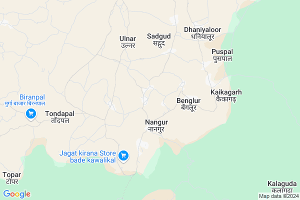
Manjhiguda Map
EDIT Map
Add Your House
 ..
..
Current Corona Virus Infected Patients Count in Bastar District
| City Name | District Name | Total Covid cases |
|---|
Locality Name :
Manjhiguda
( मांझीगुड़ा )
Tehsil Name : Jagdalpur
District : Bastar
State : Chattisgarh
Language : Oriya and Hindi
Current Time 11:45 PM
Date: Friday , May 02,2025 (IST)
Time zone: IST (UTC+5:30)
Elevation / Altitude: 569 meters. Above Seal level
Telephone Code / Std Code: 07782
Assembly constituency : Jagdalpur assembly constituency
Assembly MLA : Kiran Deo
Lok Sabha constituency : Bastar parliamentary constituency
Parliament MP : DEEPAK BAIJ
Serpanch Name :
Pin Code : 494001
Post Office Name : Jagdalpur
Commodities Prices : Jagdalpur Market / Mandi
Rivers Near Manjhiguda
Koyar
Bhaskel
Koyar
Bhaskel
About Manjhiguda
Correct below Info and add more info about ManjhigudaManjhiguda is a Village in Jagdalpur Tehsil in Bastar District of Chattisgarh State, India. It is located 34 KM towards South from District head quarters Jagdalpur. 13 KM from Jagdalpur. 302 KM from State capital Raipur
Manjhiguda Pin code is 494001 and postal head office is Jagdalpur .
Hatpadmur ( 3 KM ) , Ulnar ( 3 KM ) , Chhotekawali ( 3 KM ) , Kakarwada ( 4 KM ) , Sadgud ( 5 KM ) are the nearby Villages to Manjhiguda. Manjhiguda is surrounded by Darbha Tehsil towards west , Tokapal Tehsil towards west , Bakawand Tehsil towards North , Bastar Tehsil towards North .
Jagdalpur , Jeypur , Nabarangapur , Malkangiri are the near by Cities to Manjhiguda.
Manjhiguda 2011 Census Details
Manjhiguda Local Language is Oriya. Manjhiguda Village Total population is 952 and number of houses are 249. Female Population is 50.1%. Village literacy rate is 36.3% and the Female Literacy rate is 14.0%.
Population
| Census Parameter | Census Data |
| Total Population | 952 |
| Total No of Houses | 249 |
| Female Population % | 50.1 % ( 477) |
| Total Literacy rate % | 36.3 % ( 346) |
| Female Literacy rate | 14.0 % ( 133) |
| Scheduled Tribes Population % | 76.5 % ( 728) |
| Scheduled Caste Population % | 0.0 % ( 0) |
| Working Population % | 32.0 % |
| Child(0 -6) Population by 2011 | 132 |
| Girl Child(0 -6) Population % by 2011 | 48.5 % ( 64) |
Manjhiguda Census More Deatils.
Politics in Manjhiguda
Indian National Congress , BJP , INC are the major political parties in this area.Polling Stations /Booths near Manjhiguda
1)Mangnar2)Alangnar
3)Sedhva
4)Nakktisemra
5)Halbakachora
HOW TO REACH Manjhiguda
By Rail
There is no railway station near to Manjhiguda in less than 10 km.Colleges near Manjhiguda
Bastar Medical College Of Alternative Medicines (bmcam)
Address :
Bastar College
Address :
Late Shri Baliram Kashyap Memorial Govt.medical College Jagdalpur
Address : Dimrapal Campus Jagdalpur Pin -494001
Christ College
Address : Christ College Campus,geedam Road, Jagdalpurbastar
College Of Arya Prerna Samiti
Address : Arya Prerna Samitiparekh Building, Circuit House R
Schools near Manjhiguda
Govt Model School Naktisemra (rmsa)
Address : nakte smra , jagdalpur , baster , Chattisgarh . PIN- 494001 , Post - Jagdalpur
Ups Patel Pandripani
Address : pandripani , jagdalpur , baster , Chattisgarh . PIN- 494001 , Post - Jagdalpur
Sc Primary School
Address : chilkuti , jagdalpur , baster , Chattisgarh . PIN- 494001 , Post - Jagdalpur
Primary School Tondapal
Address : bringpal patel para , jagdalpur , baster , Chattisgarh . PIN- 494001 , Post - Jagdalpur
Govt Health Centers near Manjhiguda
1) SHC Nangur , SUB HEALTH CENTRE NANGUR , VILLAGE NANGUR ,2) SHC Ulnar , SUB HEALTH CENTRE ULNAR , VILLAGE ULNAR ,
3) SHC Puspal(BASTAR) , SUB HEALTH CENTRE PUSPAL(BASTAR) , VILLAGE PUSPAL(BASTAR) ,
Petrol Bunks in Manjhiguda,Jagdalpur
HP PETROL PUMP - ADHOC B DAMODAR & CO.
Hpcl Retail Outlet Village- Adawal Jagdalpur; Raipur; Chhattisgarh 494001; India
14.9 KM distance Detail
Indian Oil Petrol Pump
Santosi Ward; Bastar; NH-43; Jagdalpur; Jagdalpur; Chhattisgarh 494334; India
15.6 KM distance Detail
more ..
Colleges in Manjhiguda,Jagdalpur
Christ College Of Nursing
Chitrakot Road; Pally Villlage; Jagdalpur; Chhattisgarh 494001; India
14.4 KM distance Detail
Taj Computer Education & Traning Centre
Near Kalibadi School; Vrindavan Colony; Jagdalpur; Chhattisgarh 494001; India
15.3 KM distance Detail
Danteshwari Politecnic College
Frezerpur; Jagdalpur; Chhattisgarh 494001; India
15.6 KM distance Detail
government girls danteshwari college
Frezerpur; Jagdalpur; Chhattisgarh 494001; India
15.6 KM distance Detail
more ..
Police Stations near Manjhiguda,Jagdalpur
HQ 80 BN CRPF
Near; New Bus Stand Rd; Shanti Nagar; Hikmipara; Jagdalpur; Chhattisgarh 494001; India
15.2 KM distance Detail
About Manjhiguda &
History
How to reach Manjhiguda
Tourist Places Near By Manjhiguda
Schools in Manjhiguda
Colleges in Manjhiguda
Temperature & weather of Manjhiguda
places in Manjhiguda
Manjhiguda photos
More Information
How to reach Manjhiguda
Tourist Places Near By Manjhiguda
Schools in Manjhiguda
Colleges in Manjhiguda
Temperature & weather of Manjhiguda
places in Manjhiguda
Manjhiguda photos
More Information
Village Talk
Post News or Events about this Village
Near Cities
Jagdalpur 15 KM near
Jeypur 63 KM near
Nabarangapur 68 KM near
Malkangiri 77 KM near
Jagdalpur 15 KM near
Jeypur 63 KM near
Nabarangapur 68 KM near
Malkangiri 77 KM near
Near By Taluks
Jagdalpur 13 KM near
Darbha 21 KM near
Tokapal 21 KM near
Bakawand 36 KM near
Jagdalpur 13 KM near
Darbha 21 KM near
Tokapal 21 KM near
Bakawand 36 KM near
Near By Air Ports
Vishakhapatnam Airport 207 KM near
Rajahmundry Airport 231 KM near
Raipur Airport 279 KM near
Vijayawada Airport 336 KM near
Vishakhapatnam Airport 207 KM near
Rajahmundry Airport 231 KM near
Raipur Airport 279 KM near
Vijayawada Airport 336 KM near
Near By Tourist Places
Jagdalpur 15 KM near
Bastar 18 KM near
Jeypore 62 KM near
Dantewada 81 KM near
Araku Valley 124 KM near
Jagdalpur 15 KM near
Bastar 18 KM near
Jeypore 62 KM near
Dantewada 81 KM near
Araku Valley 124 KM near
Near By Districts
Bastar 32 KM near
Nabarangpur 69 KM near
Malkangiri 77 KM near
Dantewada 78 KM near
Bastar 32 KM near
Nabarangpur 69 KM near
Malkangiri 77 KM near
Dantewada 78 KM near
Near By RailWay Station
Koraput Junction Rail Way Station 82 KM near
Bobbili Junction Rail Way Station 161 KM near
Koraput Junction Rail Way Station 82 KM near
Bobbili Junction Rail Way Station 161 KM near