| Home | City Bus | Maps | Villages | Cities | Rail | Tourist Places | School | College | Pin Codes | Corona Cases Count |
| Distance Calculator Bus Services IFSC Codes Trace Mobile Number Weather Search Place Trace IP Available Cash ATM/Banks Locate Polling Booth Report an Error contact People |
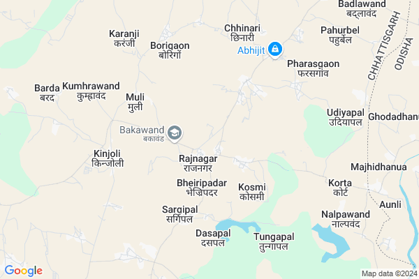
Mohlai (b.)
Mohlai (b.) Map
EDIT Map
Add Your House
 ..
..
Current Corona Virus Infected Patients Count in Bastar District
| City Name | District Name | Total Covid cases |
|---|
Locality Name :
Mohlai (b.)
( मोहले (b.) )
Tehsil Name : Bakawand
District : Bastar
State : Chattisgarh
Language : Oriya and Hindi
Current Time 06:45 AM
Date: Saturday , May 03,2025 (IST)
Time zone: IST (UTC+5:30)
Elevation / Altitude: 562 meters. Above Seal level
Telephone Code / Std Code: 07782
Assembly constituency : Bastar assembly constituency
Assembly MLA : Baghel Lakheshwar
Lok Sabha constituency : Bastar parliamentary constituency
Parliament MP : DEEPAK BAIJ
Serpanch Name :
Alternate Village Name : Mohlai
Commodities Prices : Muli Market / Mandi
Mohlai (b.) Live Weather
Temperature: 24.0 °C
clear sky
Humidity: 63%
Wind : 1.88 mt/sec towards S
StationName : "Jagdalpur"
observed on 58 Mins Back
Temperature: 24.0 °C
clear sky
Humidity: 63%
Wind : 1.88 mt/sec towards S
StationName : "Jagdalpur"
observed on 58 Mins Back
Mohlai (b.) Weather Forecast for Next 5 days
04-05-2025
24.0°C to 35.4°C
clear sky, light rain, moderate rain, scattered clouds, broken clouds
24.0°C to 35.4°C
clear sky, light rain, moderate rain, scattered clouds, broken clouds
05-05-2025
24.9°C to 37.2°C
broken clouds, scattered clouds, clear sky, light rain
24.9°C to 37.2°C
broken clouds, scattered clouds, clear sky, light rain
06-05-2025
24.9°C to 38.4°C
scattered clouds, clear sky, broken clouds, light rain
24.9°C to 38.4°C
scattered clouds, clear sky, broken clouds, light rain
07-05-2025
25.5°C to 38.6°C
scattered clouds, overcast clouds, broken clouds
25.5°C to 38.6°C
scattered clouds, overcast clouds, broken clouds
08-05-2025
25.7°C to 38.2°C
broken clouds, overcast clouds, scattered clouds
25.7°C to 38.2°C
broken clouds, overcast clouds, scattered clouds
Rivers Near Mohlai (b.)
Indravati :Indravati River
Turi
Indravati :Indravati River
Turi
About Mohlai (b.)
Correct below Info and add more info about Mohlai (b.)Mohlai (b.) is a Village in Bakawand Tehsil in Bastar District of Chattisgarh State, India. It is located 19 KM towards East from District head quarters Jagdalpur. 265 KM from State capital Raipur
Mohlai (b.) is surrounded by Kosagumuda Tehsil towards East , Jagdalpur Tehsil towards South , Bastar Tehsil towards west , Tokapal Tehsil towards South .
Jagdalpur , Umarkote , Nabarangapur , Kondagaon are the near by Cities to Mohlai (b.).
Mohlai 2011 Census Details
Mohlai (b.) Local Language is Oriya. Mohlai Village Total population is 808 and number of houses are 180. Female Population is 50.2%. Village literacy rate is 24.3% and the Female Literacy rate is 8.9%.
Population
| Census Parameter | Census Data |
| Total Population | 808 |
| Total No of Houses | 180 |
| Female Population % | 50.2 % ( 406) |
| Total Literacy rate % | 24.3 % ( 196) |
| Female Literacy rate | 8.9 % ( 72) |
| Scheduled Tribes Population % | 96.3 % ( 778) |
| Scheduled Caste Population % | 0.5 % ( 4) |
| Working Population % | 59.9 % |
| Child(0 -6) Population by 2011 | 199 |
| Girl Child(0 -6) Population % by 2011 | 47.2 % ( 94) |
Mohlai Census More Deatils.
Politics in Mohlai (b.)
Indian National Congress , BJP , INC are the major political parties in this area.Polling Stations /Booths near Mohlai (b.)
1)Bhatpal2)Kosami 2
3)Korta
4)Rajnagar 2
5)Rajnagar 4
HOW TO REACH Mohlai (b.)
By Rail
There is no railway station near to Mohlai (b.) in less than 10 km.Pincodes near Mohlai (b.)
494222 ( Bakawand ) , 494221 ( Asna ) , 494223 ( Bastar )Colleges near Mohlai (b.)
Govt College Bhanpuri Besoli
Address :
Bastar Medical College Of Alternative Medicines (bmcam)
Address :
Bastar College
Address :
Late Shri Baliram Kashyap Memorial Govt.medical College Jagdalpur
Address : Dimrapal Campus Jagdalpur Pin -494001
Higher Secondary School Gamhari
Address : Gamhari .kondagaon Road
Schools in Mohlai (b.)
Ups Mohlai 2
Address : mohlai , bakawand , baster , Chattisgarh . PIN- 494224 , Post - Bhanpuri
S.c. Primary School
Address : mohlai , bakawand , baster , Chattisgarh . PIN- 494224 , Post - Bhanpuri
Ms Mohlai
Address : mohlai , bakawand , baster , Chattisgarh . PIN- 494224 , Post - Bhanpuri
Govt Health Centers near Mohlai (b.)
1) SHC Rajnagar , SUB HEALTH CENTRE RAJNAGAR , VILLAGE- RAJNAGAR PANCHAYAT- RAJNAGAR ,2) SHC Kosmi(BASTAR) , SUB HEALTH CENTRE KOSMI , VILLAGE KOSMI PANCHAYAT KOSMI ,
3) CHC BAKAWAND , CHC Community Helath Centre, Bakawand , Community Helath Centre, Bakawand , IN FRONT OF SBI BAKAWAND
Petrol Bunks in Mohlai (b.),Bakawand
Tirath Singh Manmohan Singh Petrol Pump
NH43; Aasana; Chhattisgarh 494221; India
19.4 KM distance Detail
Bharat Petroleum
Aasana; Bastar; NH-43; Jagdalpur; Jagdalpur; Chhattisgarh 494224; India
19.4 KM distance Detail
more ..
Colleges in Mohlai (b.),Bakawand
Late Baliram Kashyap Govt. College Bakawand
Bakawand; Chhattisgarh 494222; India
1.1 KM distance Detail
more ..
Electronic Shops in Mohlai (b.),Bakawand
Rajveer Electronics
Singsari - Karpawand Rd; Karpawand; Chhattisgarh 494222; India
15.3 KM distance Detail
R.K.Enterprises
Singsari - Karpawand Rd; Karpawand; Chhattisgarh 494224; India
15.3 KM distance Detail
Governement Offices near Mohlai (b.),Bakawand
Chetana RTE Office
Unnamed Rd;; Darampura; Jagdalpur; Chhattisgarh 494005; India
22.1 KM distance Detail
About Mohlai (b.) &
History
How to reach Mohlai (b.)
Tourist Places Near By Mohlai (b.)
Schools in Mohlai (b.)
Colleges in Mohlai (b.)
Temperature & weather of Mohlai (b.)
places in Mohlai (b.)
Mohlai (b.) photos
More Information
How to reach Mohlai (b.)
Tourist Places Near By Mohlai (b.)
Schools in Mohlai (b.)
Colleges in Mohlai (b.)
Temperature & weather of Mohlai (b.)
places in Mohlai (b.)
Mohlai (b.) photos
More Information
Village Talk
Post News or Events about this Village
Near Cities
Jagdalpur 21 KM near
Umarkote 53 KM near
Nabarangapur 55 KM near
Kondagaon 63 KM near
Jagdalpur 21 KM near
Umarkote 53 KM near
Nabarangapur 55 KM near
Kondagaon 63 KM near
Near By Taluks
Bakawand 0 KM near
Kosagumuda 22 KM near
Jagdalpur 23 KM near
Bastar 24 KM near
Bakawand 0 KM near
Kosagumuda 22 KM near
Jagdalpur 23 KM near
Bastar 24 KM near
Near By Air Ports
Vishakhapatnam Airport 232 KM near
Raipur Airport 244 KM near
Rajahmundry Airport 268 KM near
Vijayawada Airport 371 KM near
Vishakhapatnam Airport 232 KM near
Raipur Airport 244 KM near
Rajahmundry Airport 268 KM near
Vijayawada Airport 371 KM near
Near By Tourist Places
Jagdalpur 21 KM near
Bastar 23 KM near
Jeypore 74 KM near
Dantewada 96 KM near
Kanker 144 KM near
Jagdalpur 21 KM near
Bastar 23 KM near
Jeypore 74 KM near
Dantewada 96 KM near
Kanker 144 KM near
Near By Districts
Bastar 18 KM near
Nabarangpur 56 KM near
Koraput 92 KM near
Dantewada 94 KM near
Bastar 18 KM near
Nabarangpur 56 KM near
Koraput 92 KM near
Dantewada 94 KM near
Near By RailWay Station
Koraput Junction Rail Way Station 94 KM near
Singapur Road Rail Way Station 155 KM near
Koraput Junction Rail Way Station 94 KM near
Singapur Road Rail Way Station 155 KM near