| Home | City Bus | Maps | Villages | Cities | Rail | Tourist Places | School | College | Pin Codes | Corona Cases Count |
| Distance Calculator Bus Services IFSC Codes Trace Mobile Number Weather Search Place Trace IP Available Cash ATM/Banks Locate Polling Booth Report an Error contact People |
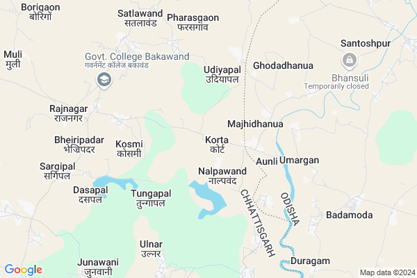
Korta
Korta Map
EDIT Map
Add Your House
 ..
..
Current Corona Virus Infected Patients Count in Bastar District
| City Name | District Name | Total Covid cases |
|---|
Locality Name :
Korta
( करता )
Tehsil Name : Bakawand
District : Bastar
State : Chattisgarh
Language : Oriya and Hindi
Current Time 12:43 AM
Date: Saturday , May 03,2025 (IST)
Time zone: IST (UTC+5:30)
Elevation / Altitude: 562 meters. Above Seal level
Telephone Code / Std Code: 07782
Assembly constituency : Bastar assembly constituency
Assembly MLA : Baghel Lakheshwar
Lok Sabha constituency : Bastar parliamentary constituency
Parliament MP : DEEPAK BAIJ
Serpanch Name :
Pin Code : 494222
Post Office Name : Bakawand
Commodities Prices : Jaitgiri Market / Mandi
Korta Live Weather
Temperature: 26.9 °C
few clouds
Humidity: 52%
Wind : 3.58 mt/sec towards S
StationName : "Jagdalpur"
observed on 2 Hours Back
Temperature: 26.9 °C
few clouds
Humidity: 52%
Wind : 3.58 mt/sec towards S
StationName : "Jagdalpur"
observed on 2 Hours Back
Korta Weather Forecast for Next 5 days
03-05-2025
25.0°C to 26.3°C
few clouds
25.0°C to 26.3°C
few clouds
04-05-2025
23.3°C to 36.4°C
clear sky, light rain, broken clouds
23.3°C to 36.4°C
clear sky, light rain, broken clouds
05-05-2025
24.7°C to 38.4°C
broken clouds, scattered clouds, few clouds, light rain
24.7°C to 38.4°C
broken clouds, scattered clouds, few clouds, light rain
06-05-2025
24.6°C to 38.8°C
few clouds, clear sky, overcast clouds, broken clouds
24.6°C to 38.8°C
few clouds, clear sky, overcast clouds, broken clouds
07-05-2025
24.2°C to 38.5°C
scattered clouds, broken clouds, overcast clouds
24.2°C to 38.5°C
scattered clouds, broken clouds, overcast clouds
Rivers Near Korta
Indravati :Indravati River
Turi
Indravati :Indravati River
Turi
About Korta
Correct below Info and add more info about KortaKorta is a Village in Bakawand Tehsil in Bastar District of Chattisgarh State, India. It is located 26 KM towards East from District head quarters Jagdalpur. 8 KM from Bakawand. 270 KM from State capital Raipur
Korta Pin code is 494222 and postal head office is Bakawand .
Kosmi ( 5 KM ) , Bajawand ( 6 KM ) , Sargipal ( 7 KM ) , Bakawand ( 8 KM ) , Bhejripadar ( 8 KM ) are the nearby Villages to Korta. Korta is surrounded by Kosagumuda Tehsil towards East , Jagdalpur Tehsil towards South , Kotpad Tehsil towards East , Bastar Tehsil towards west .
Jagdalpur , Nabarangapur , Umarkote , Jeypur are the near by Cities to Korta.
Korta 2011 Census Details
Korta Local Language is Oriya. Korta Village Total population is 1447 and number of houses are 370. Female Population is 50.4%. Village literacy rate is 40.6% and the Female Literacy rate is 15.3%.
Population
| Census Parameter | Census Data |
| Total Population | 1447 |
| Total No of Houses | 370 |
| Female Population % | 50.4 % ( 729) |
| Total Literacy rate % | 40.6 % ( 588) |
| Female Literacy rate | 15.3 % ( 222) |
| Scheduled Tribes Population % | 70.7 % ( 1023) |
| Scheduled Caste Population % | 0.0 % ( 0) |
| Working Population % | 55.3 % |
| Child(0 -6) Population by 2011 | 222 |
| Girl Child(0 -6) Population % by 2011 | 56.8 % ( 126) |
Korta Census More Deatils.
Politics in Korta
Indian National Congress , BJP , INC are the major political parties in this area.Polling Stations /Booths near Korta
1)Kolchur-22)Mundapal
3)Cholnar
4)Piplavand 1
5)Tuhati Dewada
HOW TO REACH Korta
By Rail
There is no railway station near to Korta in less than 10 km.Colleges near Korta
Govt College Bhanpuri Besoli
Address :
Bastar Medical College Of Alternative Medicines (bmcam)
Address :
Bastar College
Address :
Late Shri Baliram Kashyap Memorial Govt.medical College Jagdalpur
Address : Dimrapal Campus Jagdalpur Pin -494001
Higher Secondary School Gamhari
Address : Gamhari .kondagaon Road
Schools in Korta
Ups Korta
Address : korta , bakawand , baster , Chattisgarh . PIN- 494222 , Post - Bakawand
Govt Health Centers near Korta
1) SHC Nalpawand , SUB HEALTH CENTRE NALPAWAND , VILLAGE NALPAWAND PANCHAYAT- NALPAWAND ,2) SHC Sargipal , SUB HEALTH CENTRE SARGIPAL , VILLAGE SARGIPAL PANCHAYAT- SARGIPAL ,
3) SHC Kosmi(BASTAR) , SUB HEALTH CENTRE KOSMI , VILLAGE KOSMI PANCHAYAT KOSMI ,
Petrol Bunks in Korta,Bakawand
Tirath Singh Manmohan Singh Petrol Pump
NH43; Aasana; Chhattisgarh 494221; India
20.8 KM distance Detail
more ..
Colleges in Korta,Bakawand
Late Baliram Kashyap Govt. College Bakawand
Bakawand; Chhattisgarh 494222; India
7.0 KM distance Detail
more ..
Schools in Korta,Bakawand
Dav Mukhyamantri Public School
Ulnar; Block Bakawand; Distt Bastar; Chhattisgarh; Bastar; Chhattisgarh; India
7.2 KM distance Detail
About Korta &
History
How to reach Korta
Tourist Places Near By Korta
Schools in Korta
Colleges in Korta
Temperature & weather of Korta
places in Korta
Korta photos
More Information
How to reach Korta
Tourist Places Near By Korta
Schools in Korta
Colleges in Korta
Temperature & weather of Korta
places in Korta
Korta photos
More Information
Village Talk
Post News or Events about this Village
Near Cities
Jagdalpur 22 KM near
Nabarangapur 48 KM near
Umarkote 54 KM near
Jeypur 68 KM near
Jagdalpur 22 KM near
Nabarangapur 48 KM near
Umarkote 54 KM near
Jeypur 68 KM near
Near By Taluks
Bakawand 7 KM near
Kosagumuda 15 KM near
Jagdalpur 23 KM near
Kotpad 29 KM near
Bakawand 7 KM near
Kosagumuda 15 KM near
Jagdalpur 23 KM near
Kotpad 29 KM near
Near By Air Ports
Vishakhapatnam Airport 226 KM near
Raipur Airport 247 KM near
Rajahmundry Airport 266 KM near
Vijayawada Airport 372 KM near
Vishakhapatnam Airport 226 KM near
Raipur Airport 247 KM near
Rajahmundry Airport 266 KM near
Vijayawada Airport 372 KM near
Near By Tourist Places
Jagdalpur 22 KM near
Bastar 26 KM near
Jeypore 67 KM near
Dantewada 102 KM near
Araku Valley 140 KM near
Jagdalpur 22 KM near
Bastar 26 KM near
Jeypore 67 KM near
Dantewada 102 KM near
Araku Valley 140 KM near
Near By Districts
Bastar 24 KM near
Nabarangpur 49 KM near
Koraput 85 KM near
Dantewada 99 KM near
Bastar 24 KM near
Nabarangpur 49 KM near
Koraput 85 KM near
Dantewada 99 KM near
Near By RailWay Station
Koraput Junction Rail Way Station 87 KM near
Singapur Road Rail Way Station 148 KM near
Koraput Junction Rail Way Station 87 KM near
Singapur Road Rail Way Station 148 KM near