| Home | City Bus | Maps | Villages | Cities | Rail | Tourist Places | School | College | Pin Codes | Corona Cases Count |
| Distance Calculator Bus Services IFSC Codes Trace Mobile Number Weather Search Place Trace IP Available Cash ATM/Banks Locate Polling Booth Report an Error contact People |
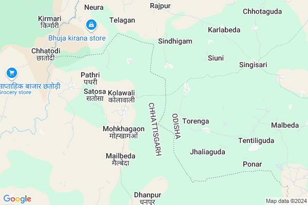
Kolawal
Kolawal Map
EDIT Map
Add Your House
 ..
..
Current Corona Virus Infected Patients Count in Bastar District
| City Name | District Name | Total Covid cases |
|---|
Locality Name :
Kolawal
( कोलावल )
Tehsil Name : Bakawand
District : Bastar
State : Chattisgarh
Language : Oriya and Hindi
Current Time 12:34 AM
Date: Saturday , May 03,2025 (IST)
Time zone: IST (UTC+5:30)
Elevation / Altitude: 562 meters. Above Seal level
Telephone Code / Std Code: 07782
Assembly constituency : Bastar assembly constituency
Assembly MLA : Baghel Lakheshwar
Lok Sabha constituency : Bastar parliamentary constituency
Parliament MP : DEEPAK BAIJ
Serpanch Name :
Pin Code : 494222
Post Office Name : Bakawand
Alternate Village Name : Kolawali
Commodities Prices : Karpawand Market / Mandi
Kolawal Live Weather
Temperature: 26.0 °C
few clouds
Humidity: 55%
Wind : 1.78 mt/sec towards SW
StationName : "Umarkot"
observed on 35 Mins Back
Temperature: 26.0 °C
few clouds
Humidity: 55%
Wind : 1.78 mt/sec towards SW
StationName : "Umarkot"
observed on 35 Mins Back
Kolawal Weather Forecast for Next 5 days
03-05-2025
24.6°C to 25.6°C
few clouds
24.6°C to 25.6°C
few clouds
04-05-2025
23.3°C to 34.8°C
clear sky, light rain, scattered clouds, broken clouds
23.3°C to 34.8°C
clear sky, light rain, scattered clouds, broken clouds
05-05-2025
24.5°C to 36.6°C
broken clouds, few clouds, light rain, overcast clouds
24.5°C to 36.6°C
broken clouds, few clouds, light rain, overcast clouds
06-05-2025
23.9°C to 38.2°C
scattered clouds, clear sky, overcast clouds, light rain, broken clouds
23.9°C to 38.2°C
scattered clouds, clear sky, overcast clouds, light rain, broken clouds
07-05-2025
25.0°C to 37.9°C
scattered clouds, broken clouds, light rain, overcast clouds
25.0°C to 37.9°C
scattered clouds, broken clouds, light rain, overcast clouds
Rivers Near Kolawal
Indravati :Indravati River
Turi
Indravati :Indravati River
Turi
About Kolawal
Correct below Info and add more info about KolawalKolawal is a Village in Bakawand Tehsil in Bastar District of Chattisgarh State, India. It is located 41 KM towards North from District head quarters Jagdalpur. 29 KM from Bakawand. 237 KM from State capital Raipur
Kolawal Pin code is 494222 and postal head office is Bakawand .
Dhanpur ( 7 KM ) , Choknar ( 11 KM ) , Karpawand ( 13 KM ) , Chhindgaon ( 14 KM ) , Dimrapal ( 15 KM ) are the nearby Villages to Kolawal. Kolawal is surrounded by Bakawand Tehsil towards South , Dabugam Tehsil towards East , Kosagumuda Tehsil towards South , Jharigam Tehsil towards East .
Umarkote , Jagdalpur , Kondagaon , Nabarangapur are the near by Cities to Kolawal.
Kolawali 2011 Census Details
Kolawal Local Language is Oriya. Kolawali Village Total population is 3474 and number of houses are 711. Female Population is 49.0%. Village literacy rate is 35.9% and the Female Literacy rate is 12.7%.
Population
| Census Parameter | Census Data |
| Total Population | 3474 |
| Total No of Houses | 711 |
| Female Population % | 49.0 % ( 1702) |
| Total Literacy rate % | 35.9 % ( 1248) |
| Female Literacy rate | 12.7 % ( 440) |
| Scheduled Tribes Population % | 81.6 % ( 2836) |
| Scheduled Caste Population % | 0.5 % ( 18) |
| Working Population % | 55.6 % |
| Child(0 -6) Population by 2011 | 588 |
| Girl Child(0 -6) Population % by 2011 | 49.0 % ( 288) |
Kolawali Census More Deatils.
Politics in Kolawal
Indian National Congress , BJP , INC are the major political parties in this area.Polling Stations /Booths near Kolawal
1)Kohkapal 12)Kolaval
3)Kolavali-1
4)Mohlai Va. G
5)Bhejripdar
HOW TO REACH Kolawal
By Rail
There is no railway station near to Kolawal in less than 10 km.Colleges near Kolawal
Govt College Bhanpuri Besoli
Address :
Bastar Medical College Of Alternative Medicines (bmcam)
Address :
Bastar College
Address :
Late Shri Baliram Kashyap Memorial Govt.medical College Jagdalpur
Address : Dimrapal Campus Jagdalpur Pin -494001
Higher Secondary School Gamhari
Address : Gamhari .kondagaon Road
Schools in Kolawal
Ups Kolawal
Address : kolawal , bakawand , baster , Chattisgarh . PIN- 494222 , Post - Bakawand
Ups Mailbeda
Address : kolawal , bakawand , baster , Chattisgarh . PIN- 494222 , Post - Bakawand
Ups Mokhagaon
Address : kolawal , bakawand , baster , Chattisgarh . PIN- 494222 , Post - Bakawand
Ms Pathri
Address : kolawal , bakawand , baster , Chattisgarh . PIN- 494222 , Post - Bakawand
Ups Bhirenda
Address : kolawal , bakawand , baster , Chattisgarh . PIN- 494222 , Post - Bakawand
Govt Health Centers near Kolawal
1) PHC Kolawal , BEHIND PRIMARY SCHOOL , PANCHAYAT KOLAWAL ,2) SHC Pathri(BASTAR) , SUB HEALTH CENTRE PATHRI , VILLAGE PATHRI PANCHAYAT- PATHRI ,
3) SHC Satosa , SUB HEALTH CENTRE Satosa , VILLAGE SATOSHA PANCHAYAT- Satosa ,
Schools in Kolawal,Bakawand
Eklavya Model Residential School Karpawand
Karpawand; Chhattisgarh 494222; India
13.2 KM distance Detail
Saraswati Shishu Mandir High School Karpawand
Karpawand; Chhattisgarh 494222; India
15.2 KM distance Detail
sarsvati shishu mandir hight school jaibel
Dimrapal; Chhattisgarh 494224; India
16.2 KM distance Detail
Electronic Shops in Kolawal,Bakawand
R.K.Enterprises
Singsari - Karpawand Rd; Karpawand; Chhattisgarh 494224; India
14.7 KM distance Detail
Rajveer Electronics
Singsari - Karpawand Rd; Karpawand; Chhattisgarh 494222; India
14.8 KM distance Detail
Super Markets in Kolawal,Bakawand
Local Parks in Kolawal,Bakawand
Police Stations near Kolawal,Bakawand
Governement Offices near Kolawal,Bakawand
About Kolawal &
History
How to reach Kolawal
Tourist Places Near By Kolawal
Schools in Kolawal
Colleges in Kolawal
Temperature & weather of Kolawal
places in Kolawal
Kolawal photos
More Information
How to reach Kolawal
Tourist Places Near By Kolawal
Schools in Kolawal
Colleges in Kolawal
Temperature & weather of Kolawal
places in Kolawal
Kolawal photos
More Information
Village Talk
Post News or Events about this Village
Near Cities
Umarkote 26 KM near
Jagdalpur 50 KM near
Kondagaon 51 KM near
Nabarangapur 61 KM near
Umarkote 26 KM near
Jagdalpur 50 KM near
Kondagaon 51 KM near
Nabarangapur 61 KM near
Near By Taluks
Umerkote 23 KM near
Bakawand 28 KM near
Dabugam 31 KM near
Kosagumuda 33 KM near
Umerkote 23 KM near
Bakawand 28 KM near
Dabugam 31 KM near
Kosagumuda 33 KM near
Near By Air Ports
Raipur Airport 216 KM near
Vishakhapatnam Airport 255 KM near
Rajahmundry Airport 297 KM near
Vijayawada Airport 398 KM near
Raipur Airport 216 KM near
Vishakhapatnam Airport 255 KM near
Rajahmundry Airport 297 KM near
Vijayawada Airport 398 KM near
Near By Tourist Places
Jagdalpur 50 KM near
Bastar 50 KM near
Jeypore 93 KM near
Dantewada 114 KM near
Kanker 120 KM near
Jagdalpur 50 KM near
Bastar 50 KM near
Jeypore 93 KM near
Dantewada 114 KM near
Kanker 120 KM near
Near By Districts
Bastar 39 KM near
Nabarangpur 62 KM near
Narayanpur 102 KM near
Koraput 110 KM near
Bastar 39 KM near
Nabarangpur 62 KM near
Narayanpur 102 KM near
Koraput 110 KM near
Near By RailWay Station
Koraput Junction Rail Way Station 112 KM near
Singapur Road Rail Way Station 155 KM near
Koraput Junction Rail Way Station 112 KM near
Singapur Road Rail Way Station 155 KM near