| Home | City Bus | Maps | Villages | Cities | Rail | Tourist Places | School | College | Pin Codes | Corona Cases Count |
| Distance Calculator Bus Services IFSC Codes Trace Mobile Number Weather Search Place Trace IP Available Cash ATM/Banks Locate Polling Booth Report an Error contact People |
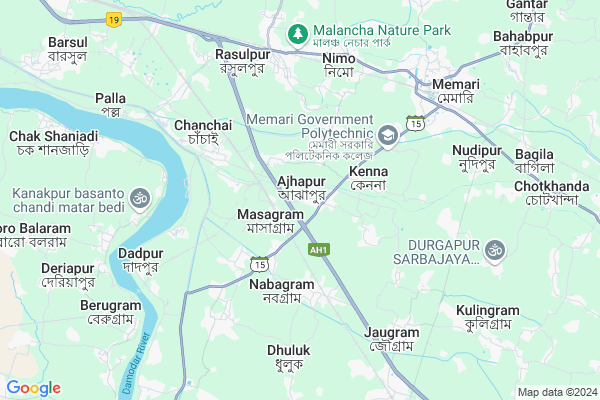
Ajhapur
Ajhapur Map
EDIT Map
Add Your House
 ..
..
Current Corona Virus Infected Patients Count in Bardhaman District
| City Name | District Name | Total Covid cases |
|---|
Locality Name :
Ajhapur
( আঝাপুর )
Block Name : Jamal Pur
District : Bardhaman
State : West Bengal
Division : Burdwan
Language : Bengali and English
Current Time 01:19 AM
Date: Saturday , May 03,2025 (IST)
Time zone: IST (UTC+5:30)
Elevation / Altitude: 21 meters. Above Seal level
Telephone Code / Std Code: 03213
Assembly constituency : Jamalpur assembly constituency
Assembly MLA : Alok Kumar Majhi
Lok Sabha constituency : Bardhaman Purba parliamentary constituency
Parliament MP : SUNIL KUMAR MONDAL
Serpanch Name :
Pin Code : 713401
Post Office Name : Ajhapur
Commodities Prices : Memari Market / Mandi
Ajhapur Live Weather
Temperature: 26.8 °C
clear sky
Humidity: 56%
Wind : 2.05 mt/sec towards SW
StationName : "MemÄ\u0081ri"
observed on Now
Temperature: 26.8 °C
clear sky
Humidity: 56%
Wind : 2.05 mt/sec towards SW
StationName : "MemÄ\u0081ri"
observed on Now
Ajhapur Weather Forecast for Next 5 days
03-05-2025
26.6°C to 26.6°C
clear sky
26.6°C to 26.6°C
clear sky
04-05-2025
24.3°C to 35.8°C
few clouds, clear sky, light rain, scattered clouds
24.3°C to 35.8°C
few clouds, clear sky, light rain, scattered clouds
05-05-2025
24.8°C to 37.5°C
scattered clouds, clear sky, few clouds, broken clouds
24.8°C to 37.5°C
scattered clouds, clear sky, few clouds, broken clouds
06-05-2025
25.7°C to 39.6°C
light rain, clear sky, broken clouds, scattered clouds
25.7°C to 39.6°C
light rain, clear sky, broken clouds, scattered clouds
07-05-2025
27.2°C to 41.0°C
broken clouds, few clouds, light rain, scattered clouds
27.2°C to 41.0°C
broken clouds, few clouds, light rain, scattered clouds
National Highways Reachable To Ajhapur
Nationa High Way :NH19
Nationa High Way :NH19
Rivers Near Ajhapur
Bhagirathi :Hooghly River
Jamuna River
Bhagirathi :Hooghly River
Jamuna River
About Ajhapur
Correct below Info and add more info about AjhapurAjhapur is a Village in Jamal Pur Block in Bardhaman District of West Bengal State, India. It belongs to Burdwan Division . It is located 27 KM towards East from District head quarters Bardhaman. 12 KM from Jamal Pur. 82 KM from State capital Kolkata
Ajhapur Pin code is 713401 and postal head office is Ajhapur .
Dogachhia ( 7 KM ) , Bagila ( 9 KM ) , Berugram ( 9 KM ) , Amadpur ( 9 KM ) , Jamalpur-ii ( 12 KM ) are the nearby Villages to Ajhapur. Ajhapur is surrounded by Memari-1 Block towards East , Jamal Pur Block towards South , Raina-I Block towards west , Burdwan-Ii Block towards North .
Memari , Bardhaman , Pandua , Srirampur are the near by Cities to Ajhapur.
This Place is in the border of the Bardhaman District and Hooghly District. Hooghly District Dhaniakhali is South towards this place .
Ajhapur 2011 Census Details
Ajhapur Local Language is Bengali. Ajhapur Village Total population is 8502 and number of houses are 2065. Female Population is 49.3%. Village literacy rate is 58.8% and the Female Literacy rate is 25.9%.
Population
| Census Parameter | Census Data |
| Total Population | 8502 |
| Total No of Houses | 2065 |
| Female Population % | 49.3 % ( 4194) |
| Total Literacy rate % | 58.8 % ( 5001) |
| Female Literacy rate | 25.9 % ( 2204) |
| Scheduled Tribes Population % | 21.7 % ( 1843) |
| Scheduled Caste Population % | 39.0 % ( 3318) |
| Working Population % | 46.2 % |
| Child(0 -6) Population by 2011 | 983 |
| Girl Child(0 -6) Population % by 2011 | 47.9 % ( 471) |
Ajhapur Census More Deatils.
Politics in Ajhapur
CPM , AITC , All India Trinamool Congress are the major political parties in this area.Polling Stations /Booths near Ajhapur
1)Ajhapur High School (right)2)Parul Prathamik Vidyalaya
3)Patherdabi Prathamik Vidyalaya(room No. 1)
4)Ajhapur F.p. School
5)Ajhapur High School (left)
HOW TO REACH Ajhapur
By Rail
Masagram Junction Rail Way Station , Chanchai Rail Way Station are the very nearby railway stations to Ajhapur.Colleges near Ajhapur
Sir Rash Behari Ghosh Mahavidhalaya, Ukhrid Collage
Address :
Sir Rash Behari Ghosh Mahavidhalaya,ukhrid
Address :
International Institute Of Business & Excellence
Address :
Laudoha Govt.p.t.t.i
Address : Laudoha ,burdwan ,pin-713385
Katwa College
Address :
Schools near Ajhapur
Panchra S.c.r.s. Bidyamandir
Address : panchra/vii , jamalpur , barddhaman , West Bengal . PIN- 713401 , Post - Ajhapur
Kalna Kanshra High School
Address : jamalpur-ii/vi , jamalpur , barddhaman , West Bengal . PIN- 713408 , Post - Jamalpur (Bardhaman)
Chakshanjadi G.m. Institution
Address : berugram/ii , jamalpur , barddhaman , West Bengal . PIN- 713124 , Post - Barsul Unnayani
Parbatpur High School
Address : paratal-i/ii , jamalpur , barddhaman , West Bengal . PIN- 713408 , Post - Jamalpur (Bardhaman)
Govt Health Centers near Ajhapur
1) Ajhapur SC , Ajhapur SC , ,2) Jabui SC , Jabui SC Building , Kamarpara Road , Haragouri Tala
3) Ashapur SC , Ashapur School Building , Kalna Road , Dakhalpur Bridge
Hospitals in Ajhapur,Jamal Pur
Memorial Nursing Home
Memari-Tarkeswar Rd; Ajhapur; West Bengal 713401; India
1.1 KM distance Detail
more ..
Petrol Bunks in Ajhapur,Jamal Pur
SARADA SERVICE STATION
Masagram Station Road;Ajhapur; Burdwan; West Bengal 713401; India
1.3 KM distance Detail
more ..
Colleges in Ajhapur,Jamal Pur
GITARANI PRIVATE INDUSTRIAL TRAINING INSTITUTE
Mohanpur; Masagram; West Bengal 713401; India
1.6 KM distance Detail
more ..
Schools in Ajhapur,Jamal Pur
Ajhapur Balikha vidyalay;
Balika Vidyalay;ps jamalpur; Ajhapur; West Bengal 713401; India
0.3 KM distance Detail
Ajhapur High School
Burdwan; Memari-Tarkeswar Road; Ajhapur; West Bengal 713401; India
0.9 KM distance Detail
Super Markets in Ajhapur,Jamal Pur
Masagram Cable Network
Masagram Station Road; Masagram; West Bengal 713401; India
1.3 KM distance Detail
Local Parks in Ajhapur,Jamal Pur
Malancha Nature Park
Rasulpur - Kuchut Road; Chak Nara; West Bengal 713154; India
6.2 KM distance Detail
Sabujabho Park (সবুজাভ)
Sahebbagan Rasulpur Burdwan; GT ROAD; SH 13; Baidyadanga; West Bengal 713151; India
6.2 KM distance Detail
Governement Offices near Ajhapur,Jamal Pur
OFFICE OF BURDWAN JILA PARISHAD; MEMARI; BURDWAN.
Memari; West Bengal 713146; India
5.8 KM distance Detail
About Ajhapur &
History
How to reach Ajhapur
Tourist Places Near By Ajhapur
Schools in Ajhapur
Colleges in Ajhapur
Temperature & weather of Ajhapur
places in Ajhapur
Ajhapur photos
More Information
How to reach Ajhapur
Tourist Places Near By Ajhapur
Schools in Ajhapur
Colleges in Ajhapur
Temperature & weather of Ajhapur
places in Ajhapur
Ajhapur photos
More Information
Village Talk
Post News or Events about this Village
Near Cities
Memari 10 KM near
Bardhaman 24 KM near
Pandua 27 KM near
Srirampur 27 KM near
Memari 10 KM near
Bardhaman 24 KM near
Pandua 27 KM near
Srirampur 27 KM near
Near By Taluks
Memari-Ii 7 KM near
Memari-1 8 KM near
Jamal Pur 11 KM near
Raina-I 18 KM near
Memari-Ii 7 KM near
Memari-1 8 KM near
Jamal Pur 11 KM near
Raina-I 18 KM near
Near By Air Ports
Netaji Subhas Chandra Bose Airport 76 KM near
Ranchi Airport 312 KM near
Singerbhil Airport 376 KM near
Gaya Airport 406 KM near
Netaji Subhas Chandra Bose Airport 76 KM near
Ranchi Airport 312 KM near
Singerbhil Airport 376 KM near
Gaya Airport 406 KM near
Near By Tourist Places
Burdwan 24 KM near
Bardhaman 24 KM near
Navadvipa 49 KM near
Mayapur 52 KM near
Jairambati 55 KM near
Burdwan 24 KM near
Bardhaman 24 KM near
Navadvipa 49 KM near
Mayapur 52 KM near
Jairambati 55 KM near
Near By Districts
Bardhaman 26 KM near
Hooghly 49 KM near
Nadia 60 KM near
24 Paraganas North 72 KM near
Bardhaman 26 KM near
Hooghly 49 KM near
Nadia 60 KM near
24 Paraganas North 72 KM near
Near By RailWay Station
Masagram Junction Rail Way Station 1.1 KM near
Chanchai Rail Way Station 3.8 KM near
Nabagram Rail Way Station 5.8 KM near
Barddhaman Junction Rail Way Station 24 KM near
Ambika Kalna Rail Way Station 35 KM near
Masagram Junction Rail Way Station 1.1 KM near
Chanchai Rail Way Station 3.8 KM near
Nabagram Rail Way Station 5.8 KM near
Barddhaman Junction Rail Way Station 24 KM near
Ambika Kalna Rail Way Station 35 KM near