| Home | City Bus | Maps | Villages | Cities | Rail | Tourist Places | School | College | Pin Codes | Corona Cases Count |
| Distance Calculator Bus Services IFSC Codes Trace Mobile Number Weather Search Place Trace IP Available Cash ATM/Banks Locate Polling Booth Report an Error contact People |
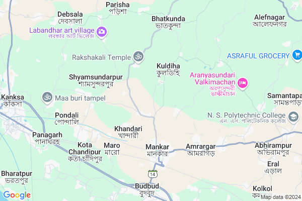
Ramnagar
Ramnagar Map
EDIT Map
Add Your House
 ..
..
Current Corona Virus Infected Patients Count in Bardhaman District
| City Name | District Name | Total Covid cases |
|---|
Locality Name :
Ramnagar
( রামনগর )
Block Name : Ausgram-ii
District : Bardhaman
State : West Bengal
Division : Burdwan
Language : Bengali and English
Current Time 02:31 AM
Date: Sunday , May 04,2025 (IST)
Time zone: IST (UTC+5:30)
Elevation / Altitude: 65 meters. Above Seal level
Telephone Code / Std Code: 03452
Assembly constituency : Ausgram assembly constituency
Assembly MLA : Abhedananda Thander
Lok Sabha constituency : Bolpur parliamentary constituency
Parliament MP : ASIT KUMAR MAL
Serpanch Name :
Pin Code : 713144
Post Office Name : Mankar
Commodities Prices : Durgapur Market / Mandi
Ramnagar Live Weather
Temperature: 26.3 °C
clear sky
Humidity: 75%
Wind : 3.37 mt/sec towards S
StationName : "Guskhara"
observed on 26 Mins Back
Temperature: 26.3 °C
clear sky
Humidity: 75%
Wind : 3.37 mt/sec towards S
StationName : "Guskhara"
observed on 26 Mins Back
Ramnagar Weather Forecast for Next 5 days
04-05-2025
26.1°C to 26.1°C
clear sky
26.1°C to 26.1°C
clear sky
05-05-2025
25.4°C to 37.2°C
clear sky, broken clouds, light rain
25.4°C to 37.2°C
clear sky, broken clouds, light rain
06-05-2025
26.5°C to 39.5°C
few clouds, scattered clouds, light rain, broken clouds, overcast clouds
26.5°C to 39.5°C
few clouds, scattered clouds, light rain, broken clouds, overcast clouds
07-05-2025
27.4°C to 41.8°C
overcast clouds, few clouds, scattered clouds, broken clouds
27.4°C to 41.8°C
overcast clouds, few clouds, scattered clouds, broken clouds
08-05-2025
28.0°C to 43.6°C
scattered clouds, clear sky, overcast clouds, broken clouds
28.0°C to 43.6°C
scattered clouds, clear sky, overcast clouds, broken clouds
Rivers Near Ramnagar
Khari River
Damodar
Khari River
Damodar
About Ramnagar
Correct below Info and add more info about RamnagarRamnagar is a Village in Ausgram-ii Block in Bardhaman District of West Bengal State, India. It belongs to Burdwan Division . It is located 45 KM towards west from District head quarters Bardhaman. 5 KM from Ausgram-Ii. 151 KM from State capital Kolkata
Ramnagar Pin code is 713144 and postal head office is Mankar .
Pratappur ( 5 KM ) , Budbud ( 7 KM ) , Debshala ( 9 KM ) , Kanksa ( 10 KM ) , Trilokchandrapur ( 10 KM ) are the nearby Villages to Ramnagar. Ramnagar is surrounded by Galsi -I Block towards South , Kanksa Block towards west , Ausgram-I Block towards East , Illambazar Block towards North .
Sonamukhi , Bardhaman , Sainthia , Suri are the near by Cities to Ramnagar.
This Place is in the border of the Bardhaman District and Birbhum District. Birbhum District Illambazar is North towards this place .
Ramnagar 2011 Census Details
Ramnagar Local Language is Bengali. Ramnagar Village Total population is 1242 and number of houses are 249. Female Population is 49.8%. Village literacy rate is 55.4% and the Female Literacy rate is 24.6%.
Population
| Census Parameter | Census Data |
| Total Population | 1242 |
| Total No of Houses | 249 |
| Female Population % | 49.8 % ( 619) |
| Total Literacy rate % | 55.4 % ( 688) |
| Female Literacy rate | 24.6 % ( 305) |
| Scheduled Tribes Population % | 93.8 % ( 1165) |
| Scheduled Caste Population % | 2.6 % ( 32) |
| Working Population % | 49.1 % |
| Child(0 -6) Population by 2011 | 135 |
| Girl Child(0 -6) Population % by 2011 | 45.9 % ( 62) |
Ramnagar Census More Deatils.
Politics in Ramnagar
CPM , CPI(M) , AITC , All India Trinamool Congress , INC are the major political parties in this area.Polling Stations /Booths near Ramnagar
1)Sagarputul F.p School2)Rangakhila F.p. School (r-2)
3)Pallishri F.p. School
4)Gonna Improved Primary School
5)Kayrapur High School
HOW TO REACH Ramnagar
By Rail
Mankar Rail Way Station , Panagarh Rail Way Station are the very nearby railway stations to Ramnagar.Colleges near Ramnagar
Sir Rash Behari Ghosh Mahavidhalaya, Ukhrid Collage
Address :
Sir Rash Behari Ghosh Mahavidhalaya,ukhrid
Address :
International Institute Of Business & Excellence
Address :
Laudoha Govt.p.t.t.i
Address : Laudoha ,burdwan ,pin-713385
Katwa College
Address :
Schools near Ramnagar
Eral Anchal High School
Address : eral/x , ausgram-ii , barddhaman , West Bengal . PIN- 713144 , Post - Mankar
Jamtara High School
Address : bhalki/x , ausgram-ii , barddhaman , West Bengal . PIN- 713171 , Post - Suata
P.p.d. High School
Address : ramnagar/vii , ausgram-ii , barddhaman , West Bengal . PIN- 713152 , Post - Bamnabagram
Debshala High School
Address : debsala/v , ausgram-ii , barddhaman , West Bengal . PIN- 713148 , Post - Panagar Bazara
Govt Health Centers near Ramnagar
1) Ramkrishnapur SC , Ramkrishnapur SC , Vill. Ramkrishnapur, P.O. Brahmanigram, P.S. Labpur. , Attached with Ramkrishnapur PHC2) Ramkrishnapur PHC , Ramkrishnapur PHC , Vill. Ramkrishnapur, P.O. Brahmanigram, P.S. Labpur, , Near Jamna Gram Panchayet
3) Thiba PHC , Thiba PHC , Vill. Thiba, P.O. Bhatra, P.S. Labpur, , Near Thiba Gram Panchayet
Petrol Bunks in Ramnagar,Ausgram-ii
HP PETROL PUMP - BUD BUD AUTO SERVICE
Budbud Chatty; Durgapur; West Bengal 713403; India
7.9 KM distance Detail
more ..
Colleges in Ramnagar,Ausgram-ii
Mankar Institute Of Education And Research
Bhatkunda Road;; Mankar; West Bengal 713144; India
1.6 KM distance Detail
Kanad Institute Of Engineering & Management
Burdwan; Mankar; West Bengal 713144; India
3.4 KM distance Detail
Camellia Institute of Engineering and Technology
Budbud; West Bengal 713155; India
6.9 KM distance Detail
more ..
Electronic Shops in Ramnagar,Ausgram-ii
Maa Saran Kali Electronics
Mankar Haat near Mankar; chandra club; Mankar; West Bengal; India
3.8 KM distance Detail
Bapi Mobile And Computer Repairing Center
Mankar (Krishna ganga Dakshin par); Po- Mankar; Ps - Budbud; Dist - Purba Burdwan; 713144; West Bengal 9933599642; India
4.2 KM distance Detail
Local Parks in Ramnagar,Ausgram-ii
Pratappur Wildlife and Safari Park 1
Radhaballabhpur; West Bengal 713144; India
3.7 KM distance Detail
Police Stations near Ramnagar,Ausgram-ii
Budbud Police Station
Old GT Rd; Sukanta Nagar; Budbud; West Bengal 713403; India
7.9 KM distance Detail
Kanksa Police Station
Kanksa Road; Near Kanksa Girls High School; Kanksa; West Bengal 713148; India
11.0 KM distance Detail
About Ramnagar &
History
How to reach Ramnagar
Tourist Places Near By Ramnagar
Schools in Ramnagar
Colleges in Ramnagar
Temperature & weather of Ramnagar
places in Ramnagar
Ramnagar photos
More Information
How to reach Ramnagar
Tourist Places Near By Ramnagar
Schools in Ramnagar
Colleges in Ramnagar
Temperature & weather of Ramnagar
places in Ramnagar
Ramnagar photos
More Information
Village Talk
Post News or Events about this Village
Near Cities
Sonamukhi 25 KM near
Bardhaman 44 KM near
Sainthia 52 KM near
Suri 59 KM near
Sonamukhi 25 KM near
Bardhaman 44 KM near
Sainthia 52 KM near
Suri 59 KM near
Near By Taluks
Ausgram-Ii 5 KM near
Galsi -I 9 KM near
Kanksa 10 KM near
Ausgram-I 15 KM near
Ausgram-Ii 5 KM near
Galsi -I 9 KM near
Kanksa 10 KM near
Ausgram-I 15 KM near
Near By Air Ports
Netaji Subhas Chandra Bose Airport 143 KM near
Ranchi Airport 255 KM near
Gaya Airport 336 KM near
Patna Airport 385 KM near
Netaji Subhas Chandra Bose Airport 143 KM near
Ranchi Airport 255 KM near
Gaya Airport 336 KM near
Patna Airport 385 KM near
Near By Tourist Places
Durgapur 26 KM near
Santiniketan 31 KM near
Bardhaman 44 KM near
Burdwan 45 KM near
Bishnupur 54 KM near
Durgapur 26 KM near
Santiniketan 31 KM near
Bardhaman 44 KM near
Burdwan 45 KM near
Bishnupur 54 KM near
Near By Districts
Bardhaman 43 KM near
Birbhum 54 KM near
Bankura 62 KM near
Jamtara 105 KM near
Bardhaman 43 KM near
Birbhum 54 KM near
Bankura 62 KM near
Jamtara 105 KM near
Near By RailWay Station
Mankar Rail Way Station 5.2 KM near
Panagarh Rail Way Station 10 KM near
Guskara Rail Way Station 21 KM near
Mankar Rail Way Station 5.2 KM near
Panagarh Rail Way Station 10 KM near
Guskara Rail Way Station 21 KM near