| Home | City Bus | Maps | Villages | Cities | Rail | Tourist Places | School | College | Pin Codes | Corona Cases Count |
| Distance Calculator Bus Services IFSC Codes Trace Mobile Number Weather Search Place Trace IP Available Cash ATM/Banks Locate Polling Booth Report an Error contact People |
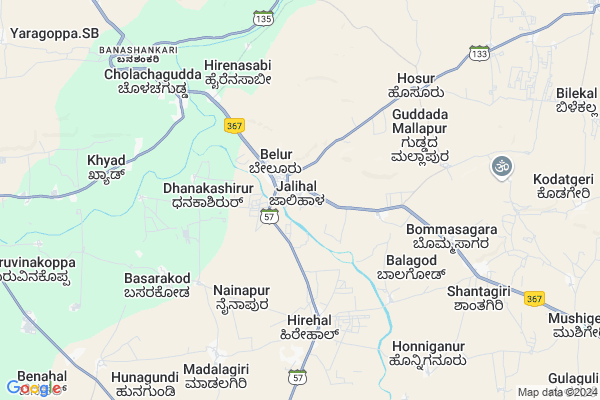
Jalihal Map
EDIT Map
Add Your House
 ..
..
Current Corona Virus Infected Patients Count in Bagalkot District
| City Name | District Name | Total Covid cases |
|---|---|---|
| Bagalkote District | Bagalkote | 13 |
| Mudhol | Bagalkote | 8 |
| Jamakhandi | Bagalkote | 2 |
| Jamkhandi | Bagalkote | 1 |
Locality Name :
Jalihal
( ಜಾಲೀಹಾಳ್ )
Taluk Name : Badami
District : Bagalkot
State : Karnataka
Division : Belgaum
Language : Kannada and Konkani, Telugu, English
Current Time 05:35 AM
Date: Friday , May 02,2025 (IST)
Time zone: IST (UTC+5:30)
Elevation / Altitude: 573 meters. Above Seal level
Telephone Code / Std Code: 08357
Assembly constituency : Badami assembly constituency
Assembly MLA : B.B.Chimmanakatti
Lok Sabha constituency : Bagalkot parliamentary constituency
Parliament MP : Gaddigoudar Parvatagouda Chandanagouda
Serpanch Name :
Pin Code : 587114
Post Office Name : Belur (Bagalkot)
Commodities Prices : Badami Market / Mandi
Jalihal Live Weather
Temperature: 26.4 °C
clear sky
Humidity: 64%
Wind : 3.15 mt/sec towards SW
StationName : "Ron"
observed on Now
Temperature: 26.4 °C
clear sky
Humidity: 64%
Wind : 3.15 mt/sec towards SW
StationName : "Ron"
observed on Now
Jalihal Weather Forecast for Next 5 days
03-05-2025
27.7°C to 39.8°C
clear sky, few clouds, scattered clouds, overcast clouds
27.7°C to 39.8°C
clear sky, few clouds, scattered clouds, overcast clouds
04-05-2025
25.1°C to 38.5°C
overcast clouds, clear sky, few clouds, broken clouds
25.1°C to 38.5°C
overcast clouds, clear sky, few clouds, broken clouds
05-05-2025
24.4°C to 37.4°C
clear sky, broken clouds, few clouds
24.4°C to 37.4°C
clear sky, broken clouds, few clouds
06-05-2025
24.3°C to 38.7°C
clear sky, scattered clouds
24.3°C to 38.7°C
clear sky, scattered clouds
07-05-2025
26.1°C to 38.5°C
broken clouds, clear sky, few clouds
26.1°C to 38.5°C
broken clouds, clear sky, few clouds
Edit below overview about Jalihal
Edit below overview about Jalihal
OverView of Jalihal
According to 2014 survey Jalihal population 10000 .Right now Jalihal gram panchayat chairman Mrs Mamatajbegam M DodamaniEdit below overview about Jalihal
National Highways Reachable To Jalihal
Nationa High Way :NH50
Nationa High Way :NH367
Nationa High Way :NH50
Nationa High Way :NH367
Rivers Near Jalihal
Malaprabha :ಮಲಪ್ರಭಾ
Malaprabha :ಮಲಪ್ರಭಾ
Malaprabha :ಮಲಪ್ರಭಾ
Malaprabha :ಮಲಪ್ರಭಾ
About Jalihal
Jalihal is a Village in Badami Taluk in Bagalkot District of Karnataka State, India. It belongs to Belgaum Division . It is located 45 KM towards South from District head quarters Bagalkot. 20 KM from Badami. 439 KM from State capital Bangalore
Jalihal Pin code is 587114 and postal head office is Belur (Bagalkot).
Cholachagud ( 7 KM ) , Rampur ( 9 KM ) , Badami ( 14 KM ) , Nandikeshwar ( 14 KM ) are the nearby Villages to Jalihal. Jalihal is surrounded by Badami Taluk towards North , Naragund Taluk towards west , Hungund Taluk towards East , Bagalkot Taluk towards North .
Ron , Nargund , Gadag , Ramdurg are the near by Cities to Jalihal.
Jalihal 2011 Census Details
Jalihal Local Language is Kannada. Jalihal Village Total population is 5917 and number of houses are 1160. Female Population is 49.5%. Village literacy rate is 61.1% and the Female Literacy rate is 24.9%.
Population
| Census Parameter | Census Data |
| Total Population | 5917 |
| Total No of Houses | 1160 |
| Female Population % | 49.5 % ( 2928) |
| Total Literacy rate % | 61.1 % ( 3614) |
| Female Literacy rate | 24.9 % ( 1474) |
| Scheduled Tribes Population % | 4.4 % ( 262) |
| Scheduled Caste Population % | 26.6 % ( 1572) |
| Working Population % | 43.8 % |
| Child(0 -6) Population by 2011 | 812 |
| Girl Child(0 -6) Population % by 2011 | 47.0 % ( 382) |
Jalihal Census More Deatils.
Politics in Jalihal
JD(U) , Bharatiya Janata Party , BJP , Indian National Congress (INC) , INC are the major political parties in this area.Polling Stations /Booths near Jalihal
1)Govt Hps Boys School West Wing Cholachagudda2)Kannada Boys School North Wing Opp T.m.c. Kerur
3)Kannada Higher Primary School North Wing Tippu Nagar Badami
4)Kannada Boys School West Side B.b.desai Govt Hps School Belavalakoppa
5)Govt Hps Girl School East Wing Jalihal
HOW TO REACH Jalihal
By Rail
There is no railway station near to Jalihal in less than 10 km.Colleges near Jalihal
Shee Annadaneswar Junier Cllege Belur
Address :
Govt Pu College Pattadakal
Address : Pattadakal
Sri Veera Pulikeshi Ayurvedic Medical College
Address : Badami 587201bagalkot
Schools in Jalihal
S.j.s.s. Kanna Primary School Jalih
Address : jalihal , badami , bagalkot , Karnataka . PIN- 587114 , Post - Belur (Bagalkot)
Govt Ubs Jalihal
Address : jalihal , badami , bagalkot , Karnataka . PIN- 587114 , Post - Belur (Bagalkot)
Govt Mps Jalihal
Address : jalihal , badami , bagalkot , Karnataka . PIN- 587114 , Post - Belur (Bagalkot)
Govt Health Centers near Jalihal
1) Goudageri , Goudageri , Goudageri , Goudageri2) Sirur , Sirur , Sirur , Sirur
3) Tavargera-A , Sub Centre Tavargera A , Mudagal Road ,
Hospitals in Jalihal,Badami
Venkateshwar Hospital
Ramdurg Road; Bagalkot District; State Highway 14; Badami; Karnataka 587201; India
14.3 KM distance Detail
more ..
Petrol Bunks in Jalihal,Badami
M/S Aivalli & Co
Banashankari Road; Manjunath Nagar; Badami; Karnataka 587201; India
12.9 KM distance Detail
Ms Vivalli Hindustan Petroleum
Kabbalageri; Bagalkot; SH-57; Badami; Badami; Karnataka 587201; India
12.9 KM distance Detail
K.M.PATTANSHETTI & CO.
BADAMI; MAIN ROAD;BAGALKOT; BAGALKOT; Karnataka 587201; India
14.5 KM distance Detail
more ..
Colleges in Jalihal,Badami
Shree Kalidas Ayurvedic Medical College
Badami Rd; Badami; Karnataka 587201; India
12.5 KM distance Detail
SHRI VEERAPULIKESHI RURAL AYURVEDIC MEDICAL COLLEGE BADAMI..
Badami; Karnataka 587201; India
14.1 KM distance Detail
more ..
Schools in Jalihal,Badami
Al ameen Urdu Primary School
Al ameen Urdu Primary School; Badami Rd; Badami; Karnataka 587201; India
13.9 KM distance Detail
Anjuman Urdu High School
Anjuman Urdu High School Badami; Badami Rd; Badami; Karnataka 587201; India
13.9 KM distance Detail
Electronic Shops in Jalihal,Badami
M/s Kulkarni Enterprises
Manjunath Nagar; Kabbalageri; Karnataka 587201; India
12.7 KM distance Detail
Local Parks in Jalihal,Badami
Guledalakavva Park & Garden
Hospital Road; Anand Nagar; Badami; Karnataka 587201; India
15.0 KM distance Detail
About Jalihal &
History
How to reach Jalihal
Tourist Places Near By Jalihal
Schools in Jalihal
Colleges in Jalihal
Temperature & weather of Jalihal
places in Jalihal
Jalihal photos
More Information
How to reach Jalihal
Tourist Places Near By Jalihal
Schools in Jalihal
Colleges in Jalihal
Temperature & weather of Jalihal
places in Jalihal
Jalihal photos
More Information
Village Talk
Post News or Events about this Village
Near Cities
Ron 19 KM near
Nargund 47 KM near
Gadag 53 KM near
Ramdurg 57 KM near
Ron 19 KM near
Nargund 47 KM near
Gadag 53 KM near
Ramdurg 57 KM near
Near By Taluks
Ron 11 KM near
Badami 19 KM near
Naragund 43 KM near
Hungund 45 KM near
Ron 11 KM near
Badami 19 KM near
Naragund 43 KM near
Hungund 45 KM near
Near By Air Ports
Hubli Airport 100 KM near
Sambre Airport 136 KM near
Kolhapur Airport 199 KM near
Sholapur Airport 224 KM near
Hubli Airport 100 KM near
Sambre Airport 136 KM near
Kolhapur Airport 199 KM near
Sholapur Airport 224 KM near
Near By Tourist Places
Badami 13 KM near
Pattadakkal 15 KM near
Aihole 26 KM near
Hubli 100 KM near
Hospet 103 KM near
Badami 13 KM near
Pattadakkal 15 KM near
Aihole 26 KM near
Hubli 100 KM near
Hospet 103 KM near
Near By Districts
Bagalkot 43 KM near
Gadag 53 KM near
Koppal 78 KM near
Dharwad 101 KM near
Bagalkot 43 KM near
Gadag 53 KM near
Koppal 78 KM near
Dharwad 101 KM near
Near By RailWay Station
Badami Rail Way Station 15 KM near
Bagalkot Junction Rail Way Station 42 KM near
Badami Rail Way Station 15 KM near
Bagalkot Junction Rail Way Station 42 KM near