| Home | City Bus | Maps | Villages | Cities | Rail | Tourist Places | School | College | Pin Codes | Corona Cases Count |
| Distance Calculator Bus Services IFSC Codes Trace Mobile Number Weather Search Place Trace IP Available Cash ATM/Banks Locate Polling Booth Report an Error contact People |
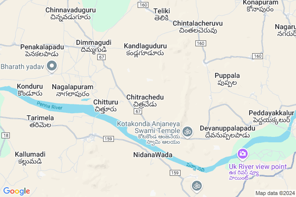
Chitrachedu
Chitrachedu Map
EDIT Map
Add Your House
 ..
..
Current Corona Virus Infected Patients Count in Anantapur District
| City Name | District Name | Total Covid cases |
|---|---|---|
| Anantapur District | Anantapur | 36 |
| Anantapur | Anantapur | 5 |
| Hindupur | Anantapur | 3 |
| R K Function Hall Backside | Anantapur | 2 |
| Lepakshi | Anantapur | 2 |
| Kalyana Durgam | Anantapur | 1 |
| Hindupur Mandal | Anantapur | 1 |
| Naik Nagar | Anantapur | 1 |
| Kothacheruvu | Anantapur | 1 |
| Aravinda Nagar | Anantapur | 1 |
Locality Name :
Chitrachedu
( చిత్రచేడు )
Mandal Name : Peddavadugur
District : Anantapur
State : Andhra Pradesh
Region : Rayalaseema
Language : Telugu and Urdu
Current Time 05:04 AM
Date: Friday , May 02,2025 (IST)
Time zone: IST (UTC+5:30)
Elevation / Altitude: 329 meters. Above Seal level
Telephone Code / Std Code: 08552
Assembly constituency : assembly constituency
Assembly MLA : K. PEDDA REDDY
Lok Sabha constituency : parliamentary constituency
Parliament MP : TALARI RANGAIAH
Serpanch Name :
Pin Code : 515611
Post Office Name : Tarimala
Commodities Prices : Dhone Market / Mandi
Chitrachedu Live Weather
Temperature: 30.4 °C
scattered clouds
Humidity: 47%
Wind : 1.5 mt/sec towards SE
StationName : "Gooty"
observed on 18 Mins Back
Temperature: 30.4 °C
scattered clouds
Humidity: 47%
Wind : 1.5 mt/sec towards SE
StationName : "Gooty"
observed on 18 Mins Back
Chitrachedu Weather Forecast for Next 5 days
03-05-2025
30.2°C to 40.1°C
scattered clouds, few clouds, broken clouds, light rain
30.2°C to 40.1°C
scattered clouds, few clouds, broken clouds, light rain
04-05-2025
28.7°C to 40.6°C
scattered clouds, clear sky, few clouds, light rain
28.7°C to 40.6°C
scattered clouds, clear sky, few clouds, light rain
05-05-2025
27.8°C to 40.7°C
broken clouds, clear sky, few clouds
27.8°C to 40.7°C
broken clouds, clear sky, few clouds
06-05-2025
29.6°C to 42.0°C
scattered clouds, clear sky, few clouds, broken clouds
29.6°C to 42.0°C
scattered clouds, clear sky, few clouds, broken clouds
National Highways Reachable To Chitrachedu
Nationa High Way :NH 150
Nationa High Way :NH42
Nationa High Way :NH 150
Nationa High Way :NH42
Rivers Near Chitrachedu
Puli Vanka
Penna :ಪೆನ್ನಾ :పెన్నా
Puli Vanka
Penna :ಪೆನ್ನಾ :పెన్నా
About Chitrachedu
Correct below Info and add more info about ChitracheduChitrachedu is a Village in Peddavadugur Mandal in Anantapur District of Andhra Pradesh State, India. It belongs to Rayalaseema region . It is located 37 KM towards North from District head quarters Anantapur. 10 KM from Peddavadugur. 332 KM from State capital Hyderabad
Chitrachedu Pin code is 515611 and postal head office is Tarimala .
Kandlaguduru ( 4 KM ) , Nidhanawada ( 5 KM ) , Dimmagudi ( 6 KM ) , Puppala ( 7 KM ) , Devanuppalapadu ( 7 KM ) are the nearby Villages to Chitrachedu. Chitrachedu is surrounded by Singanamala Mandal towards South , Peddapappur Mandal towards East , Pamidi Mandal towards west , Yadiki Mandal towards East .
Gooty , Tadpatri , Anantapur , Guntakal are the near by Cities to Chitrachedu.
Chitrachedu 2011 Census Details
Chitrachedu Local Language is Telugu. Chitrachedu Village Total population is 1834 and number of houses are 436. Female Population is 49.9%. Village literacy rate is 44.9% and the Female Literacy rate is 17.9%.
Population
| Census Parameter | Census Data |
| Total Population | 1834 |
| Total No of Houses | 436 |
| Female Population % | 49.9 % ( 916) |
| Total Literacy rate % | 44.9 % ( 823) |
| Female Literacy rate | 17.9 % ( 328) |
| Scheduled Tribes Population % | 0.8 % ( 14) |
| Scheduled Caste Population % | 19.9 % ( 365) |
| Working Population % | 61.7 % |
| Child(0 -6) Population by 2011 | 204 |
| Girl Child(0 -6) Population % by 2011 | 50.5 % ( 103) |
Chitrachedu Census More Deatils.
HOW TO REACH Chitrachedu
By Road
Tadpatri is the Nearest Town to Chitrachedu. Tadpatri is 68 km from Chitrachedu. Road connectivity is there from Tadpatri to Chitrachedu.By Rail
There is no railway station near to Chitrachedu in less than 10 km. How ever there are railway Stations from Near By town Tadpatri. are the railway Stations near to Tadpatri. You can reach from Tadpatri to Chitrachedu by road after .By Bus
Pamidi APSRTC Bus Station , Rayala Cheruvu APSRTC Bus Station , Yadiki APSRTC Bus Station are the nearby by Bus Stations to Chitrachedu .APSRTC runs Number of busses from major cities to here.Colleges near Chitrachedu
Gates Institute Of Technology
Address : Nh-7, Gooty, Peddavaduguru(m), Anantapur Dist. -5
Schools in Chitrachedu
Zphs Chitrachedu
Address : chitrachedu , peddavadugur , anantapur , Andhra Pradesh . PIN- 515611 , Post - Tarimala
Govt Health Centers near Chitrachedu
1) Sc Devuniuppalapadu , 1-117-A , Main Road , Beside MPP School2) Sc Kallumaddi , 33-8 , Main Road , Tarimela Road
3) Peddavadugur , , , MIDUTUR ROAD
Hospitals in Chitrachedu,Peddavadugur
Shree sai medical store and clinic
Chinnavaduguru road peddavaduguru; Anantapur dist; Peddavaduguru; Andhra Pradesh 515004; India
12.5 KM distance Detail
more ..
Petrol Bunks in Chitrachedu,Peddavadugur
Veera Badra Filling Station Petrol Bunk
; Peddvaduguru; Andhra Pradesh 515405; India
12.1 KM distance Detail
HP PETROL PUMP - MEDA SERVICE STATION
Dealer Hpcl BLY RD Kamalnagar Anantapur A P; Pamidi; Andhra Pradesh 515001; India
16.6 KM distance Detail
more ..
Governement Offices near Chitrachedu,Peddavadugur
MeeSeva Center
SHOP NO :1; Amarnath Generals; Main Road; Near Andhra Bank; Peddavadugur(V); Peddavadugur(M); Anantapur(D);515405; main road; Peddvaduguru; Andhra Pradesh 515405; India
12.9 KM distance Detail
About Chitrachedu &
History
How to reach Chitrachedu
Tourist Places Near By Chitrachedu
Schools in Chitrachedu
Colleges in Chitrachedu
Temperature & weather of Chitrachedu
places in Chitrachedu
Chitrachedu photos
More Information
How to reach Chitrachedu
Tourist Places Near By Chitrachedu
Schools in Chitrachedu
Colleges in Chitrachedu
Temperature & weather of Chitrachedu
places in Chitrachedu
Chitrachedu photos
More Information
Village Talk
Post News or Events about this Village
Near Cities
Gooty 26 KM near
Tadpatri 34 KM near
Anantapur 39 KM near
Guntakal 49 KM near
Gooty 26 KM near
Tadpatri 34 KM near
Anantapur 39 KM near
Guntakal 49 KM near
Near By Taluks
Peddavadugur 10 KM near
Singanamala 14 KM near
Peddapappur 17 KM near
Pamidi 20 KM near
Peddavadugur 10 KM near
Singanamala 14 KM near
Peddapappur 17 KM near
Pamidi 20 KM near
Near By Air Ports
Bengaluru International Airport 216 KM near
Tirupati Airport 272 KM near
Rajiv Gandhi International Airport 298 KM near
Hubli Airport 322 KM near
Bengaluru International Airport 216 KM near
Tirupati Airport 272 KM near
Rajiv Gandhi International Airport 298 KM near
Hubli Airport 322 KM near
Near By Tourist Places
Puttaparthi 96 KM near
Kurnool 115 KM near
Mantralayam 129 KM near
Lepakshi 142 KM near
Kadapa 144 KM near
Puttaparthi 96 KM near
Kurnool 115 KM near
Mantralayam 129 KM near
Lepakshi 142 KM near
Kadapa 144 KM near
Near By Districts
Anantapur 35 KM near
Bellary 100 KM near
Kurnool 115 KM near
Cuddapah 145 KM near
Anantapur 35 KM near
Bellary 100 KM near
Kurnool 115 KM near
Cuddapah 145 KM near
Near By RailWay Station
Gooty Junction Rail Way Station 29 KM near
Tadipatri Rail Way Station 30 KM near
Gooty Junction Rail Way Station 29 KM near
Tadipatri Rail Way Station 30 KM near