| Home | City Bus | Maps | Villages | Cities | Rail | Tourist Places | School | College | Pin Codes | Corona Cases Count |
| Distance Calculator Bus Services IFSC Codes Trace Mobile Number Weather Search Place Trace IP Available Cash ATM/Banks Locate Polling Booth Report an Error contact People |
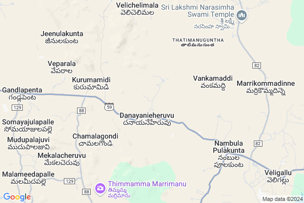
Somaraju Kunta
Somaraju Kunta Map
EDIT Map
Add Your House
 ..
..
Current Corona Virus Infected Patients Count in Anantapur District
| City Name | District Name | Total Covid cases |
|---|---|---|
| Anantapur District | Anantapur | 36 |
| Anantapur | Anantapur | 5 |
| Hindupur | Anantapur | 3 |
| R K Function Hall Backside | Anantapur | 2 |
| Lepakshi | Anantapur | 2 |
| Kalyana Durgam | Anantapur | 1 |
| Hindupur Mandal | Anantapur | 1 |
| Naik Nagar | Anantapur | 1 |
| Kothacheruvu | Anantapur | 1 |
| Aravinda Nagar | Anantapur | 1 |
Locality Name :
Somaraju Kunta
( సోమరాజు కుంట )
Mandal Name : Nambulapulikunta
District : Anantapur
State : Andhra Pradesh
Region : Rayalaseema
Language : Telugu and Urdu
Current Time 10:56 AM
Date: Saturday , May 03,2025 (IST)
Time zone: IST (UTC+5:30)
Elevation / Altitude: 577 meters. Above Seal level
Telephone Code / Std Code: 08498
Assembly constituency : assembly constituency
Assembly MLA : P.V. SIDDA REDDY
Lok Sabha constituency : parliamentary constituency
Parliament MP : KURUVA GORANTLA MADHAV
Serpanch Name :
Pin Code : 515521
Post Office Name : Gandlapenta
Main Village Name : Dhaniyanicheruvu
Commodities Prices : Mulakalacheruvu Market / Mandi
Somaraju Kunta Live Weather
Temperature: 34.8 °C
scattered clouds
Humidity: 31%
Wind : 1.85 mt/sec towards SW
StationName : "Kadiri"
observed on 53 Mins Back
Temperature: 34.8 °C
scattered clouds
Humidity: 31%
Wind : 1.85 mt/sec towards SW
StationName : "Kadiri"
observed on 53 Mins Back
Somaraju Kunta Weather Forecast for Next 5 days
04-05-2025
29.4°C to 39.1°C
few clouds, scattered clouds, overcast clouds, light rain
29.4°C to 39.1°C
few clouds, scattered clouds, overcast clouds, light rain
05-05-2025
28.6°C to 37.2°C
light rain, broken clouds, few clouds, scattered clouds
28.6°C to 37.2°C
light rain, broken clouds, few clouds, scattered clouds
06-05-2025
27.2°C to 38.9°C
broken clouds, clear sky, scattered clouds
27.2°C to 38.9°C
broken clouds, clear sky, scattered clouds
07-05-2025
28.7°C to 38.9°C
broken clouds, overcast clouds, clear sky, scattered clouds
28.7°C to 38.9°C
broken clouds, overcast clouds, clear sky, scattered clouds
08-05-2025
27.4°C to 38.3°C
overcast clouds, clear sky, broken clouds, light rain
27.4°C to 38.3°C
overcast clouds, clear sky, broken clouds, light rain
Edit below overview about Somaraju Kunta
Edit below overview about Somaraju Kunta
OverView of Somaraju Kunta
Her worth people are good their faith and famous god is Gangamma talli and every year ugadi they celebrated the festival very large extent and prays god at a huge dignity most of people depend on formationEdit below overview about Somaraju Kunta
National Highways Reachable To Somaraju Kunta
Nationa High Way :NH342
Nationa High Way :NH42
Nationa High Way :NH342
Nationa High Way :NH42
Rivers Near Somaraju Kunta
Chitravati :ಚಿತ್ರಾವತಿ :చిత్రావతి
Madduleru River
Chitravati :ಚಿತ್ರಾವತಿ :చిత్రావతి
Madduleru River
About Somaraju Kunta
Somaraju Kunta is a small Village/hamlet in Nambulapulikunta Mandal in Anantapur District of Andhra Pradesh State, India. It comes under Dhaniyanicheruvu Panchayath. It belongs to Rayalaseema region . It is located 123 KM towards East from District head quarters Anantapur. 3 KM from Nambulapulikunta. 429 KM from State capital Hyderabad
Somaraju Kunta Pin code is 515521 and postal head office is Gandlapenta .
Somaraju Kunta is surrounded by Gandlapenta Mandal towards west , Galiveedu Mandal towards East , Talupula Mandal towards North , Chakrayapet Mandal towards North .
Kadiri , Rayachoti , Madanapalle , Yerraguntla are the near by Cities to Somaraju Kunta.
This Place is in the border of the Anantapur District and Cuddapah District. Cuddapah District Galiveedu is East towards this place .
Demographics of Somaraju Kunta
Telugu is the Local Language here. Total population of Somaraju Kunta is 3109 .Males are 1551 and Females are 1,558 living in 763 Houses. Total area of Somaraju Kunta is 2942 hectares.HOW TO REACH Somaraju Kunta
By Road
Kadiri is the Nearest Town to Somaraju Kunta. Kadiri is 22 km from Somaraju Kunta. Road connectivity is there from Kadiri to Somaraju Kunta.By Rail
There is no railway station near to Somaraju Kunta in less than 10 km. How ever there are railway Stations from Near By town Kadiri. are the railway Stations near to Kadiri. You can reach from Kadiri to Somaraju Kunta by road after .By Bus
Kadiri APSRTC Bus Station , Thanakallu APSRTC Bus Station , Chakrayapeta APSRTC Bus Station are the nearby by Bus Stations to Somaraju Kunta .APSRTC runs Number of busses from major cities to here.Colleges near Somaraju Kunta
Sri Venkateswara Instute Of Technology
Address :
Naidu College
Address :
Government Junior College For Boys
Address :
Govt Junior College Kundurpi
Address : Govt Junior College Kundurpi Near Rama Swamy Temple Kundurpi Anantapur
Sri Mahatma Jr College Gooty
Address : Neha Nagar
gooty V
gooty M
anantapur Dist 515401
Schools in Somaraju Kunta
Zphs
Address : dhaniyanicheruvu , nambulapulikunta , anantapur , Andhra Pradesh . PIN- 515521 , Post - Gandlapenta
Govt Health Centers near Somaraju Kunta
1) Gandlapenta , 4-260-A1 , malameedapalli road , malameedapalli road2) SC Veligallu , 9/126 , MAIN ROAD , COMMUNITY HAL
3) SC Odiveedu , Pvt.Building , 1st lane , 1st Lane
Petrol Bunks in Somaraju Kunta,Nambulapulikunta
Sri Kalikadevi Filling Station Gandlapenta
Mallameedapalli Road; Gandlapenta; Andhra Pradesh 515521; India
11.3 KM distance Detail
Madeena Motors
near gate; Madanapalli Rd; Galiveedu; Andhra Pradesh 516267; India
20.3 KM distance Detail
more ..
Schools in Somaraju Kunta,Nambulapulikunta
SRI SANTHINIKATHAN RESIDENTIAL SCHOOL
Kurumamidi; Andhra Pradesh 515521; India
6.0 KM distance Detail
Mpps Somayajulapalli
near anjaneyaswsmy; Pancha Muka Anjaneyswamy Temple; Drivers Colony; Anantapur; Andhra Pradesh 515001; India
10.5 KM distance Detail
Electronic Shops in Somaraju Kunta,Nambulapulikunta
Jakeer two wheeler bike point galiveedu
SH 34; Galiveedu; Andhra Pradesh 516267; India
19.9 KM distance Detail
Governement Offices near Somaraju Kunta,Nambulapulikunta
MeeSeva Center
Chakkavandla Palli; Opp: Andhra Pragathi Gramina Bank; Main Road; Galiveedu;; Galiveedu; Andhra Pradesh 516267; India
21.0 KM distance Detail
About Somaraju Kunta &
History
How to reach Somaraju Kunta
Tourist Places Near By Somaraju Kunta
Schools in Somaraju Kunta
Colleges in Somaraju Kunta
Temperature & weather of Somaraju Kunta
places in Somaraju Kunta
Somaraju Kunta photos
More Information
How to reach Somaraju Kunta
Tourist Places Near By Somaraju Kunta
Schools in Somaraju Kunta
Colleges in Somaraju Kunta
Temperature & weather of Somaraju Kunta
places in Somaraju Kunta
Somaraju Kunta photos
More Information
Village Talk
Post News or Events about this Village
Near Cities
Kadiri 24 KM near
Rayachoti 46 KM near
Madanapalle 68 KM near
Yerraguntla 72 KM near
Kadiri 24 KM near
Rayachoti 46 KM near
Madanapalle 68 KM near
Yerraguntla 72 KM near
Near By Taluks
Nambulapulikunta 3 KM near
Gandlapenta 12 KM near
Galiveedu 20 KM near
Talupula 22 KM near
Nambulapulikunta 3 KM near
Gandlapenta 12 KM near
Galiveedu 20 KM near
Talupula 22 KM near
Near By Air Ports
Bengaluru International Airport 136 KM near
Tirupati Airport 153 KM near
Chennai Airport 258 KM near
Mysore Airport 304 KM near
Bengaluru International Airport 136 KM near
Tirupati Airport 153 KM near
Chennai Airport 258 KM near
Mysore Airport 304 KM near
Near By Tourist Places
Horsley Hills 54 KM near
Puttaparthi 69 KM near
Kadapa 73 KM near
Lepakshi 97 KM near
Nandi Hills 122 KM near
Horsley Hills 54 KM near
Puttaparthi 69 KM near
Kadapa 73 KM near
Lepakshi 97 KM near
Nandi Hills 122 KM near
Near By Districts
Cuddapah 73 KM near
Chikballapur 112 KM near
Anantapur 118 KM near
Kolar 121 KM near
Cuddapah 73 KM near
Chikballapur 112 KM near
Anantapur 118 KM near
Kolar 121 KM near
Near By RailWay Station
Kadiri Rail Way Station 23 KM near
Madanapalle Road Rail Way Station 60 KM near
Kadiri Rail Way Station 23 KM near
Madanapalle Road Rail Way Station 60 KM near