| Home | City Bus | Maps | Villages | Cities | Rail | Tourist Places | School | College | Pin Codes | Corona Cases Count |
| Distance Calculator Bus Services IFSC Codes Trace Mobile Number Weather Search Place Trace IP Available Cash ATM/Banks Locate Polling Booth Report an Error contact People |
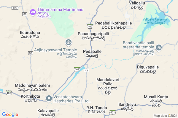
Kothamiddi
Kothamiddi Map
EDIT Map
Add Your House
 ..
..
Current Corona Virus Infected Patients Count in Anantapur District
| City Name | District Name | Total Covid cases |
|---|---|---|
| Anantapur District | Anantapur | 36 |
| Anantapur | Anantapur | 5 |
| Hindupur | Anantapur | 3 |
| R K Function Hall Backside | Anantapur | 2 |
| Lepakshi | Anantapur | 2 |
| Kalyana Durgam | Anantapur | 1 |
| Hindupur Mandal | Anantapur | 1 |
| Naik Nagar | Anantapur | 1 |
| Kothacheruvu | Anantapur | 1 |
| Aravinda Nagar | Anantapur | 1 |
Locality Name :
Kothamiddi
( కొత్తమిడ్డి )
Mandal Name : Nambulapulikunta
District : Anantapur
State : Andhra Pradesh
Region : Rayalaseema
Language : Telugu and Urdu
Current Time 12:58 PM
Date: Saturday , May 03,2025 (IST)
Time zone: IST (UTC+5:30)
Elevation / Altitude: 577 meters. Above Seal level
Telephone Code / Std Code: 08498
Assembly constituency : assembly constituency
Assembly MLA : P.V. SIDDA REDDY
Lok Sabha constituency : parliamentary constituency
Parliament MP : KURUVA GORANTLA MADHAV
Serpanch Name :
Pin Code : 515231
Post Office Name : Gorantla
Main Village Name : Pedaballi
Commodities Prices : Mulakalacheruvu Market / Mandi
Kothamiddi Live Weather
Temperature: 37.1 °C
clear sky
Humidity: 26%
Wind : 1.7 mt/sec towards NW
StationName : "Kadiri"
observed on 42 Mins Back
Temperature: 37.1 °C
clear sky
Humidity: 26%
Wind : 1.7 mt/sec towards NW
StationName : "Kadiri"
observed on 42 Mins Back
Kothamiddi Weather Forecast for Next 5 days
04-05-2025
30.3°C to 38.8°C
few clouds, light rain, overcast clouds, scattered clouds
30.3°C to 38.8°C
few clouds, light rain, overcast clouds, scattered clouds
05-05-2025
27.2°C to 33.9°C
scattered clouds, light rain, overcast clouds, broken clouds
27.2°C to 33.9°C
scattered clouds, light rain, overcast clouds, broken clouds
06-05-2025
26.0°C to 38.5°C
broken clouds, scattered clouds, clear sky, few clouds, overcast clouds
26.0°C to 38.5°C
broken clouds, scattered clouds, clear sky, few clouds, overcast clouds
07-05-2025
28.2°C to 38.9°C
overcast clouds, broken clouds, scattered clouds
28.2°C to 38.9°C
overcast clouds, broken clouds, scattered clouds
08-05-2025
27.9°C to 38.9°C
broken clouds, scattered clouds, clear sky, light rain
27.9°C to 38.9°C
broken clouds, scattered clouds, clear sky, light rain
National Highways Reachable To Kothamiddi
Nationa High Way :NH342
Nationa High Way :NH42
Nationa High Way :NH342
Nationa High Way :NH42
Rivers Near Kothamiddi
Chitravati :ಚಿತ್ರಾವತಿ :చిత్రావతి
Madduleru River
Chitravati :ಚಿತ್ರಾವತಿ :చిత్రావతి
Madduleru River
About Kothamiddi
Correct below Info and add more info about KothamiddiKothamiddi is a small Village/hamlet in Nambulapulikunta Mandal in Anantapur District of Andhra Pradesh State, India. It comes under Pedaballi Panchayath. It belongs to Rayalaseema region . It is located 135 KM towards East from District head quarters Anantapur. 11 KM from Nambulapulikunta. 442 KM from State capital Hyderabad
Kothamiddi Pin code is 515231 and postal head office is Gorantla .
Kothamiddi is surrounded by Galiveedu Mandal towards East , Peddamandyam Mandal towards East , Gandlapenta Mandal towards west , Thamballapalle Mandal towards South .
Kadiri , Rayachoti , Madanapalle , Punganur are the near by Cities to Kothamiddi.
This Place is in the border of the Anantapur District and Cuddapah District. Cuddapah District Galiveedu is East towards this place .
Demographics of Kothamiddi
Telugu is the Local Language here. Total population of Kothamiddi is 2971 .Males are 1469 and Females are 1,502 living in 777 Houses. Total area of Kothamiddi is 2823 hectares.HOW TO REACH Kothamiddi
By Road
Kadiri is the Nearest Town to Kothamiddi. Kadiri is 40 km from Kothamiddi. Road connectivity is there from Kadiri to Kothamiddi.By Rail
There is no railway station near to Kothamiddi in less than 10 km. How ever there are railway Stations from Near By town Kadiri. are the railway Stations near to Kadiri. You can reach from Kadiri to Kothamiddi by road after .By Bus
Thanakallu APSRTC Bus Station , Molakala Cheruvu APSRTC Bus Station , Burakayala Kota APSRTC Bus Station are the nearby by Bus Stations to Kothamiddi .APSRTC runs Number of busses from major cities to here.Colleges near Kothamiddi
Sri Venkateswara Instute Of Technology
Address :
Naidu College
Address :
Government Junior College For Boys
Address :
Govt Junior College Kundurpi
Address : Govt Junior College Kundurpi Near Rama Swamy Temple Kundurpi Anantapur
Sri Mahatma Jr College Gooty
Address : Neha Nagar
gooty V
gooty M
anantapur Dist 515401
Schools in Kothamiddi
Mpups Pedaballi
Address : pedaballi , nambulapulikunta , anantapur , Andhra Pradesh . PIN- 515571 , Post - Tanakallu
Govt Health Centers near Kothamiddi
1) BANDREVU , , Near Bus stop , Near Bus stop2) Kotala , , GOVT., PANCHAYTI BUILDING , GOVT., PANCHAYTI BUILDING
3) SC Veligallu , 9/126 , MAIN ROAD , COMMUNITY HAL
Petrol Bunks in Kothamiddi,Nambulapulikunta
Madeena Motors
near gate; Madanapalli Rd; Galiveedu; Andhra Pradesh 516267; India
15.8 KM distance Detail
HP PETROL PUMP - KETHANA AUTO FILLING STATION
Hpcl Dealers Survey # 944 Rayachoty-kadiri Road; Kadapa; Andhra Pradesh 516267; India
17.0 KM distance Detail
more ..
Electronic Shops in Kothamiddi,Nambulapulikunta
Jakeer two wheeler bike point galiveedu
SH 34; Galiveedu; Andhra Pradesh 516267; India
15.2 KM distance Detail
Governement Offices near Kothamiddi,Nambulapulikunta
MeeSeva Center
Chakkavandla Palli; Opp: Andhra Pragathi Gramina Bank; Main Road; Galiveedu;; Galiveedu; Andhra Pradesh 516267; India
16.2 KM distance Detail
About Kothamiddi &
History
How to reach Kothamiddi
Tourist Places Near By Kothamiddi
Schools in Kothamiddi
Colleges in Kothamiddi
Temperature & weather of Kothamiddi
places in Kothamiddi
Kothamiddi photos
More Information
How to reach Kothamiddi
Tourist Places Near By Kothamiddi
Schools in Kothamiddi
Colleges in Kothamiddi
Temperature & weather of Kothamiddi
places in Kothamiddi
Kothamiddi photos
More Information
Village Talk
Post News or Events about this Village
Near Cities
Kadiri 32 KM near
Rayachoti 43 KM near
Madanapalle 54 KM near
Punganur 79 KM near
Kadiri 32 KM near
Rayachoti 43 KM near
Madanapalle 54 KM near
Punganur 79 KM near
Near By Taluks
Nambulapulikunta 11 KM near
Galiveedu 18 KM near
Peddamandyam 19 KM near
Gandlapenta 21 KM near
Nambulapulikunta 11 KM near
Galiveedu 18 KM near
Peddamandyam 19 KM near
Gandlapenta 21 KM near
Near By Air Ports
Bengaluru International Airport 127 KM near
Tirupati Airport 145 KM near
Chennai Airport 248 KM near
Salem Airport 291 KM near
Bengaluru International Airport 127 KM near
Tirupati Airport 145 KM near
Chennai Airport 248 KM near
Salem Airport 291 KM near
Near By Tourist Places
Horsley Hills 40 KM near
Puttaparthi 76 KM near
Kadapa 80 KM near
Lepakshi 96 KM near
Nandi Hills 115 KM near
Horsley Hills 40 KM near
Puttaparthi 76 KM near
Kadapa 80 KM near
Lepakshi 96 KM near
Nandi Hills 115 KM near
Near By Districts
Cuddapah 80 KM near
Chikballapur 105 KM near
Kolar 109 KM near
Bangalore Rural 122 KM near
Cuddapah 80 KM near
Chikballapur 105 KM near
Kolar 109 KM near
Bangalore Rural 122 KM near
Near By RailWay Station
Kadiri Rail Way Station 31 KM near
Madanapalle Road Rail Way Station 46 KM near
Kadiri Rail Way Station 31 KM near
Madanapalle Road Rail Way Station 46 KM near