| Home | City Bus | Maps | Villages | Cities | Rail | Tourist Places | School | College | Pin Codes | Corona Cases Count |
| Distance Calculator Bus Services IFSC Codes Trace Mobile Number Weather Search Place Trace IP Available Cash ATM/Banks Locate Polling Booth Report an Error contact People |
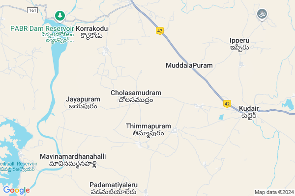
Cholasamudram
Cholasamudram Map
EDIT Map
Add Your House
 ..
..
Current Corona Virus Infected Patients Count in Anantapur District
| City Name | District Name | Total Covid cases |
|---|---|---|
| Anantapur District | Anantapur | 36 |
| Anantapur | Anantapur | 5 |
| Hindupur | Anantapur | 3 |
| R K Function Hall Backside | Anantapur | 2 |
| Lepakshi | Anantapur | 2 |
| Kalyana Durgam | Anantapur | 1 |
| Hindupur Mandal | Anantapur | 1 |
| Naik Nagar | Anantapur | 1 |
| Kothacheruvu | Anantapur | 1 |
| Aravinda Nagar | Anantapur | 1 |
Locality Name :
Cholasamudram
( చోలాసముద్రం )
Mandal Name : Kudair
District : Anantapur
State : Andhra Pradesh
Region : Rayalaseema
Language : Telugu and Urdu
Current Time 07:26 PM
Date: Friday , May 02,2025 (IST)
Time zone: IST (UTC+5:30)
Elevation / Altitude: 349 meters. Above Seal level
Telephone Code / Std Code: 08554
Assembly constituency : assembly constituency
Assembly MLA : PAYYAVULA KESHAV
Lok Sabha constituency : parliamentary constituency
Parliament MP : TALARI RANGAIAH
Serpanch Name :
Pin Code : 515711
Post Office Name : Kuderu (Ananthapur)
Commodities Prices : Bellary Market / Mandi
National Highways Reachable To Cholasamudram
Nationa High Way :NH42
Nationa High Way :NH544DD
Nationa High Way :NH42
Nationa High Way :NH544DD
Rivers Near Cholasamudram
Puli Vanka
Penna :ಪೆನ್ನಾ :పెన్నా
Puli Vanka
Penna :ಪೆನ್ನಾ :పెన్నా
About Cholasamudram
Correct below Info and add more info about CholasamudramCholasamudram is a Village in Kudair Mandal in Anantapur District of Andhra Pradesh State, India. It belongs to Rayalaseema region . It is located 30 KM towards west from District head quarters Anantapur. 4 KM from Kudair. 371 KM from State capital Hyderabad
Cholasamudram Pin code is 515711 and postal head office is Kuderu (Ananthapur).
Thimmapuram ( 5 KM ) , P.narayanapuram ( 5 KM ) , Korrakodu ( 7 KM ) , Kudair ( 7 KM ) , Ipperu ( 9 KM ) are the nearby Villages to Cholasamudram. Cholasamudram is surrounded by Atmakur Mandal towards South , Beluguppa Mandal towards west , Uravakonda Mandal towards North , Garladinne Mandal towards East .
Anantapur , Uravakonda , Kalyandurg , Guntakal are the near by Cities to Cholasamudram.
Cholasamudram 2011 Census Details
Cholasamudram Local Language is Telugu. Cholasamudram Village Total population is 2034 and number of houses are 472. Female Population is 49.5%. Village literacy rate is 47.5% and the Female Literacy rate is 20.1%.
Population
| Census Parameter | Census Data |
| Total Population | 2034 |
| Total No of Houses | 472 |
| Female Population % | 49.5 % ( 1007) |
| Total Literacy rate % | 47.5 % ( 967) |
| Female Literacy rate | 20.1 % ( 409) |
| Scheduled Tribes Population % | 5.2 % ( 105) |
| Scheduled Caste Population % | 22.0 % ( 447) |
| Working Population % | 54.7 % |
| Child(0 -6) Population by 2011 | 242 |
| Girl Child(0 -6) Population % by 2011 | 46.3 % ( 112) |
Cholasamudram Census More Deatils.
HOW TO REACH Cholasamudram
By Road
Anantapur is the Nearest Town to Cholasamudram. Anantapur is 30 km from Cholasamudram. Road connectivity is there from Anantapur to Cholasamudram.By Rail
There is no railway station near to Cholasamudram in less than 10 km. How ever there are railway Stations from Near By town Anantapur. are the railway Stations near to Anantapur. You can reach from Anantapur to Cholasamudram by road after .By Bus
Atmakur(Atp) APSRTC Bus Station , Bellary APSRTC Bus Station , Uravakonda APSRTC Bus Station are the nearby by Bus Stations to Cholasamudram .APSRTC runs Number of busses from major cities to here.Colleges near Cholasamudram
Sri Venkateswara Instute Of Technology
Address :
Naidu College
Address :
Government Junior College For Boys
Address :
Govt Junior College Kundurpi
Address : Govt Junior College Kundurpi Near Rama Swamy Temple Kundurpi Anantapur
Sri Mahatma Jr College Gooty
Address : Neha Nagar
gooty V
gooty M
anantapur Dist 515401
Schools in Cholasamudram
Mpups Cholasamudram
Address : cholasamudram , kudair , anantapur , Andhra Pradesh . PIN- 515711 , Post - Kuderu (Ananthapur)
Govt Health Centers near Cholasamudram
1) Kudair , , SRI SATHA SAI COLONY , NEAR POLICE STATION2) Kudair , , MAIN ROAD , MPDO OFFICE
3) Sc Shaikshanipalli , , Main road , OPP New MPPs
Petrol Bunks in Cholasamudram,Kudair
Indian Oil Petrol Pump
Kuderu - Atmakur Rd; Kuderu; Andhra Pradesh 515711; India
8.0 KM distance Detail
more ..
Colleges in Cholasamudram,Kudair
Sri Sangameswara School; Kudair
Bellary-Anantapur Rd; Kuderu; Andhra Pradesh 515711; India
9.0 KM distance Detail
INTELLECTUAL INSTITUTE OF TECHNOLOGYy
Gotkur(V); Kuderu (M);; Bellary Road; Anantapur; Andhra Pradesh 515711; India
19.9 KM distance Detail
more ..
Electronic Shops in Cholasamudram,Kudair
RAMANJINEYULU MOTOR MECHANIC
Karutlapalli; Thimmapuram; Andhra Pradesh 515711; India
3.8 KM distance Detail
Sangameswara Mobiles Kudair
Kudair; Marutla road; Kuderu; Andhra Pradesh; India
5.6 KM distance Detail
Ganesh mobiles
1; Bellary - Uravakonda - Anantapur Rd; Kudair; Andhra Pradesh 515711; India
8.8 KM distance Detail
Super Markets in Cholasamudram,Kudair
Kasamsetty Sreenivasulu General Store
Ramalayam Road; Korrakodu; Andhra Pradesh 515711; India
5.5 KM distance Detail
Sri Venkateswara Cool Drinks
1-115; Boya Street; Kuderu; Andhra Pradesh 515711; India
8.7 KM distance Detail
sri Venkateswara Agencies
1-115; Boya Street; Kuderu; Andhra Pradesh 515711; India
9.5 KM distance Detail
Governement Offices near Cholasamudram,Kudair
GRAMA PANCHAYATH OFFICE; MUDDALAPURAM
MuddalaPuram; Andhra Pradesh 515711; India
4.7 KM distance Detail
About Cholasamudram &
History
How to reach Cholasamudram
Tourist Places Near By Cholasamudram
Schools in Cholasamudram
Colleges in Cholasamudram
Temperature & weather of Cholasamudram
places in Cholasamudram
Cholasamudram photos
More Information
How to reach Cholasamudram
Tourist Places Near By Cholasamudram
Schools in Cholasamudram
Colleges in Cholasamudram
Temperature & weather of Cholasamudram
places in Cholasamudram
Cholasamudram photos
More Information
Village Talk
Post News or Events about this Village
Near Cities
Anantapur 25 KM near
Uravakonda 29 KM near
Kalyandurg 39 KM near
Guntakal 52 KM near
Anantapur 25 KM near
Uravakonda 29 KM near
Kalyandurg 39 KM near
Guntakal 52 KM near
Near By Taluks
Kudair 3 KM near
Atmakur 18 KM near
Beluguppa 24 KM near
Uravakonda 25 KM near
Kudair 3 KM near
Atmakur 18 KM near
Beluguppa 24 KM near
Uravakonda 25 KM near
Near By Air Ports
Bengaluru International Airport 196 KM near
Hubli Airport 284 KM near
Tirupati Airport 297 KM near
Mysore Airport 315 KM near
Bengaluru International Airport 196 KM near
Hubli Airport 284 KM near
Tirupati Airport 297 KM near
Mysore Airport 315 KM near
Near By Tourist Places
Puttaparthi 87 KM near
Lepakshi 120 KM near
Hampi 130 KM near
Chitradurga 132 KM near
Hospet 134 KM near
Puttaparthi 87 KM near
Lepakshi 120 KM near
Hampi 130 KM near
Chitradurga 132 KM near
Hospet 134 KM near
Near By Districts
Anantapur 29 KM near
Bellary 73 KM near
Chitradurga 132 KM near
Kurnool 157 KM near
Anantapur 29 KM near
Bellary 73 KM near
Chitradurga 132 KM near
Kurnool 157 KM near
Near By RailWay Station
Anantapur Rail Way Station 29 KM near
Guntakal Junction Rail Way Station 54 KM near
Anantapur Rail Way Station 29 KM near
Guntakal Junction Rail Way Station 54 KM near