| Home | City Bus | Maps | Villages | Cities | Rail | Tourist Places | School | College | Pin Codes | Corona Cases Count |
| Distance Calculator Bus Services IFSC Codes Trace Mobile Number Weather Search Place Trace IP Available Cash ATM/Banks Locate Polling Booth Report an Error contact People |
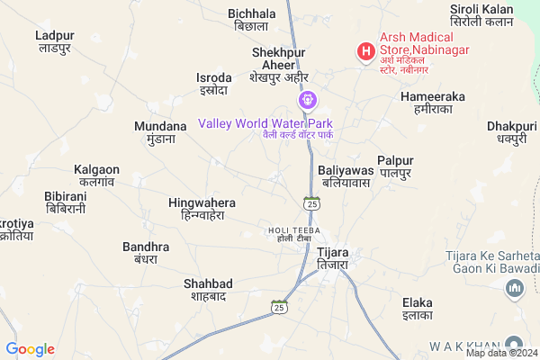
Luhadera Map
EDIT Map
Add Your House
 ..
..
Current Corona Virus Infected Patients Count in Alwar District
| City Name | District Name | Total Covid cases |
|---|---|---|
| Alwar District | Alwar | 7 |
Locality Name :
Luhadera
( लुहादेरा )
Tehsil Name : Tijara
District : Alwar
State : Rajasthan
Division : Jaipur
Language : Rajasthani
Current Time 12:55 AM
Date: Sunday , May 04,2025 (IST)
Time zone: IST (UTC+5:30)
Elevation / Altitude: 286 meters. Above Seal level
Telephone Code / Std Code: 01493
Assembly constituency : Tijara assembly constituency
Assembly MLA : Mahant Balak Nath
Lok Sabha constituency : Alwar parliamentary constituency
Parliament MP : Balak Nath
Serpanch Name :
Pin Code : 301411
Post Office Name : Tizara
Commodities Prices : Khairthal Market / Mandi
Luhadera Live Weather
Temperature: 27.3 °C
overcast clouds
Humidity: 33%
Wind : 2.59 mt/sec towards S
StationName : "TijÄ\u0081ra"
observed on 24 Mins Back
Temperature: 27.3 °C
overcast clouds
Humidity: 33%
Wind : 2.59 mt/sec towards S
StationName : "TijÄ\u0081ra"
observed on 24 Mins Back
Luhadera Weather Forecast for Next 5 days
04-05-2025
26.1°C to 26.9°C
light rain
26.1°C to 26.9°C
light rain
05-05-2025
26.6°C to 37.3°C
overcast clouds, scattered clouds, broken clouds, clear sky
26.6°C to 37.3°C
overcast clouds, scattered clouds, broken clouds, clear sky
06-05-2025
27.6°C to 38.2°C
light rain, overcast clouds
27.6°C to 38.2°C
light rain, overcast clouds
07-05-2025
27.6°C to 38.1°C
broken clouds, light rain, scattered clouds, clear sky, few clouds
27.6°C to 38.1°C
broken clouds, light rain, scattered clouds, clear sky, few clouds
08-05-2025
28.1°C to 39.4°C
scattered clouds, few clouds, clear sky, broken clouds, overcast clouds
28.1°C to 39.4°C
scattered clouds, few clouds, clear sky, broken clouds, overcast clouds
Edit below overview about Luhadera
Edit below overview about Luhadera
OverView of Luhadera
luhadera is a village located to 2 km far away from tijara.
It is a good village having 2 primary school and a secondary school. This village is called by a"Pollitition village " bcoz so many pollitition came out from this village.
Edit below overview about Luhadera
National Highways Reachable To Luhadera
Nationa High Way :NH48
Nationa High Way :NH24
Nationa High Way :NH48
Nationa High Way :NH24
About Luhadera
Luhadera is a Village in Tijara Tehsil in Alwar District of Rajasthan State, India. It belongs to Jaipur Division . It is located 57 KM towards North from District head quarters Alwar. 8 KM from Tijara. 179 KM from State capital Jaipur
Luhadera Pin code is 301411 and postal head office is Tizara .
Palpur ( 4 KM ) , Ishroda ( 4 KM ) , Mundana ( 5 KM ) , Shahabad ( 5 KM ) , Hamiraka ( 7 KM ) are the nearby Villages to Luhadera. Luhadera is surrounded by Kotkasim Tehsil towards west , Nagina Tehsil towards East , Kishangarh Bas Tehsil towards South , Mewat Tehsil towards East .
Bawal , Rewari , Sohna , Alwar are the near by Cities to Luhadera.
This Place is in the border of the Alwar District and Mewat District. Mewat District Nagina is East towards this place . It is near to the Haryana State Border.
Luhadera 2011 Census Details
Luhadera Local Language is Rajasthani. Luhadera Village Total population is 1917 and number of houses are 335. Female Population is 48.5%. Village literacy rate is 67.7% and the Female Literacy rate is 26.7%.
Population
| Census Parameter | Census Data |
| Total Population | 1917 |
| Total No of Houses | 335 |
| Female Population % | 48.5 % ( 930) |
| Total Literacy rate % | 67.7 % ( 1298) |
| Female Literacy rate | 26.7 % ( 511) |
| Scheduled Tribes Population % | 0.0 % ( 0) |
| Scheduled Caste Population % | 22.8 % ( 438) |
| Working Population % | 47.8 % |
| Child(0 -6) Population by 2011 | 248 |
| Girl Child(0 -6) Population % by 2011 | 49.6 % ( 123) |
Luhadera Census More Deatils.
Politics in Luhadera
Bharatiya Janata Party , BJP , BSP , INC are the major political parties in this area.Polling Stations /Booths near Luhadera
1)Govt. Primary School Arandaka2)Govt. Senior Secondary School Maheshra
3)Govt. Secondary School Majra Pipli
4)Govt. Hr Secondary School Room No. 6 Bhiwadi
5)Govt. Primary School Mundana Mev
HOW TO REACH Luhadera
By Rail
There is no railway station near to Luhadera in less than 10 km.Colleges near Luhadera
Anibesaint Girls College
Address :
Rajasthan Degree Girls College Tapukra
Address :
Modern Institute Of Tecnology & Reserch Institute
Address : Sirmoli Road,6 Th Mile Stone, Delhi - Tijara High
Schools in Luhadera
Govt.ups (g), Lahadera
Address : luhadera , tizara , alwar , Rajasthan . PIN- 301411 , Post - Tizara
Lmups Luhadera
Address : luhadera , tizara , alwar , Rajasthan . PIN- 301411 , Post - Tizara
Govt.ss, Luhadera
Address : luhadera , tizara , alwar , Rajasthan . PIN- 301411 , Post - Tizara
Govt Health Centers near Luhadera
1) Teouwas , teouwas , jodiya , kotkasim2) Jodiya , jodiya , jodiya , kotkasim
3) Deegli , Deengli , pur , kotkasim
Hospitals in Luhadera,Tijara
Sonography & Diagnostic Center
Opp. Doctor's Residence (Mahal Baag); Tijara; Rajasthan 301018; India
4.4 KM distance Detail
more ..
Petrol Bunks in Luhadera,Tijara
iocl petrol pump
Tijara Rd; Ward 2; Ibrahimpur at Virampur; Rajasthan 301411; India
2.6 KM distance Detail
Jain Dharamkanta
near by indian oil petrol pump ward no. 2; Alwar - Bhiwadi Rd; India
3.0 KM distance Detail
more ..
Colleges in Luhadera,Tijara
CPD Jain Kanya PG College
Rd to ChandraPrabhu Jain Temple; Tijara; Rajasthan 301411; India
4.1 KM distance Detail
Chandra Prubhu Digmer Jain College Tijara
301411; RD Complex; U-3; Unnamed Rd; Sector 3; Avas Vikas Colony; Sikandra; Agra; Rajasthan 282004; India
4.2 KM distance Detail
Sarthak computer institute
alwar road tijara jain honda; Alwar; Rajasthan; India
4.5 KM distance Detail
more ..
Schools in Luhadera,Tijara
Avi Amway Nutrilite Distributer& Products Retailing Center Luhadera
Luhadera; Rajasthan 301411; India
0.4 KM distance Detail
Electronic Shops in Luhadera,Tijara
Dev Communication
Bilaspur road; Shri Ram Colony; Tijara; Rajasthan 301411; India
4.3 KM distance Detail
Deepak Enterprises
Vikash Path; opp. BSNL Exchange; Shri Ram Colony; Tijara; Rajasthan 301411; India
4.5 KM distance Detail
Super Markets in Luhadera,Tijara
Hahi schoolrode
Vikash Path; Khuntala Mohalla; Tijara; Rajasthan 301411; India
4.3 KM distance Detail
Shree Sandeep Kumar Adishwar Kumar Ji Jain Shops(Shopping Complex)
Kayasthwari; Tijara; Rajasthan 301411; India
4.3 KM distance Detail
Governement Offices near Luhadera,Tijara
Panchayat Samiti Office
Alwar-Tijara Rd; Shri Ram Colony; Tijara; Rajasthan 301411; India
4.5 KM distance Detail
About Luhadera &
History
How to reach Luhadera
Tourist Places Near By Luhadera
Schools in Luhadera
Colleges in Luhadera
Temperature & weather of Luhadera
places in Luhadera
Luhadera photos
More Information
How to reach Luhadera
Tourist Places Near By Luhadera
Schools in Luhadera
Colleges in Luhadera
Temperature & weather of Luhadera
places in Luhadera
Luhadera photos
More Information
Village Talk
Post News or Events about this Village
Near Cities
Bawal 31 KM near
Rewari 37 KM near
Sohna 44 KM near
Alwar 54 KM near
Bawal 31 KM near
Rewari 37 KM near
Sohna 44 KM near
Alwar 54 KM near
Near By Taluks
Tijara 7 KM near
Kotkasim 14 KM near
Nagina 22 KM near
Kishangarh Bas 23 KM near
Tijara 7 KM near
Kotkasim 14 KM near
Nagina 22 KM near
Kishangarh Bas 23 KM near
Near By Air Ports
Indira Gandhi International Airport 80 KM near
Kheria Airport 160 KM near
Sanganeer Airport 181 KM near
Muzaffarnagar Airport 204 KM near
Indira Gandhi International Airport 80 KM near
Kheria Airport 160 KM near
Sanganeer Airport 181 KM near
Muzaffarnagar Airport 204 KM near
Near By Tourist Places
Nuh 26 KM near
Sohna 44 KM near
Manesar 50 KM near
Alwar 55 KM near
Dabchick 59 KM near
Nuh 26 KM near
Sohna 44 KM near
Manesar 50 KM near
Alwar 55 KM near
Dabchick 59 KM near
Near By Districts
Mewat 25 KM near
Rewari 38 KM near
Alwar 54 KM near
Palwal 58 KM near
Mewat 25 KM near
Rewari 38 KM near
Alwar 54 KM near
Palwal 58 KM near
Near By RailWay Station
Khairthal Rail Way Station 28 KM near
Rewari Junction Rail Way Station 38 KM near
Khairthal Rail Way Station 28 KM near
Rewari Junction Rail Way Station 38 KM near