| Home | City Bus | Maps | Villages | Cities | Rail | Tourist Places | School | College | Pin Codes | Corona Cases Count |
| Distance Calculator Bus Services IFSC Codes Trace Mobile Number Weather Search Place Trace IP Available Cash ATM/Banks Locate Polling Booth Report an Error contact People |
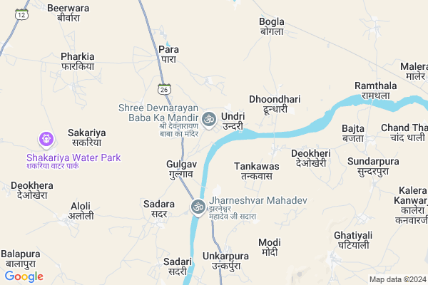
Pranheda Map
EDIT Map
Add Your House
 ..
..
Current Corona Virus Infected Patients Count in Ajmer District
| City Name | District Name | Total Covid cases |
|---|---|---|
| Ajmer District | Ajmer | 119 |
| Ajmer | Ajmer | 4 |
Locality Name :
Pranheda
( प्रान्हेड़ा )
Tehsil Name : Kekri
District : Ajmer
State : Rajasthan
Division : Ajmer
Language : Rajasthani and Urdu, Rajasthani
Current Time 09:58 PM
Date: Friday , May 02,2025 (IST)
Time zone: IST (UTC+5:30)
Elevation / Altitude: 440 meters. Above Seal level
Telephone Code / Std Code: 01467
Assembly constituency : Kekri assembly constituency
Assembly MLA : Shatrughan Gautam
Lok Sabha constituency : Ajmer parliamentary constituency
Parliament MP : Bhagirath Chaudhary
Serpanch Name :
Pin Code : 305404
Post Office Name : Kekri
Alternate Village Name : Pranhera
Commodities Prices : Kekri Market / Mandi
Pranheda Live Weather
Temperature: 27.2 °C
broken clouds
Humidity: 40%
Wind : 6.48 mt/sec towards SW
StationName : "Deoli"
observed on 2 Hours Back
Temperature: 27.2 °C
broken clouds
Humidity: 40%
Wind : 6.48 mt/sec towards SW
StationName : "Deoli"
observed on 2 Hours Back
Pranheda Weather Forecast for Next 5 days
03-05-2025
30.1°C to 32.8°C
light rain, broken clouds, overcast clouds
30.1°C to 32.8°C
light rain, broken clouds, overcast clouds
04-05-2025
28.0°C to 40.6°C
overcast clouds, light rain, broken clouds
28.0°C to 40.6°C
overcast clouds, light rain, broken clouds
05-05-2025
26.6°C to 38.6°C
light rain, broken clouds, scattered clouds, overcast clouds
26.6°C to 38.6°C
light rain, broken clouds, scattered clouds, overcast clouds
06-05-2025
27.7°C to 37.9°C
overcast clouds, broken clouds, light rain, moderate rain
27.7°C to 37.9°C
overcast clouds, broken clouds, light rain, moderate rain
07-05-2025
26.5°C to 38.7°C
overcast clouds, broken clouds, light rain, scattered clouds
26.5°C to 38.7°C
overcast clouds, broken clouds, light rain, scattered clouds
Rivers Near Pranheda
Mansi
Para Kala
Mansi
Para Kala
About Pranheda
Correct below Info and add more info about PranhedaPranheda is a Village in Kekri Tehsil in Ajmer District of Rajasthan State, India. It belongs to Ajmer Division . It is located 103 KM towards South from District head quarters Ajmer. 156 KM from State capital Jaipur
Pranheda Pin code is 305404 and postal head office is Kekri .
Pranheda is surrounded by Deoli Tehsil towards East , Jahazpur Tehsil towards South , Shahpura Tehsil towards west , Todaraisingh Tehsil towards East .
Todaraisingh , Shahpura , Malpura , Tonk are the near by Cities to Pranheda.
This Place is in the border of the Ajmer District and Tonk District. Tonk District Deoli is East towards this place .
Pranhera 2011 Census Details
Pranheda Local Language is Rajasthani. Pranhera Village Total population is 4455 and number of houses are 901. Female Population is 49.4%. Village literacy rate is 49.7% and the Female Literacy rate is 16.3%.
Population
| Census Parameter | Census Data |
| Total Population | 4455 |
| Total No of Houses | 901 |
| Female Population % | 49.4 % ( 2200) |
| Total Literacy rate % | 49.7 % ( 2216) |
| Female Literacy rate | 16.3 % ( 724) |
| Scheduled Tribes Population % | 2.0 % ( 90) |
| Scheduled Caste Population % | 40.2 % ( 1792) |
| Working Population % | 57.8 % |
| Child(0 -6) Population by 2011 | 643 |
| Girl Child(0 -6) Population % by 2011 | 50.9 % ( 327) |
Pranhera Census More Deatils.
Politics in Pranheda
Bharatiya Janata Party , BJP , INC are the major political parties in this area.Polling Stations /Booths near Pranheda
1)Government Primary School Sanpala Get Ka New Building Sarwar2)Government Primary School East Part Room Devkhera
3)Government Secondry School Tajpura Class 8 Room
4)Government Senior Secondry School West Part Room Kadera
5)Government Senior Secondry School East Part Room Hingoniya
HOW TO REACH Pranheda
By Rail
There is no railway station near to Pranheda in less than 10 km.Colleges near Pranheda
Govt. Iti College Tantoti
Address : Bhinay Road Tantoti
Dayanand College
Address :
Kirnani Technologies
Address :
Sanskar Itc
Address :
G.c.a.
Address : Ajmer
Schools in Pranheda
G.s.sec.s. Pranheda
Address : pranheda , kekri , ajmer , Rajasthan . PIN- 305404 , Post - Kekri
Govt Health Centers near Pranheda
1) Bijwar , VILLAGE BEEJWAR , ,2) Maleda , VILLAGE MALEDA , ,
3) Badla , VILLAGE BADLA , ,
Hospitals in Pranheda,Kekri
Leela Devi Nursing Cair Center
Anant's Sweat Colony; Kekri; Rajasthan 305404; India
18.5 KM distance Detail
more ..
Petrol Bunks in Pranheda,Kekri
Srinagar Filling-Indian Oil Petrol Pump
Kadera; Ajmer; SH-12; Ajmer Road; Kekri; Kekri; Rajasthan 305405; India
17.8 KM distance Detail
more ..
Colleges in Pranheda,Kekri
National Institute of Electronics and Information Technology
Gopal Pura; Kekri; Rajasthan 305404; India
17.6 KM distance Detail
more ..
Electronic Shops in Pranheda,Kekri
Shankar Meena
304507; RD Complex; U-3; Unnamed Rd; Sector 3; Avas Vikas Colony; Sikandra; Agra; Rajasthan 282004; India
16.9 KM distance Detail
Super Markets in Pranheda,Kekri
Shri Devnarayan Motor Parts
Old; Kota Rd; Purani Kekri; Kekri; Rajasthan 305404; India
17.3 KM distance Detail
हरिओम एग्रो इंडस्ट्रीज
Ajmer - Kota Rd; Purani Kekri; Kekri; Rajasthan 305404; India
17.9 KM distance Detail
Local Parks in Pranheda,Kekri
Gandhi Park
vegetable market; Anant's Sweat Colony; Kekri; Rajasthan 305404; India
18.5 KM distance Detail
Police Stations near Pranheda,Kekri
Police Station Kekri
Civil Lines; Kekri; Anant's Sweat Colony; Kekri; Rajasthan 305404; India
18.7 KM distance Detail
Governement Offices near Pranheda,Kekri
Asset Center-Au Small Finance Bank LTD
Sawar Road; Gopal Pura; Kekri; Rajasthan 305404; India
16.9 KM distance Detail
Kekri Sessional Court
SH 12; Anant's Sweat Colony; Kekri; Rajasthan 305404; India
18.5 KM distance Detail
About Pranheda &
History
How to reach Pranheda
Tourist Places Near By Pranheda
Schools in Pranheda
Colleges in Pranheda
Temperature & weather of Pranheda
places in Pranheda
Pranheda photos
More Information
How to reach Pranheda
Tourist Places Near By Pranheda
Schools in Pranheda
Colleges in Pranheda
Temperature & weather of Pranheda
places in Pranheda
Pranheda photos
More Information
Village Talk
Post News or Events about this Village
Near Cities
Todaraisingh 38 KM near
Shahpura 40 KM near
Malpura 60 KM near
Tonk 76 KM near
Todaraisingh 38 KM near
Shahpura 40 KM near
Malpura 60 KM near
Tonk 76 KM near
Near By Taluks
Kekri 0 KM near
Deoli 34 KM near
Jahazpur 36 KM near
Shahpura 41 KM near
Kekri 0 KM near
Deoli 34 KM near
Jahazpur 36 KM near
Shahpura 41 KM near
Near By Air Ports
Sanganeer Airport 138 KM near
Dabok Airport 212 KM near
Jodhpur Airport 247 KM near
Gwalior Airport 342 KM near
Sanganeer Airport 138 KM near
Dabok Airport 212 KM near
Jodhpur Airport 247 KM near
Gwalior Airport 342 KM near
Near By Tourist Places
Bundi 69 KM near
Bijolia 86 KM near
Bhilwara 89 KM near
Kishangarh 98 KM near
Ajmer 99 KM near
Bundi 69 KM near
Bijolia 86 KM near
Bhilwara 89 KM near
Kishangarh 98 KM near
Ajmer 99 KM near
Near By Districts
Bundi 70 KM near
Tonk 78 KM near
Bhilwara 89 KM near
Ajmer 99 KM near
Bundi 70 KM near
Tonk 78 KM near
Bhilwara 89 KM near
Ajmer 99 KM near
Near By RailWay Station
Bijainagar Rail Way Station 63 KM near
Bundi Rail Way Station 73 KM near
Bijainagar Rail Way Station 63 KM near
Bundi Rail Way Station 73 KM near