| Home | City Bus | Maps | Villages | Cities | Rail | Tourist Places | School | College | Pin Codes | Corona Cases Count |
| Distance Calculator Bus Services IFSC Codes Trace Mobile Number Weather Search Place Trace IP Available Cash ATM/Banks Locate Polling Booth Report an Error contact People |
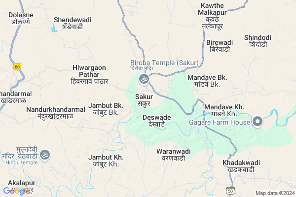
Sakur
Sakur Map
EDIT Map
Add Your House
 ..
..
Current Corona Virus Infected Patients Count in Ahmednagar District
| City Name | District Name | Total Covid cases |
|---|
Locality Name :
Sakur
( साकुर )
Taluka Name : Sangamner
District : Ahmednagar
State : Maharashtra
Region : Khandesh and Northern Maharashtra
Division : Nashik
Language : English and Hindi, Marathi, Urdu
Current Time 06:01 AM
Date: Saturday , May 03,2025 (IST)
Time zone: IST (UTC+5:30)
Elevation / Altitude: 509 meters. Above Seal level
Telephone Code / Std Code: 02425
Assembly constituency : Sangamner assembly constituency
Assembly MLA : Vijay Alias Balasaheb Bhausaheb Thorat
Lok Sabha constituency : Shirdi parliamentary constituency
Parliament MP : SADASHIV KISAN LOKHANDE
Serpanch Name :
Pin Code : 422622
Post Office Name : Sakur
Commodities Prices : Sangamner Market / Mandi
Edit below overview about Sakur
Edit below overview about Sakur
OverView of Sakur
In sakur There is Holy mandir of God Biroba or Veerbhadra .Many devotees of Dhanagar communities praise to god .In Hindu month of Sharavan festival or Jatra aranged by people of sakur Langauage of sakur is Marathi not English.Edit below overview about Sakur
National Highways Reachable To Sakur
Nationa High Way :NH61
Nationa High Way :NH60
Nationa High Way :NH61
Nationa High Way :NH60
Rivers Near Sakur
Pravara :प्रवरा
Pravara :प्रवरा
Pravara :प्रवरा
Pravara :प्रवरा
About Sakur
Sakur is a Village in Sangamner Taluka in Ahmednagar District of Maharashtra State, India. It belongs to Khandesh and Northern Maharashtra region . It belongs to Nashik Division . It is located 61 KM towards west from District head quarters Ahmednagar. 28 KM from Sangamner. 181 KM from State capital Mumbai
Sakur Pin code is 422622 and postal head office is Sakur .
Birewadi ( 7 KM ) , Nandur Khandarmal ( 7 KM ) , Pokhari ( 8 KM ) , Khadakwadi ( 10 KM ) , Shindodi ( 10 KM ) are the nearby Villages to Sakur. Sakur is surrounded by Parner Taluka towards South , Rahuri Taluka towards East , Rahata Taluka towards North , Akole Taluka towards west .
Sangamner , Rahuri , Junnar , Shrirampur are the near by Cities to Sakur.
Sakur 2011 Census Details
Sakur Local Language is English. Sakur Village Total population is 8974 and number of houses are 1677. Female Population is 49.1%. Village literacy rate is 64.6% and the Female Literacy rate is 28.5%.
Population
| Census Parameter | Census Data |
| Total Population | 8974 |
| Total No of Houses | 1677 |
| Female Population % | 49.1 % ( 4408) |
| Total Literacy rate % | 64.6 % ( 5794) |
| Female Literacy rate | 28.5 % ( 2555) |
| Scheduled Tribes Population % | 19.7 % ( 1768) |
| Scheduled Caste Population % | 8.6 % ( 772) |
| Working Population % | 49.7 % |
| Child(0 -6) Population by 2011 | 1223 |
| Girl Child(0 -6) Population % by 2011 | 46.7 % ( 571) |
Sakur Census More Deatils.
Politics in Sakur
RPI(A) , Shivsena , SHS , INC are the major political parties in this area.Polling Stations /Booths near Sakur
1)Virbhadra High School Sakur North South Building Room No. 5 From South2)Virbhadra Highschool Sakur North South Building Room No. 1 From South
3)Urdu Z P School Samnapur - South North Building Room No 1 From South
4)Zilha Parishad Primary School Sakur East West Building Room No. 1 From West
5)Zilha Parishad Primary School Jambhulwadi North South Building Room No. 2 From North
HOW TO REACH Sakur
By Road
Sangamner is the Nearest Town to Sakur. Sangamner is 36 km from Sakur. Road connectivity is there from Sangamner to Sakur.By Rail
There is no railway station near to Sakur in less than 10 km.Colleges near Sakur
Ramesh Phirodia College Of Arts Commerece And Science
Address :
Virbhadra Junior College
Address :
Schools in Sakur
Virbhadra V.sakur
Address : sakur , sangamner , ahmadnagar , Maharashtra . PIN- 422622 , Post - Sakur
Vidya Prabodhini Prashala Saku
Address : sakur , sangamner , ahmadnagar , Maharashtra . PIN- 422622 , Post - Sakur
Govt.ashramshala Sakur
Address : sakur , sangamner , ahmadnagar , Maharashtra . PIN- 422622 , Post - Sakur
Urdu Hgh Sakur
Address : sakur , sangamner , ahmadnagar , Maharashtra . PIN- 422622 , Post - Sakur
Z.p.p.school Chinchewadi
Address : sakur , sangamner , ahmadnagar , Maharashtra . PIN- 422622 , Post - Sakur
Govt Health Centers near Sakur
1) R.H. Sakur , , Bus stand road ,2) Hiwargaon Pathar , Hiwargaon Pathar , near zp school gouthan , near zp school gouthan
3) Karjule Pathar , Karjule Pathar , Ghavthan , near school
Sub Villages in Sakur
Colleges in Sakur,Sangamner
Ramesh Firodia Education Trusts Ramesh Firodia Arts; Commerce & Science College
Sakur; Sangamner; Ahmednagar; Maharashtra 422605; India
4.9 KM distance Detail
more ..
About Sakur &
History
How to reach Sakur
Tourist Places Near By Sakur
Schools in Sakur
Colleges in Sakur
Temperature & weather of Sakur
places in Sakur
Sakur photos
More Information
How to reach Sakur
Tourist Places Near By Sakur
Schools in Sakur
Colleges in Sakur
Temperature & weather of Sakur
places in Sakur
Sakur photos
More Information
Village Talk
Post News or Events about this Village
Near Cities
Sangamner 29 KM near
Rahuri 41 KM near
Junnar 52 KM near
Shrirampur 55 KM near
Sangamner 29 KM near
Rahuri 41 KM near
Junnar 52 KM near
Shrirampur 55 KM near
Near By Taluks
Sangamner 26 KM near
Parner 38 KM near
Rahuri 42 KM near
Rahata 48 KM near
Sangamner 26 KM near
Parner 38 KM near
Rahuri 42 KM near
Rahata 48 KM near
Near By Air Ports
Gandhinagar Airport 96 KM near
Lohegaon Airport 104 KM near
Chikkalthana Airport 144 KM near
Chhatrapati Shivaji International Airport 170 KM near
Gandhinagar Airport 96 KM near
Lohegaon Airport 104 KM near
Chikkalthana Airport 144 KM near
Chhatrapati Shivaji International Airport 170 KM near
Near By Tourist Places
Ozar 44 KM near
Junnar 52 KM near
Shirdi 58 KM near
Ahmednagar 60 KM near
Malshej Ghat 63 KM near
Ozar 44 KM near
Junnar 52 KM near
Shirdi 58 KM near
Ahmednagar 60 KM near
Malshej Ghat 63 KM near
Near By Districts
Ahmednagar 58 KM near
Nashik 99 KM near
Pune 113 KM near
Aurangabad District 139 KM near
Ahmednagar 58 KM near
Nashik 99 KM near
Pune 113 KM near
Aurangabad District 139 KM near
Near By RailWay Station
Belapur Rail Way Station 54 KM near
Sainagar Shirdi Rail Way Station 58 KM near
Belapur Rail Way Station 54 KM near
Sainagar Shirdi Rail Way Station 58 KM near