| Home | City Bus | Maps | Villages | Cities | Rail | Tourist Places | School | College | Pin Codes | Corona Cases Count |
| Distance Calculator Bus Services IFSC Codes Trace Mobile Number Weather Search Place Trace IP Available Cash ATM/Banks Locate Polling Booth Report an Error contact People |
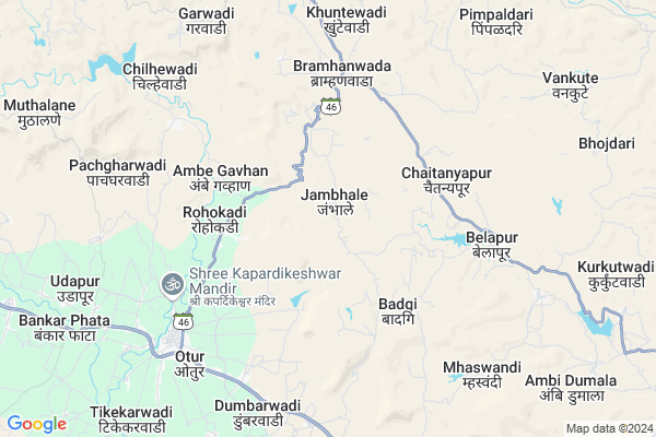
Jambhale
Jambhale Map
EDIT Map
Add Your House
 ..
..
Current Corona Virus Infected Patients Count in Ahmednagar District
| City Name | District Name | Total Covid cases |
|---|
Locality Name :
Jambhale
( जांभळे )
Taluka Name : Akole
District : Ahmednagar
State : Maharashtra
Region : Khandesh and Northern Maharashtra
Division : Nashik
Language : English and Hindi, Marathi, Urdu
Current Time 01:32 PM
Date: Thursday , May 01,2025 (IST)
Time zone: IST (UTC+5:30)
Elevation / Altitude: 587 meters. Above Seal level
Telephone Code / Std Code: 02424
Assembly constituency : Akole assembly constituency
Assembly MLA : Dr. Kiran Yamaji Lahamate
Lok Sabha constituency : Shirdi parliamentary constituency
Parliament MP : SADASHIV KISAN LOKHANDE
Serpanch Name :
Pin Code : 422602
Post Office Name : Bota
Commodities Prices : Junnar(Otur) Market / Mandi
Jambhale Live Weather
Temperature: 38.0 °C
clear sky
Humidity: 12%
Wind : 4.91 mt/sec towards NW
StationName : "Junnar"
observed on Now
Temperature: 38.0 °C
clear sky
Humidity: 12%
Wind : 4.91 mt/sec towards NW
StationName : "Junnar"
observed on Now
Jambhale Weather Forecast for Next 5 days
02-05-2025
25.1°C to 38.2°C
clear sky, few clouds
25.1°C to 38.2°C
clear sky, few clouds
03-05-2025
23.9°C to 38.6°C
clear sky, few clouds
23.9°C to 38.6°C
clear sky, few clouds
04-05-2025
20.9°C to 35.6°C
clear sky, broken clouds, scattered clouds, few clouds
20.9°C to 35.6°C
clear sky, broken clouds, scattered clouds, few clouds
05-05-2025
19.7°C to 34.6°C
clear sky, few clouds
19.7°C to 34.6°C
clear sky, few clouds
06-05-2025
19.8°C to 35.4°C
clear sky
19.8°C to 35.4°C
clear sky
Edit below overview about Jambhale
Edit below overview about Jambhale
OverView of Jambhale
Beautiful Place in Sahyadi Range like Hill Station With Sun set Point.
Edit below overview about Jambhale
National Highways Reachable To Jambhale
Nationa High Way :NH61
Nationa High Way :NH160
Nationa High Way :NH61
Nationa High Way :NH160
Rivers Near Jambhale
Bhairangi
Kalu
Bhairangi
Kalu
About Jambhale
Jambhale is a Village in Akole Taluka in Ahmednagar District of Maharashtra State, India. It belongs to Khandesh and Northern Maharashtra region . It belongs to Nashik Division . It is located 89 KM towards west from District head quarters Ahmednagar. 31 KM from Akole. 149 KM from State capital Mumbai
Jambhale Pin code is 422602 and postal head office is Bota .
Bramhanwada ( 4 KM ) , Khuntewadi ( 7 KM ) , Jachakwadi ( 8 KM ) , Kalamb ( 9 KM ) , Pimpaldari ( 9 KM ) are the nearby Villages to Jambhale. Jambhale is surrounded by Akole Taluka towards North , Sangamner Taluka towards North , Ambegaon Taluka towards South , Parner Taluka towards East .
Junnar , Sangamner , Manchar , Sinnar are the near by Cities to Jambhale.
Jambhale 2011 Census Details
Jambhale Local Language is English. Jambhale Village Total population is 524 and number of houses are 113. Female Population is 47.5%. Village literacy rate is 69.8% and the Female Literacy rate is 29.4%.
Population
| Census Parameter | Census Data |
| Total Population | 524 |
| Total No of Houses | 113 |
| Female Population % | 47.5 % ( 249) |
| Total Literacy rate % | 69.8 % ( 366) |
| Female Literacy rate | 29.4 % ( 154) |
| Scheduled Tribes Population % | 6.3 % ( 33) |
| Scheduled Caste Population % | 33.8 % ( 177) |
| Working Population % | 66.2 % |
| Child(0 -6) Population by 2011 | 59 |
| Girl Child(0 -6) Population % by 2011 | 45.8 % ( 27) |
Jambhale Census More Deatils.
Politics in Jambhale
RPI(A) , NCP , Shivsena , SHS , INC are the major political parties in this area.Polling Stations /Booths near Jambhale
1)Jahagirdarwadi Z.p.school North South Building Room No.1 From North2)Bramhanwada Z.p.school South Side East West Building Room No.1 From East
3)Babhulwandi Z.p.school East West Building Room No.1 From East
4)Bramhanwada Z.p.school North Part East West Building
5)Bota Z.p.school East West Building Room No.1 From East
HOW TO REACH Jambhale
By Road
Sangamner is the Nearest Town to Jambhale. Sangamner is 61 km from Jambhale. Road connectivity is there from Sangamner to Jambhale.By Rail
There is no railway station near to Jambhale in less than 10 km.Colleges near Jambhale
Bhau Daji Patil D.ed College ,kotul
Address :
Govt.junior College Of Keli Kotul
Address :
Govt. Jr. College Kelirumhanwadi
Address :
Adv.mn.deshmukh College Rajur Akole
Address : At.post.rajur Tal. Akole
Schools in Jambhale
Z.p.p.school Jambhale
Address : jambhale , akole , ahmadnagar , Maharashtra . PIN- 422602 , Post - Bota
Govt Health Centers near Jambhale
1) Jambhale , Jambhale , 0 , 02) Rohkadi , , ,
3) Bramhanwada , PHC Bramhanwada Buliding , SH 21 , Sahyadri Vidhalya Brmhanwada
Sub Villages in Jambhale
Hospitals in Jambhale,Akole
Dr.Bhandari Hospital Ghargaon
Sangamner;; Ghargaon; Maharashtra 422620; India
17.8 KM distance Detail
more ..
Petrol Bunks in Jambhale,Akole
BPCL M/S. Deshmukh Petroleum
Near Pwd guest house; Akole Rd; Kotul; Maharashtra 422610; India
18.8 KM distance Detail
more ..
Schools in Jambhale,Akole
SHRI KARMAYOGI MARUTIRAO PATIL VIDYANIKETAN KALAMB
; Kalamb; Maharashtra 422610; India
10.0 KM distance Detail
जिल्हा परिषद प्राथमिक शाळा केळी ओतूर
केळी ओतुर ता. अकोले जि; Maharashtra 422610; India
12.7 KM distance Detail
Electronic Shops in Jambhale,Akole
Shree Sai Security Solutions
Ghargaon Rd; Ghargaon; Maharashtra 422620; India
17.6 KM distance Detail
Dnyanraj Electronics;Electrical and Mobile Shop
A/P-Ghargaon Tal-Sangamner DIst-Ahmednagar; Pune - Nashik Hwy; Ghargaon; Maharashtra 422620; India
17.8 KM distance Detail
Super Markets in Jambhale,Akole
Shaikh Gurujis Aapli Dukan
Manyale; Sangamner; 64 GAVTHAN; Other; Akole; Maharashtra 422601; India
19.2 KM distance Detail
Local Parks in Jambhale,Akole
Governement Offices near Jambhale,Akole
ग्रामपंचायत कार्यालय केळी ओतूर
केळी ओतूर ता; जि; Akole; Maharashtra 422610; India
12.6 KM distance Detail
About Jambhale &
History
How to reach Jambhale
Tourist Places Near By Jambhale
Schools in Jambhale
Colleges in Jambhale
Temperature & weather of Jambhale
places in Jambhale
Jambhale photos
More Information
How to reach Jambhale
Tourist Places Near By Jambhale
Schools in Jambhale
Colleges in Jambhale
Temperature & weather of Jambhale
places in Jambhale
Jambhale photos
More Information
Village Talk
Post News or Events about this Village
Near Cities
Junnar 21 KM near
Sangamner 38 KM near
Manchar 39 KM near
Sinnar 67 KM near
Junnar 21 KM near
Sangamner 38 KM near
Manchar 39 KM near
Sinnar 67 KM near
Near By Taluks
Junnar 19 KM near
Akole 30 KM near
Sangamner 37 KM near
Ambegaon 37 KM near
Junnar 19 KM near
Akole 30 KM near
Sangamner 37 KM near
Ambegaon 37 KM near
Near By Air Ports
Gandhinagar Airport 86 KM near
Lohegaon Airport 90 KM near
Chhatrapati Shivaji International Airport 138 KM near
Chikkalthana Airport 175 KM near
Gandhinagar Airport 86 KM near
Lohegaon Airport 90 KM near
Chhatrapati Shivaji International Airport 138 KM near
Chikkalthana Airport 175 KM near
Near By Tourist Places
Ozar 16 KM near
Junnar 21 KM near
Malshej Ghat 31 KM near
Ratanwadi 46 KM near
Bhimashankar 64 KM near
Ozar 16 KM near
Junnar 21 KM near
Malshej Ghat 31 KM near
Ratanwadi 46 KM near
Bhimashankar 64 KM near
Near By Districts
Ahmednagar 86 KM near
Nashik 89 KM near
Pune 98 KM near
Thane 131 KM near
Ahmednagar 86 KM near
Nashik 89 KM near
Pune 98 KM near
Thane 131 KM near
Near By RailWay Station
Igatpuri Rail Way Station 73 KM near
Devlali Rail Way Station 77 KM near
Igatpuri Rail Way Station 73 KM near
Devlali Rail Way Station 77 KM near