| Home | City Bus | Maps | Villages | Cities | Rail | Tourist Places | School | College | Pin Codes | Corona Cases Count |
| Distance Calculator Bus Services IFSC Codes Trace Mobile Number Weather Search Place Trace IP Available Cash ATM/Banks Locate Polling Booth Report an Error contact People |
Ghotakarwadi
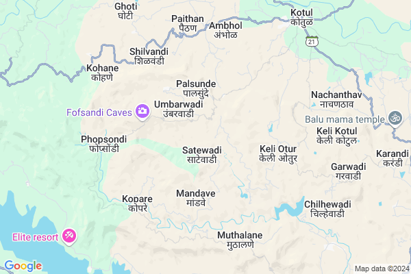
Ghotakarwadi Map
EDIT Map
Add Your House
 ..
..
Current Corona Virus Infected Patients Count in Ahmednagar District
| City Name | District Name | Total Covid cases |
|---|
Locality Name :
Ghotakarwadi
( घोटकरवाडी )
Taluka Name : Akole
District : Ahmednagar
State : Maharashtra
Region : Khandesh and Northern Maharashtra
Division : Nashik
Language : English and Hindi, Marathi, Urdu
Current Time 01:28 PM
Date: Thursday , May 01,2025 (IST)
Time zone: IST (UTC+5:30)
Elevation / Altitude: 587 meters. Above Seal level
Telephone Code / Std Code: 02424
Assembly constituency : Akole assembly constituency
Assembly MLA : Dr. Kiran Yamaji Lahamate
Lok Sabha constituency : Shirdi parliamentary constituency
Parliament MP : SADASHIV KISAN LOKHANDE
Serpanch Name :
Pin Code : 422610
Post Office Name : Kotul
Main Village Name : Satewadi
Commodities Prices : Junnar(Otur) Market / Mandi
Ghotakarwadi Live Weather
Temperature: 36.5 °C
clear sky
Humidity: 13%
Wind : 4.53 mt/sec towards NW
StationName : "Junnar"
observed on Now
Temperature: 36.5 °C
clear sky
Humidity: 13%
Wind : 4.53 mt/sec towards NW
StationName : "Junnar"
observed on Now
Ghotakarwadi Weather Forecast for Next 5 days
02-05-2025
23.7°C to 37.0°C
clear sky, few clouds
23.7°C to 37.0°C
clear sky, few clouds
03-05-2025
22.6°C to 37.6°C
clear sky, few clouds
22.6°C to 37.6°C
clear sky, few clouds
04-05-2025
19.6°C to 34.6°C
clear sky, broken clouds, scattered clouds, few clouds
19.6°C to 34.6°C
clear sky, broken clouds, scattered clouds, few clouds
05-05-2025
18.5°C to 33.3°C
clear sky, few clouds
18.5°C to 33.3°C
clear sky, few clouds
06-05-2025
18.4°C to 33.9°C
clear sky, few clouds
18.4°C to 33.9°C
clear sky, few clouds
National Highways Reachable To Ghotakarwadi
Nationa High Way :NH61
Nationa High Way :NH160
Nationa High Way :NH61
Nationa High Way :NH160
Rivers Near Ghotakarwadi
Bhairangi
Kalu
Bhairangi
Kalu
About Ghotakarwadi
Correct below Info and add more info about GhotakarwadiGhotakarwadi is a small Village/hamlet in Akole Taluka in Ahmednagar District of Maharashtra State, India. It comes under Satewadi Panchayath. It belongs to Khandesh and Northern Maharashtra region . It belongs to Nashik Division . It is located 105 KM towards west from District head quarters Ahmednagar. 19 KM from Akole. 138 KM from State capital Mumbai
Ghotakarwadi Pin code is 422610 and postal head office is Kotul .
Ghotakarwadi is surrounded by Junnar Taluka towards South , Sangamner Taluka towards East , Ambegaon Taluka towards South , Igatpuri Taluka towards North .
Junnar , Sangamner , Manchar , Sinnar are the near by Cities to Ghotakarwadi.
Demographics of Ghotakarwadi
English is the Local Language here. Total population of Ghotakarwadi is 1695 .Males are 845 and Females are 850 living in 286 Houses. Total area of Ghotakarwadi is 838 hectares.Politics in Ghotakarwadi
RPI(A) , NCP , Shivsena , SHS , INC are the major political parties in this area.Polling Stations /Booths near Ghotakarwadi
1)Jambhale Z.p.school2)Mogras Old Z.p.school East West Building Room No.1from East
3)Nachanthav Z.p.school East West Building Room No1from West
4)Z.p.school New South - North Building Room No.1 From South
5)Khandgedara Z.p.school North South Room No.1 From South
HOW TO REACH Ghotakarwadi
By Road
Sangamner is the Nearest Town to Ghotakarwadi. Sangamner is 55 km from Ghotakarwadi. Road connectivity is there from Sangamner to Ghotakarwadi.By Rail
There is no railway station near to Ghotakarwadi in less than 10 km.Colleges near Ghotakarwadi
Bhau Daji Patil D.ed College ,kotul
Address :
Govt.junior College Of Keli Kotul
Address :
Govt. Jr. College Kelirumhanwadi
Address :
Adv.mn.deshmukh College Rajur Akole
Address : At.post.rajur Tal. Akole
Schools in Ghotakarwadi
New Englishschool Jambhalewadi
Address : satewadi , akole , ahmadnagar , Maharashtra . PIN- 422610 , Post - Kotul
Z.p.p.school Jambhalewadi
Address : satewadi , akole , ahmadnagar , Maharashtra . PIN- 422610 , Post - Kotul
Govt Health Centers near Ghotakarwadi
1) Sitewadi , , ,2) Abitkhind , Subcenter Abitkhind , 0 , Bahiroba (Local Tribal God)
3) Palsunde , Sub Center Palsunde , 0 , 0
Hospitals in Ghotakarwadi,Akole
Samarth Hospital Kotul Near Maruti Temple Tal-Akole
Kotul; Maharashtra 422610; India
9.3 KM distance Detail
Dr. Bhujbal Samrath Hospital Kotul
राज्य महामार्ग २१; Kotul; Maharashtra 422610; India
9.3 KM distance Detail
more ..
Petrol Bunks in Ghotakarwadi,Akole
BPCL M/S. Deshmukh Petroleum
Near Pwd guest house; Akole Rd; Kotul; Maharashtra 422610; India
9.9 KM distance Detail
Hindustan Petroleum
Rajur; Ahmadnagar; SH-44; Rahuri Sangamner Road; Akola; Akola; 422604; India
18.9 KM distance Detail
HP PETROL PUMP - SHRINIWAS SERVICE STN
AT Rajur TQ Akole Dist; Aurangabad; Maharashtra 422601; India
19.1 KM distance Detail
more ..
Colleges in Ghotakarwadi,Akole
Satya Niketan Sansthas Adv Manoharrao Nanaheb Deshmukh Arts; Science & Commerce College
Ahmednagar; Rajur; Akole; Maharashtra 422604; India
18.9 KM distance Detail
more ..
Schools in Ghotakarwadi,Akole
जिल्हा परिषद शाळा; जांभळेवाडी
जांभळेवाडी (सातेवाडी); Akole; Maharashtra 422610; India
0.7 KM distance Detail
Sarvodaya Vidya Mandir;Abitkhind
Sarvodaya Vidya Mandir; Abit Khind; Maharashtra 422610; India
2.6 KM distance Detail
Local Parks in Ghotakarwadi,Akole
Police Stations near Ghotakarwadi,Akole
Akole Police Station
Dhumalwadi Road; Amrut Nagar; Akole; Maharashtra 422601; India
23.2 KM distance Detail
Governement Offices near Ghotakarwadi,Akole
ग्रामपंचायत कार्यालय केळी ओतूर
केळी ओतूर ता; जि; Akole; Maharashtra 422610; India
5.8 KM distance Detail
About Ghotakarwadi &
History
How to reach Ghotakarwadi
Tourist Places Near By Ghotakarwadi
Schools in Ghotakarwadi
Colleges in Ghotakarwadi
Temperature & weather of Ghotakarwadi
places in Ghotakarwadi
Ghotakarwadi photos
More Information
How to reach Ghotakarwadi
Tourist Places Near By Ghotakarwadi
Schools in Ghotakarwadi
Colleges in Ghotakarwadi
Temperature & weather of Ghotakarwadi
places in Ghotakarwadi
Ghotakarwadi photos
More Information
Village Talk
Post News or Events about this Village
Near Cities
Junnar 22 KM near
Sangamner 40 KM near
Manchar 47 KM near
Sinnar 58 KM near
Junnar 22 KM near
Sangamner 40 KM near
Manchar 47 KM near
Sinnar 58 KM near
Near By Taluks
Akole 18 KM near
Junnar 21 KM near
Sangamner 39 KM near
Ambegaon 42 KM near
Akole 18 KM near
Junnar 21 KM near
Sangamner 39 KM near
Ambegaon 42 KM near
Near By Air Ports
Gandhinagar Airport 74 KM near
Lohegaon Airport 99 KM near
Chhatrapati Shivaji International Airport 127 KM near
Chikkalthana Airport 183 KM near
Gandhinagar Airport 74 KM near
Lohegaon Airport 99 KM near
Chhatrapati Shivaji International Airport 127 KM near
Chikkalthana Airport 183 KM near
Near By Tourist Places
Malshej Ghat 19 KM near
Junnar 22 KM near
Ozar 24 KM near
Ratanwadi 29 KM near
Igatpuri 57 KM near
Malshej Ghat 19 KM near
Junnar 22 KM near
Ozar 24 KM near
Ratanwadi 29 KM near
Igatpuri 57 KM near
Near By Districts
Nashik 76 KM near
Ahmednagar 101 KM near
Pune 106 KM near
Thane 119 KM near
Nashik 76 KM near
Ahmednagar 101 KM near
Pune 106 KM near
Thane 119 KM near
Near By RailWay Station
Igatpuri Rail Way Station 57 KM near
Kasara Rail Way Station 62 KM near
Igatpuri Rail Way Station 57 KM near
Kasara Rail Way Station 62 KM near