| Home | City Bus | Maps | Villages | Cities | Rail | Tourist Places | School | College | Pin Codes | Corona Cases Count |
| Distance Calculator Bus Services IFSC Codes Trace Mobile Number Weather Search Place Trace IP Available Cash ATM/Banks Locate Polling Booth Report an Error contact People |
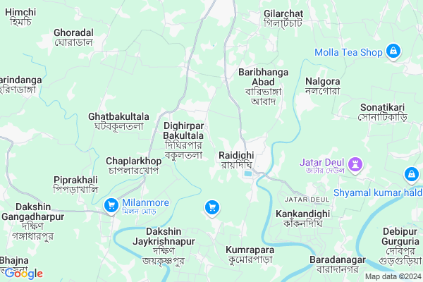
Nagendrapur
Nagendrapur Map
EDIT Map
Add Your House
 ..
..
Current Corona Virus Infected Patients Count in 24 Paraganas South District
| City Name | District Name | Total Covid cases |
|---|---|---|
| Tollygugne | South 24 Parganas | 1 |
Locality Name :
Nagendrapur
( নাগেন্দ্রপুর )
Block Name : Mathurapur-ii
District : 24 Paraganas South
State : West Bengal
Division : Presidency
Language : Bengali and English
Current Time 10:15 PM
Date: Friday , May 02,2025 (IST)
Time zone: IST (UTC+5:30)
Elevation / Altitude: 8 meters. Above Seal level
Telephone Code / Std Code: 03174
Assembly constituency : Raidighi assembly constituency
Assembly MLA : Aloke Jaldata
Lok Sabha constituency : Mathurapur parliamentary constituency
Parliament MP : CHOUDHURY MOHAN JATUA
Serpanch Name :
Pin Code : 743383
Post Office Name : Raidighi
Commodities Prices : Diamond Harbour(South 24-pgs) Market / Mandi
National Highways Reachable To Nagendrapur
Nationa High Way :NH12
Nationa High Way :NH116
Nationa High Way :NH12
Nationa High Way :NH116
Rivers Near Nagendrapur
Haldi River :হলদী নদী
Hooghly :হুগলী :Hugli :Hooghly :Hugli
Haldi River :হলদী নদী
Hooghly :হুগলী :Hugli :Hooghly :Hugli
About Nagendrapur
Correct below Info and add more info about NagendrapurNagendrapur is a Village in Mathurapur-ii Block in 24 Paraganas South District of West Bengal State, India. It belongs to Presidency Division . It is located 61 KM towards South from District head quarters Alipore. 73 KM from State capital Kolkata
Nagendrapur Pin code is 743383 and postal head office is Raidighi .
Nagendrapur is surrounded by Kultali Block towards North , Mathurapur I Block towards North , Jaynagar-Ii Block towards North , Kulpi Block towards west .
Haldia , Rajpur Sonarpur , Tamluk , Uluberia are the near by Cities to Nagendrapur.
Nagendrapur 2011 Census Details
Nagendrapur Local Language is Bengali. Nagendrapur Village Total population is 6041 and number of houses are 1195. Female Population is 48.8%. Village literacy rate is 69.9% and the Female Literacy rate is 30.9%.
Population
| Census Parameter | Census Data |
| Total Population | 6041 |
| Total No of Houses | 1195 |
| Female Population % | 48.8 % ( 2951) |
| Total Literacy rate % | 69.9 % ( 4224) |
| Female Literacy rate | 30.9 % ( 1868) |
| Scheduled Tribes Population % | 1.9 % ( 117) |
| Scheduled Caste Population % | 13.8 % ( 832) |
| Working Population % | 38.1 % |
| Child(0 -6) Population by 2011 | 721 |
| Girl Child(0 -6) Population % by 2011 | 48.5 % ( 350) |
Nagendrapur Census More Deatils.
Politics in Nagendrapur
CPM , AITC , All India Trinamool Congress are the major political parties in this area.Polling Stations /Booths near Nagendrapur
1)Dakshin Kankandighi Bhabatarini F. P. School2)Kautala Uttar Para F.p.school
3)Dighir Par Haritakitala F.p.school
4)Dighirpar-bakultala Spl Cadre F. P. School
5)Dakshin Baradanagar F. P. School
HOW TO REACH Nagendrapur
By Rail
There is no railway station near to Nagendrapur in less than 10 km.Colleges near Nagendrapur
Sukanta College
Address :
Falta Group Of Colleges
Address :
Sukata College
Address : Sonakhale
Schools near Nagendrapur
Radhakantapur Sarda Charan Jr. High School
Address : PO - RADHAKANTAPUR, PS - RAIDIGHI, BL - MATHURAPUR - II, SUB DIV - DIAMOND HARBOUR, DIST - SOUTH 24 PARGANAS, PIN -743354
Kashinagar Hs
Address : KASHINAGAR
Govt Health Centers near Nagendrapur
1) Keorakhali , VILL.- KEORAKHALI, P.O.- GHERY KEORAKHALI, P.S.- DHOLA HAT , ,2) Abad Bhagabanpur , Vill: Jagindranagar, P.O: Saratnagar, P.S: Dholahat , ,
3) Dakshin Raypur , VILL.- DAKSHIN RAYPUR, P.O.- GHERY RAYPUR, P.S.- DHOLA HAT , ,
Hospitals in Nagendrapur,Mathurapur-ii
Mangaldeep Nursing Home
Raidighi Hospital Rd; Raidighi; West Bengal 743349; India
3.0 KM distance Detail
more ..
Petrol Bunks in Nagendrapur,Mathurapur-ii
HP PETROL PUMP - ADHOC M/S URMILA SUPER SERVICE RA
HP Petrol Pump Raidighi; Kolkata; West Bengal 743383; India
2.5 KM distance Detail
more ..
Colleges in Nagendrapur,Mathurapur-ii
RICCE
743383; Dr. Ashit Baran Kayal's Building; Raidighi Hospital Rd; Raidighi; West Bengal 743349; India
3.0 KM distance Detail
Raidighi College
24 Parganas South Diamond Harbour subdivision; Raidighi; West Bengal 743383; India
3.5 KM distance Detail
Millad Girls Academi
Ramganga Rd; Dakshin Janardanpur; West Bengal 743399; India
14.3 KM distance Detail
Patharpratima Govt. I.T.I
Ramganga Rd; Dholahat; Dhola; West Bengal 743399; India
14.4 KM distance Detail
more ..
Schools in Nagendrapur,Mathurapur-ii
Digherpar Koralirchok Primary School
Dighirpar Bakultala; West Bengal 743349; India
1.4 KM distance Detail
Digherpar Koralirchack High School (H.S)
Dighirpar Bakultala; West Bengal 743349; India
1.4 KM distance Detail
Super Markets in Nagendrapur,Mathurapur-ii
manna emporium
Ramganga Main Rd; Paschim Sridharpur; West Bengal 743349; India
12.7 KM distance Detail
Police Stations near Nagendrapur,Mathurapur-ii
Dholahat Police Station
Dholahat Rd; Dholahat; Dhola; West Bengal 743399; India
14.4 KM distance Detail
Governement Offices near Nagendrapur,Mathurapur-ii
MGNREGA CELL;Mathurapur II Development Block
Baribhanga Abad; West Bengal 743349; India
3.4 KM distance Detail
About Nagendrapur &
History
How to reach Nagendrapur
Tourist Places Near By Nagendrapur
Schools in Nagendrapur
Colleges in Nagendrapur
Temperature & weather of Nagendrapur
places in Nagendrapur
Nagendrapur photos
More Information
How to reach Nagendrapur
Tourist Places Near By Nagendrapur
Schools in Nagendrapur
Colleges in Nagendrapur
Temperature & weather of Nagendrapur
places in Nagendrapur
Nagendrapur photos
More Information
Village Talk
Post News or Events about this Village
Near Cities
Haldia 36 KM near
Rajpur Sonarpur 51 KM near
Tamluk 66 KM near
Uluberia 67 KM near
Haldia 36 KM near
Rajpur Sonarpur 51 KM near
Tamluk 66 KM near
Uluberia 67 KM near
Near By Taluks
Mathurapur-Ii 0 KM near
Kultali 7 KM near
Mathurapur I 16 KM near
Jaynagar-Ii 18 KM near
Mathurapur-Ii 0 KM near
Kultali 7 KM near
Mathurapur I 16 KM near
Jaynagar-Ii 18 KM near
Near By Air Ports
Netaji Subhas Chandra Bose Airport 79 KM near
Bhubaneswar Airport 373 KM near
Ranchi Airport 391 KM near
Singerbhil Airport 399 KM near
Netaji Subhas Chandra Bose Airport 79 KM near
Bhubaneswar Airport 373 KM near
Ranchi Airport 391 KM near
Singerbhil Airport 399 KM near
Near By Tourist Places
Haldia 36 KM near
Raichak 42 KM near
Sagardwip 48 KM near
Bakkhali 58 KM near
Alipore 65 KM near
Haldia 36 KM near
Raichak 42 KM near
Sagardwip 48 KM near
Bakkhali 58 KM near
Alipore 65 KM near
Near By Districts
24 Paraganas South 58 KM near
Kolkata 64 KM near
Medinipur East 67 KM near
Howrah 72 KM near
24 Paraganas South 58 KM near
Kolkata 64 KM near
Medinipur East 67 KM near
Howrah 72 KM near
Near By RailWay Station
Tamluk Rail Way Station 66 KM near
Uluberia Rail Way Station 68 KM near
Tamluk Rail Way Station 66 KM near
Uluberia Rail Way Station 68 KM near