| Home | City Bus | Maps | Villages | Cities | Rail | Tourist Places | School | College | Pin Codes | Corona Cases Count |
| Distance Calculator Bus Services IFSC Codes Trace Mobile Number Weather Search Place Trace IP Available Cash ATM/Banks Locate Polling Booth Report an Error contact People |
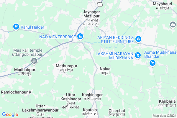
Lalpur
Lalpur Map
EDIT Map
Add Your House
 ..
..
Current Corona Virus Infected Patients Count in 24 Paraganas South District
| City Name | District Name | Total Covid cases |
|---|---|---|
| Tollygugne | South 24 Parganas | 1 |
Locality Name :
Lalpur
( লালপুর )
Block Name : Mathurapur I
District : 24 Paraganas South
State : West Bengal
Division : Presidency
Language : Bengali and English
Current Time 10:51 PM
Date: Friday , May 02,2025 (IST)
Time zone: IST (UTC+5:30)
Elevation / Altitude: 7 meters. Above Seal level
Telephone Code / Std Code: 03174
Assembly constituency : Raidighi assembly constituency
Assembly MLA : Aloke Jaldata
Lok Sabha constituency : Mathurapur parliamentary constituency
Parliament MP : CHOUDHURY MOHAN JATUA
Serpanch Name :
Pin Code : 743395
Post Office Name : South Bishnupur
Commodities Prices : Diamond Harbour(South 24-pgs) Market / Mandi
National Highways Reachable To Lalpur
Nationa High Way :NH12
Nationa High Way :NH116
Nationa High Way :NH12
Nationa High Way :NH116
Rivers Near Lalpur
Haldi River :হলদী নদী
Hooghly :হুগলী :Hugli :Hooghly :Hugli :胡格利河
Haldi River :হলদী নদী
Hooghly :হুগলী :Hugli :Hooghly :Hugli :胡格利河
About Lalpur
Correct below Info and add more info about LalpurLalpur is a Village in Mathurapur I Block in 24 Paraganas South District of West Bengal State, India. It belongs to Presidency Division . It is located 45 KM towards South from District head quarters Alipore. 3 KM from Mathurapur I. 57 KM from State capital Kolkata
Lalpur Pin code is 743395 and postal head office is South Bishnupur .
Nalua ( 2 KM ) , Mathurapur I ( 3 KM ) , Baishata ( 5 KM ) , Jaynagar-i ( 5 KM ) , Sahajadapur ( 6 KM ) are the nearby Villages to Lalpur. Lalpur is surrounded by Jaynagar-Ii Block towards East , Kultali Block towards South , Jaynagar-I Block towards North , Magra Hat-Ii Block towards North .
Rajpur Sonarpur , Haldia , Kolkata , Uluberia are the near by Cities to Lalpur.
Demographics of Lalpur
Bengali is the Local Language here.Politics in Lalpur
CPM , AITC , All India Trinamool Congress are the major political parties in this area.Polling Stations /Booths near Lalpur
1)Kumrapara Delwar Hossain Vidyapith2)Lalapur F.p.school
3)Lalapur Manikatala Em Es Ke
4)Bayaragadi Mistripada F.p.school
5)Lalapur F.p.school
HOW TO REACH Lalpur
By Rail
Mathurapur Road Rail Way Station , Jayanagar Majilpur Halt Rail Way Station are the very nearby railway stations to Lalpur.Colleges near Lalpur
Sukanta College
Address :
Falta Group Of Colleges
Address :
Sukata College
Address : Sonakhale
Schools near Lalpur
Kusumkali School
Address : katandighi krishnachandrapur s24pgs
Vivekananda Sishu Bikas Kendrya
Address : krishnachandrapur mathurapur 743354
Katandighi Jn High School
Address : katandighi krishnachandrapur mathurapur 743354
Khojkhidir Fp
Address : KHOJKHIDIR MATHURAPUR 24PGS.S
Govt Health Centers near Lalpur
1) Lalpur , Vill & P.O: Lalpur. , ,2) Maniktala , Vill: Maniktala, P.O: Chitraganj , ,
3) Santoshnagar , Vill: Santoshnagar, P.O: Lalpur , ,
Hospitals in Lalpur,Mathurapur I
Manasadwip Khasmahal Charitable Dispensarie
Mirzapur; West Bengal 743395; India
2.3 KM distance Detail
more ..
Petrol Bunks in Lalpur,Mathurapur I
HP PETROL PUMP - FRIENDS HP STATION
HP Petrol Pump Purba Bishnupur Jaynagar- Raidighi Road; Kolkata; West Bengal 743354; India
3.8 KM distance Detail
more ..
Colleges in Lalpur,Mathurapur I
Nopany Institute of Management Studies
2D; Nando Mullick Lane; Near Girish Park Metro Station / Ganesh Takiz Bustop; Kolkata; West Bengal 700006; India
2.3 KM distance Detail
PERFECT COMPUTER TRAINING ACADEMY
Ghoradal Bazar;Mathurapur Station; Mathurapur; West Bengal 743354; India
3.3 KM distance Detail
SIDDHARTHA COLLEGE OF EDUCATION
Mondalpara; Khari; South 24 Parganas; West Bengal 743349; India
4.0 KM distance Detail
more ..
Super Markets in Lalpur,Mathurapur I
Taluk Ranaghata ma Josoda Jewellers
Purba Ranaghat Rd; Purba Ranaghat; West Bengal 743354; India
3.5 KM distance Detail
Police Stations near Lalpur,Mathurapur I
Office Of The Circle Inspector Of Police (Jaynagar Circle); Nimpith
Kaikhali Rd; Nimpith; West Bengal 743338; India
4.0 KM distance Detail
Governement Offices near Lalpur,Mathurapur I
CHAKRABORTY MOTOR TRAINING SCHOOL
SD-18 BUS STAND; SOUTH BISNUPUR; West Bengal 743395; India
3.8 KM distance Detail
About Lalpur &
History
How to reach Lalpur
Tourist Places Near By Lalpur
Schools in Lalpur
Colleges in Lalpur
Temperature & weather of Lalpur
places in Lalpur
Lalpur photos
More Information
How to reach Lalpur
Tourist Places Near By Lalpur
Schools in Lalpur
Colleges in Lalpur
Temperature & weather of Lalpur
places in Lalpur
Lalpur photos
More Information
Village Talk
Post News or Events about this Village
Near Cities
Rajpur Sonarpur 36 KM near
Haldia 36 KM near
Kolkata 55 KM near
Uluberia 55 KM near
Rajpur Sonarpur 36 KM near
Haldia 36 KM near
Kolkata 55 KM near
Uluberia 55 KM near
Near By Taluks
Mathurapur I 3 KM near
Jaynagar-Ii 6 KM near
Kultali 7 KM near
Jaynagar-I 12 KM near
Mathurapur I 3 KM near
Jaynagar-Ii 6 KM near
Kultali 7 KM near
Jaynagar-I 12 KM near
Near By Air Ports
Netaji Subhas Chandra Bose Airport 64 KM near
Bhubaneswar Airport 382 KM near
Ranchi Airport 385 KM near
Singerbhil Airport 391 KM near
Netaji Subhas Chandra Bose Airport 64 KM near
Bhubaneswar Airport 382 KM near
Ranchi Airport 385 KM near
Singerbhil Airport 391 KM near
Near By Tourist Places
Raichak 35 KM near
Haldia 36 KM near
Alipore 50 KM near
Kolkata 55 KM near
Sagardwip 59 KM near
Raichak 35 KM near
Haldia 36 KM near
Alipore 50 KM near
Kolkata 55 KM near
Sagardwip 59 KM near
Near By Districts
24 Paraganas South 44 KM near
Kolkata 50 KM near
Howrah 57 KM near
Medinipur East 60 KM near
24 Paraganas South 44 KM near
Kolkata 50 KM near
Howrah 57 KM near
Medinipur East 60 KM near
Near By RailWay Station
Mathurapur Road Rail Way Station 3.8 KM near
Jayanagar Majilpur Halt Rail Way Station 5.1 KM near
Madhabpur Rail Way Station 8.8 KM near
Kolkata Shalimar Rail Way Station 54 KM near
Sealdah Rail Way Station 54 KM near
Mathurapur Road Rail Way Station 3.8 KM near
Jayanagar Majilpur Halt Rail Way Station 5.1 KM near
Madhabpur Rail Way Station 8.8 KM near
Kolkata Shalimar Rail Way Station 54 KM near
Sealdah Rail Way Station 54 KM near