| Home | City Bus | Maps | Villages | Cities | Rail | Tourist Places | School | College | Pin Codes | Corona Cases Count |
| Distance Calculator Bus Services IFSC Codes Trace Mobile Number Weather Search Place Trace IP Available Cash ATM/Banks Locate Polling Booth Report an Error contact People |
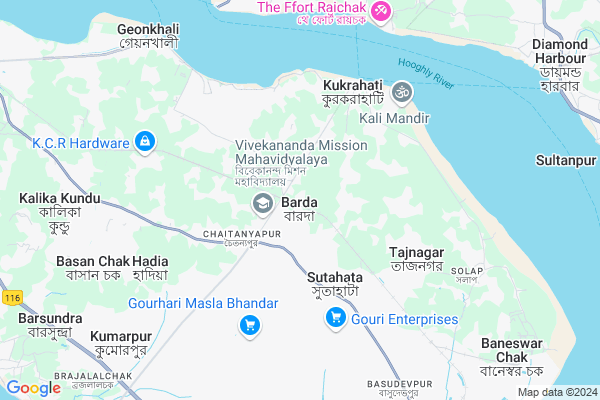
Bajitpur
Bajitpur Map
EDIT Map
Add Your House
 ..
..
Current Corona Virus Infected Patients Count in 24 Paraganas North District
| City Name | District Name | Total Covid cases |
|---|---|---|
| North 24 Parganas District | North 24 Parganas | 2 |
| Salt Lake | North 24 Parganas | 1 |
| Habra | North 24 Parganas | 1 |
Locality Name :
Bajitpur
( বাজিতপুর )
Block Name : Baduria
District : 24 Paraganas North
State : West Bengal
Division : Presidency
Language : Bengali and English
Current Time 09:09 AM
Date: Saturday , May 03,2025 (IST)
Time zone: IST (UTC+5:30)
Telephone Code / Std Code: 03217
Assembly constituency : Haldia assembly constituency
Assembly MLA : Tapasi Mondal
Lok Sabha constituency : Tamluk parliamentary constituency
Parliament MP : Adhikari Dibyendu
Serpanch Name :
Pin Code : 743427
Post Office Name : Katiahat
Commodities Prices : Diamond Harbour(South 24-pgs) Market / Mandi
Edit below overview about Bajitpur
Edit below overview about Bajitpur
OverView of Bajitpur
Bajitpur is name of a panchayaat. Which is situated in fatullapur.from katiahat which is in tentulia road one should take fatullapur road and after 30 minutes reached the destination.Edit below overview about Bajitpur
National Highways Reachable To Bajitpur
Nationa High Way :NH112
Nationa High Way :NH12
Nationa High Way :NH112
Nationa High Way :NH12
About Bajitpur
Bajitpur is a Village in Baduria Block in 24 Paraganas North District of West Bengal State, India. It belongs to Presidency Division . It is located 87 KM towards South from District head quarters Barasat. 108 KM from Baduria. 63 KM from State capital Kolkata
Bajitpur Pin code is 743427 and postal head office is Katiahat .
Bajitpur is surrounded by Haldia Block towards South , Diamond Harbour-Ii Block towards East , Mahishadal Block towards west , Diamond Harbour-I Block towards East .
Haldia , Tamluk , Uluberia , Panchla are the near by Cities to Bajitpur.
Bajitpur 2011 Census Details
Bajitpur Local Language is Bengali. Bajitpur Village Total population is 3399 and number of houses are 840. Female Population is 48.7%. Village literacy rate is 75.9% and the Female Literacy rate is 34.9%.
Population
| Census Parameter | Census Data |
| Total Population | 3399 |
| Total No of Houses | 840 |
| Female Population % | 48.7 % ( 1656) |
| Total Literacy rate % | 75.9 % ( 2580) |
| Female Literacy rate | 34.9 % ( 1185) |
| Scheduled Tribes Population % | 0.0 % ( 0) |
| Scheduled Caste Population % | 34.0 % ( 1157) |
| Working Population % | 36.6 % |
| Child(0 -6) Population by 2011 | 313 |
| Girl Child(0 -6) Population % by 2011 | 49.8 % ( 156) |
Bajitpur Census More Deatils.
Politics in Bajitpur
CPM , AITC , All India Trinamool Congress are the major political parties in this area.Polling Stations /Booths near Bajitpur
1)Baishnabchak Primary School (room No -3)2)Manichak Primary School
3)Barada I.c.d.s
4)Hariballavpur Primary School
5)Barada Rajarampur Primary School
HOW TO REACH Bajitpur
By Rail
Barda Rail Way Station , Basulyasutahata Rail Way Station are the very nearby railway stations to Bajitpur.Colleges near Bajitpur
Chandraketugarh Sahidullaha Smriti Mahavidyalaya
Address :
Hingalganj Mahavidyalaya
Address :
Derozio Memorial College
Address :
Kalinagar Mahavidyalaya
Address :
Taki Goverment College
Address :
Schools near Bajitpur
Pvt. Pantaparaaminiyamaszidke.
Address : ward no.- 3 , baduria municipality , north twenty four pargana , West Bengal . PIN- 743401 , Post - Baduria
Pvt. Suvania Madrasah
Address : bagjola/v , baduria , north twenty four pargana , West Bengal . PIN- 743438 , Post - Kolsur
Mandra Hazerali Smriti Vidyapi
Address : bagjola/viii , baduria , north twenty four pargana , West Bengal . PIN- 743438 , Post - Kolsur
Jashaikati High School
Address : jashikati atghara/xi , baduria , north twenty four pargana , West Bengal . PIN- 743401 , Post - Baduria
Govt Health Centers near Bajitpur
1) Paschim Bhabanipur PHC , P.Bhabanipur PHC , Noorpur Road , Noorpur GP Office2) P. Bhabanipur , VILL- P.BHABANIPUR, PO-DEWANTALA, PS- RAMNAGAR , NOORPUR ROAD , P.BHABANIPUR PHC
3) Natsal PHC , 157/2565 , , Near Rupnarayan River
Hospitals in Bajitpur,Baduria
Vivekananda Mission Asram Netra Niramay Niketan
Sutahata; West Bengal 721645; India
1.5 KM distance Detail
Rural Health Centre Association With BC Roy Hospital
Raghunathpur; West Bengal 721645; India
2.3 KM distance Detail
HEALTH CENTRE
Haldia - Tamluk - Mechada Rd; Uttar Chara Sankarara; West Bengal 721645; India
2.4 KM distance Detail
more ..
Petrol Bunks in Bajitpur,Baduria
MADHU FILLING STAION
SUTAHATA;EAST MEDNAPORE; PURBA MEDINIPUR; West Bengal 721635; India
7.2 KM distance Detail
Madhu Filling Point
Haldia - Tamluk - Mechada Rd; Haldia; West Bengal 721635; India
7.2 KM distance Detail
more ..
Colleges in Bajitpur,Baduria
Vivekananda Mission Mahavidyalaya
Chaitatanyapur; Sutahata; West Bengal 721645; India
1.7 KM distance Detail
Purba Medinipur B. Ed. College
Chaitanyapur; Sutahata; Purba Medinipur District; Haldia; West Bengal 721645; India
3.1 KM distance Detail
নিউ এলাহি মেডিক্যাল স্টোর
-SUTAHATA; Sutahata to Horkhali Rd; Krishna Nagar; West Bengal 721635; India
3.6 KM distance Detail
Institute of Education;Haldia
Amlat; P.O. Sutahata; Dist. Purba Medinipur; Haldia; West Bengal 721635; India
3.7 KM distance Detail
more ..
Schools in Bajitpur,Baduria
Vivekananda Mission Vidyamandir
Rampur; Sutahata; Haldia; Kukrahati To Haldia Road; Bajitpur; West Bengal 721645; India
1.7 KM distance Detail
Electronic Shops in Bajitpur,Baduria
MAA SARADA ENTERPRISE
Kukrahati To Haldia Rd; Chaitanyapur; Sutahata; West Bengal 721645; India
1.5 KM distance Detail
Avijit Enterprise/ Recharge And Xerox Dhokan
Chaitanyapur; Sutahata; West Bengal 721645; India
1.7 KM distance Detail
Barsha Enterprise Mobile And Xerox Shop
Chaitanyapur; Sutahata; West Bengal 721645; India
1.9 KM distance Detail
Super Markets in Bajitpur,Baduria
NAYAK Market....(everything Shop)
Kukrahati - Sutahata Rd; Gora Doro; West Bengal 721635; India
2.1 KM distance Detail
Satyanarayan Bhandar
Kukrahati - Haldia Rd; Begunbere; West Bengal 721658; India
8.1 KM distance Detail
Local Parks in Bajitpur,Baduria
Geokhali Park
Chaitanyapur - Geonkhali Rd; Geonkhali; West Bengal 721603; India
7.6 KM distance Detail
Police Stations near Bajitpur,Baduria
Sutahata Police Station
Haldia Mechada via Tamluk; Sutahata; West Bengal 721635; India
4.0 KM distance Detail
Bhabanipur Police Station
Bhawanipur Main Road; Haldia; West Bengal 721666; India
11.3 KM distance Detail
About Bajitpur &
History
How to reach Bajitpur
Tourist Places Near By Bajitpur
Schools in Bajitpur
Colleges in Bajitpur
Temperature & weather of Bajitpur
places in Bajitpur
Bajitpur photos
More Information
How to reach Bajitpur
Tourist Places Near By Bajitpur
Schools in Bajitpur
Colleges in Bajitpur
Temperature & weather of Bajitpur
places in Bajitpur
Bajitpur photos
More Information
Village Talk
Post News or Events about this Village
Near Cities
Haldia 10 KM near
Tamluk 27 KM near
Uluberia 39 KM near
Panchla 48 KM near
Haldia 10 KM near
Tamluk 27 KM near
Uluberia 39 KM near
Panchla 48 KM near
Near By Taluks
Sutahata 3 KM near
Haldia 10 KM near
Diamond Harbour-Ii 10 KM near
Mahishadal 13 KM near
Sutahata 3 KM near
Haldia 10 KM near
Diamond Harbour-Ii 10 KM near
Mahishadal 13 KM near
Near By Air Ports
Netaji Subhas Chandra Bose Airport 73 KM near
Ranchi Airport 350 KM near
Bhubaneswar Airport 355 KM near
Singerbhil Airport 420 KM near
Netaji Subhas Chandra Bose Airport 73 KM near
Ranchi Airport 350 KM near
Bhubaneswar Airport 355 KM near
Singerbhil Airport 420 KM near
Near By Tourist Places
Raichak 7 KM near
Haldia 11 KM near
Sagardwip 49 KM near
Alipore 54 KM near
Howrah 58 KM near
Raichak 7 KM near
Haldia 11 KM near
Sagardwip 49 KM near
Alipore 54 KM near
Howrah 58 KM near
Near By Districts
Medinipur East 27 KM near
24 Paraganas South 50 KM near
Kolkata 54 KM near
Howrah 59 KM near
Medinipur East 27 KM near
24 Paraganas South 50 KM near
Kolkata 54 KM near
Howrah 59 KM near
Near By RailWay Station
Barda Rail Way Station 1.6 KM near
Basulyasutahata Rail Way Station 5.3 KM near
Tamluk Rail Way Station 26 KM near
Uluberia Rail Way Station 40 KM near
Barda Rail Way Station 1.6 KM near
Basulyasutahata Rail Way Station 5.3 KM near
Tamluk Rail Way Station 26 KM near
Uluberia Rail Way Station 40 KM near