| Home | City Bus | Maps | Villages | Cities | Rail | Tourist Places | School | College | Pin Codes | Corona Cases Count |
| Distance Calculator Bus Services IFSC Codes Trace Mobile Number Weather Search Place Trace IP Available Cash ATM/Banks Locate Polling Booth Report an Error contact People Surnames |
Head Quarters : Mamit
Language : Mizo
Area: 3026 sq. km
Population : 85757
Sex Ratio : 924
Density : 28/ sq. km
Literacy : 85.96
Elevation / Altitude: 48 - meters. Above Seal level
Current Time 10:37 AM
Date: Sunday , May 03,2026 (IST)
Time zone: IST (UTC+5:30)
District Pin code Index: 796XXX
Vehicle Registration Number: MZ-08
RTO Office: Mamit
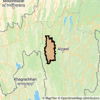
Mamit District Map
Current Corona Virus Infected Patients Count in Mamit District
| City Name | District Name | Total Covid cases |
|---|
Mamit Live Weather
Temperature: 24.4 °C
haze
Humidity: 69%
Wind : 2.06 mt/sec towards S
StationName : "Mamit"
observed on Now
Temperature: 24.4 °C
haze
Humidity: 69%
Wind : 2.06 mt/sec towards S
StationName : "Mamit"
observed on Now
Mamit Weather Forecast for Next 5 days
04-05-2026
17.9°C to 31.1°C
scattered clouds, light rain, moderate rain
17.9°C to 31.1°C
scattered clouds, light rain, moderate rain
05-05-2026
18.5°C to 31.2°C
light rain, broken clouds, scattered clouds, overcast clouds
18.5°C to 31.2°C
light rain, broken clouds, scattered clouds, overcast clouds
06-05-2026
19.9°C to 32.1°C
overcast clouds, scattered clouds, clear sky, light rain, moderate rain
19.9°C to 32.1°C
overcast clouds, scattered clouds, clear sky, light rain, moderate rain
07-05-2026
19.5°C to 30.5°C
light rain, moderate rain
19.5°C to 30.5°C
light rain, moderate rain
08-05-2026
18.9°C to 31.2°C
light rain, overcast clouds, scattered clouds, clear sky
18.9°C to 31.2°C
light rain, overcast clouds, scattered clouds, clear sky
Temples in Mamit
Historical Daily Min/Max Temperatures (Next 7 Days)
| Years | 03 May | 04 May | 05 May | 06 May | 07 May | 08 May | 09 May |
|---|---|---|---|---|---|---|---|
| 2025 | |||||||
| 2024 | |||||||
| 2023 |
About Mamit District
Mamit District is one among 8 Districts of Mizoram State ,India. Mamit District Administrative head quarter is Mamit. It is is Located 37 KM East towards State capital Aizawl . Mamit District population is 85757. It is 5 th Largest District in the State by population.Geography and Climate Mamit District
It is Located at Latitude-23.9, Longitude-92.4. Mamit District is sharing border with Aizawl District to the East , North Tripura District to the west . It is sharing Border with Tripura State to the west . Mamit District occupies an area of approximately 3026 square kilometres. . Its in the 48 meters to meters elevation range.This District belongs to Eastern India .DemoGraphics of Mamit District
Mizo is the Local Language here. Mamit District is divided into 4 Blocks , 71 Panchayats , 72 Villages. Zawlnuam Block is the Smallest Block by population with 365 population. West Phaileng Block is the Biggest Block by population with 705 population.Census 2011 of Mamit District
Mamit district Total population is 85757 according to census 2011.Males are 44572 and Females are 41185 .Literate people are 56737 among total.Its total area is 3026 sq.km. It is the 5 th largest district in the state by Population . But 4 th Largest District in the state By Area. 601 st Largest District in the Country By Population. 7 th highest District in the State By literacy rate. 63 rd highest District in the Country By literacy rate.its literacy Rate is 85.96Politics in Mamit District
Mizo National Front , INC are the major political parties in Mamit District.Assembly constituencies in Mamit District
Total 3 Assembly constituencies in Mamit District.| Constituency name | MLA name | Party |
|---|---|---|
| Hachhek | Robert Romawia Royte | |
| Dampa | Lalrintluanga Sailo | |
| Mamit | H. Lalzirliana |
Parliament constituencies in Mamit District
Total 1 Parliament constituencies in Mamit District.| Constituency name | MP name | Party |
|---|---|---|
| Mizoram | C LALROSANGA | Mizo National Front |
Mamit District Political Map
Mamit Commerce
Total Registered Comapnies with Ministry of Corporate Affairs (MCA) in Mamit areCompany Name : NORTH EAST STEVIA LIMITED
Type Of Business : Agriculture and Allied Activities
Capital : 10.0 Lakhs
Company Name : MIZO ORGANIC MAMIT PRODUCER COMPANY LIMI TED
Type Of Business : Agriculture and Allied Activities
Capital : 0
More Mamit Registered Companies
Mamit District Tourism
Mamit , are the Tourist destinations to Visit.
Mamit Transport
Road Transport
District Headquarters Mamit is well connected by road . Mamit is about 37 KM by road to Aizawl( Capital of Mizoram )Rail Transport
Bus Transport
Mizoram State Road Transportation ( MST) runs Busses from Major cities to Towns and Villages in this District.
Pin Codes in Mamit District
796501
( Reiek ) ,
796441
( Mamit ) ,
796410
( Sairang ) ,
796431
( Phaileng ) ,
more PinCodes
Hotels in Mamit
Near Cities
Aizawl 35 KM near
Dharmanagar 65 KM near
Kailasahar 73 KM near
Hailakandi 93 KM near
Near By Air Ports
Aizawl Airport 19 KM near
Kumbhirgram Airport 133 KM near
Singerbhil Airport 141 KM near
Imphal Municipal Airport 189 KM near
Near By Districts
Mamit 0 KM near
Aizawl 34 KM near
Kolasib 43 KM near
Dhalai 61 KM near