| Home | City Bus | Maps | Villages | Cities | Rail | Tourist Places | School | College | Pin Codes | Corona Cases Count |
| Distance Calculator Bus Services IFSC Codes Trace Mobile Number Weather Search Place Trace IP Available Cash ATM/Banks Locate Polling Booth Report an Error contact People Surnames |
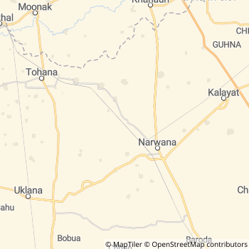
List Of Villages in Narwana
Narwana Tehsil MAP
Language : Hindi
and Punjabi, English, Haryanvi
Elevation / Altitude: 235 meters. Above Seal level
Current Time
Date:
Time zone: IST (UTC+5:30)
Telephone Code / Std Code: 01749
Vehicle Registration Number:HR-31,HR-32,HR-33,HR-56
RTO Office : Jind,Narwana,Safidon
Assembly constituency : Narwana (sc) assembly constituency
Assembly MLA : Ram Niwas
Lok Sabha constituency : Sirsa (sc) parliamentary constituency
Parliament MP : Sunita Duggal
Narwana Tehsil MAP
Current Corona Virus Infected Patients Count in Jind District
| City Name | District Name | Total Covid cases |
|---|
Narwana Live Weather
Temperature: 42.9 °C
clear sky
Humidity: 11%
Wind : 3.51 mt/sec towards SW
StationName : "NarwÄ\u0081na"
observed on 1 Hours Back
Temperature: 42.9 °C
clear sky
Humidity: 11%
Wind : 3.51 mt/sec towards SW
StationName : "NarwÄ\u0081na"
observed on 1 Hours Back
Narwana Weather Forecast for Next 5 days
26-05-2026
33.5°C to 45.5°C
clear sky
33.5°C to 45.5°C
clear sky
27-05-2026
32.3°C to 46.3°C
clear sky
32.3°C to 46.3°C
clear sky
28-05-2026
31.9°C to 47.5°C
clear sky
31.9°C to 47.5°C
clear sky
29-05-2026
33.0°C to 48.3°C
clear sky, broken clouds, scattered clouds
33.0°C to 48.3°C
clear sky, broken clouds, scattered clouds
30-05-2026
29.1°C to 45.9°C
few clouds, clear sky, scattered clouds
29.1°C to 45.9°C
few clouds, clear sky, scattered clouds
National Highways Reachable To Narwana
Nationa High Way :NH152 in Distance 34.7 KM ( Hissar Ambala Road )
Nationa High Way :NH152D in Distance 46.2 KM ( Trans Haryana Expressway :ट्रांस हरियाणा एक्सप्रेसवे )
Nationa High Way :NH52 in Distance 6.9 KM ( Hissar Ambala Road )
Nationa High Way :NH152;352 in Distance 19.3 KM ( Hissar Ambala Road )
Rivers Near Narwana
Ghaggar in Distance 26.7
Ghaggar in Distance 26.7
About Narwana Tehsil
Narwana is a Tehsil in Jind District of Haryana State, India. Narwana Tehsil Head Quarters is Narwana town . It belongs to Hisar Division .Narwana City , Tohana City , Barwala City , Patran City are the nearby Cities to Narwana.
It is in the 235 m elevation(altitude) .
Hansi , Sangrur , Mansa , Kurukshetra (Dharmakshetra) , Patiala are the near by Important tourist destinations to see.
Demographics of Narwana Tehsil
Hindi is the Local Language here. Also People Speaks Punjabi, English, Haryanvi .Politics in Narwana Tehsil
JJP , Bharatiya Janata Party , BJP , INLD , INC are the major political parties in this area.Narwana Tehsil comes under multiple assembly constituencies.There are total 2 assembly constituencies in Narwana Tehsil.
| Constituency name | MLA name | Party |
|---|---|---|
| Uchana Kalan | Dushyant Chautala | JJP |
| Narwana | Ram Niwas | JJP |
Narwana Tehsil comes under multiple parliament constituencies.There are total 2 parliament constituencies in Narwana Tehsil.
| Constituency name | MP name | Party |
|---|---|---|
| Sirsa | Sunita Duggal | Bharatiya Janata Party |
| Hisar | BRIJENDRA SINGH | Bharatiya Janata Party |
Narwana Tehsil Political Map
HOW TO REACH Narwana Tehsil
By Rail
There is no railway station near to Narwana Tehsil in less than 10 km.Pin codes of Narwana Tehsil
126110 ( Dharthrath ) , 126152 ( Dhanoda Kalan ) , 126116 ( Narwana )Banks in Narwana
Canara Bank, Narwana ( Ifsc Code : CNRB0004748 , micrCode: 126015052)Allahabad Bank, Narwana ( Ifsc Code : ALLA0212340 , micrCode: 126010001)
Andhra Bank, Narwana ( Ifsc Code : ANDB0002503 , micrCode: NA)
Axis Bank, Narwana ( Ifsc Code : UTIB0001559 , micrCode: 126211102)
Colleges in Narwana
K.m.govt. College
Address :
Adarsh University
Address :
Kgk
Address :
schools in Narwana
Sheed Suresh Kumar Ss School
Address : dhakal , narwana , jind , Haryana . PIN- 126116 , Post - Narwana
Sir Chhotu Ram S.s.s. Dhakal
Address : hatho , narwana , jind , Haryana . PIN- 126116 , Post - Narwana
Ljbmg Sen. Sec. School Khanpur
Address : khan pur , narwana , jind , Haryana . PIN- 126116 , Post - Narwana
D.h.sr.sec. School
Address : dhabi tek singh , narwana , jind , Haryana . PIN- 126116 , Post - Narwana
Saraswati High School
Address : danoda kalan , narwana , jind , Haryana . PIN- 126153
S.n.r Public School Danoda Khurd
Address : danoda khurd , narwana , jind , Haryana . PIN- 126153
R.d.s.d Sr. Sec. School
Address : dhamtan sahib , narwana , jind , Haryana . PIN- 126118
Cdl Memorial Public School
Address : narwana , narwana , jind , Haryana . PIN- 126116 , Post - Narwana
Hotels Near by Narwana
Koel Hotel
Haryana Tourism Corporation Limited, Kaithal India
Haryana
Contact No: 01746 - 224270
Price Range : Rs. 1000 - Rs. 1200
Registered Companies in Narwana Tehsil
Name : MSSHANTI OCEANS PRIVATE LIMITEDaddress : HOUSE NO 238 BPL RETAJAULI SAFIDON JIND Jind HR IN 126110
More Narwana Registered Companies
BusStation in Narwana
ATMs in Narwana
Central Bank Of India ATM
126116; Narwana Rd; Huda Market; Railway Colony; Jind; Haryana 126102; India
099966 54388 CashStatus
Cinema Theaters in Narwana
Temples in Narwana
Hotels and Lodges in Narwana
Punjab Singh Rathi House
Punjab Singh Rathi House Vpo farain kalan; Narwana; Haryana 126116; India
092167 20884 Detail
Goyal Trading Company
Goyal Trading Company; Idea Distributors & Idea Service Point ; Old Cort Near Badi Sabzi Mandi Road; Narwana; Bir Bal Nagar; Narwana; Haryana 126116; India
Detail
Hospitals in Narwana
Petrol Bunks in Narwana
Haraman Highway Petroleum Bharat Petroleum
Dharam Singh Colony; Jind; NH-71; Patran Narwana Road; Narwana; Narwana; Haryana 126116; India
097252 46026 Detail
Narwana Filling Station Hindustan Petroleum
Dharam Singh Colony; Jind; NH-71; Patran Narwana Road; Narwana; Narwana; Haryana 126116; India
089232 40540 Detail
Colleges in Narwana
Jagdamba Medical Hall
Railway Station Rd; Patram Nagar; Narwana; Haryana 126116; India
094162 27658 Detail
Schools in Narwana
BusStops in Narwana Lakes in Narwana Temples in Narwana Shops in Narwana Narwana Hospitals Hotel/Restaurants in Narwana Narwana RailwayStations Narwana BusStops ATM in Narwana
Near By Cities
Narwana 7 KM near
Tohana 20 KM near
Barwala 34 KM near
Patran 41 KM near
Narwana 7 KM near
Tohana 20 KM near
Barwala 34 KM near
Patran 41 KM near
Near By Taluks
Narwana 0 KM near
Uchana 20 KM near
Andana 23 KM near
Kalayat 24 KM near
Narwana 0 KM near
Uchana 20 KM near
Andana 23 KM near
Kalayat 24 KM near
Near By Air Ports
Chandigarh Airport 152 KM near
Ludhiana Airport 159 KM near
Indira Gandhi International Airport 175 KM near
Muzaffarnagar Airport 175 KM near
Chandigarh Airport 152 KM near
Ludhiana Airport 159 KM near
Indira Gandhi International Airport 175 KM near
Muzaffarnagar Airport 175 KM near
Near By Districts
Kaithal 43 KM near
Jind 47 KM near
Fatehabad 63 KM near
Hisar 68 KM near
Kaithal 43 KM near
Jind 47 KM near
Fatehabad 63 KM near
Hisar 68 KM near
Near By RailWay Station
Dharodi Rail Way Station 1.3 KM near
Narwana Junction Rail Way Station 7.7 KM near
Tohana Rail Way Station 20 KM near
Dharodi Rail Way Station 1.3 KM near
Narwana Junction Rail Way Station 7.7 KM near
Tohana Rail Way Station 20 KM near
Near By Bus Station