| Home | City Bus | Maps | Villages | Cities | Rail | Tourist Places | School | College | Pin Codes | Corona Cases Count |
| Distance Calculator Bus Services IFSC Codes Trace Mobile Number Weather Search Place Trace IP Available Cash ATM/Banks Locate Polling Booth Report an Error contact People Surnames |
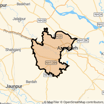
Azamgarh District.
Currently In:
India >>
Uttar Pradesh
Division : Azamgarh
Head Quarters : Azamgarh
Language : Hindi and Urdu, Bhojpuri, Bihari
Area: 4054 sq. km
Population : 4616509
Sex Ratio : 1017
Density : 1139/ sq. km
Literacy : 72.69
Elevation / Altitude: 91 - 190 meters. Above Seal level
Current Time 10:53 PM
Date: Tuesday , May 19,2026 (IST)
Time zone: IST (UTC+5:30)
District Pin code Index: 223XXX,275XXX,276XXX
Vehicle Registration Number: UP-50
RTO Office: Azamgarh
Tourist Places near Azamgarh
Jaunpur Sarnath (Mrigadava) Gorakhpur Varanasi (Benares) Basti Kushinagar (Kusinagar)
Jaunpur Sarnath (Mrigadava) Gorakhpur Varanasi (Benares) Basti Kushinagar (Kusinagar)
Azamgarh District Map
Current Corona Virus Infected Patients Count in Azamgarh District
| City Name | District Name | Total Covid cases |
|---|---|---|
| Azamgarh District | Azamgarh | 1 |
Azamgarh Live Weather
Temperature: 37.3 °C
clear sky
Humidity: 24%
Wind : 3.15 mt/sec towards E
StationName : "Azamgarh"
observed on 1 Hours Back
Temperature: 37.3 °C
clear sky
Humidity: 24%
Wind : 3.15 mt/sec towards E
StationName : "Azamgarh"
observed on 1 Hours Back
Azamgarh Weather Forecast for Next 5 days
20-05-2026
33.6°C to 37.2°C
clear sky
33.6°C to 37.2°C
clear sky
21-05-2026
32.0°C to 46.1°C
clear sky
32.0°C to 46.1°C
clear sky
22-05-2026
31.6°C to 47.0°C
clear sky
31.6°C to 47.0°C
clear sky
23-05-2026
31.4°C to 45.7°C
clear sky, broken clouds
31.4°C to 45.7°C
clear sky, broken clouds
24-05-2026
31.6°C to 46.0°C
clear sky, few clouds, scattered clouds, broken clouds
31.6°C to 46.0°C
clear sky, few clouds, scattered clouds, broken clouds
Temples in Azamgarh
Markande Baba ka Mandir
Markande Baba ka Mandir
Historical Daily Min/Max Temperatures (Next 7 Days)
| Years | 19 May | 20 May | 21 May | 22 May | 23 May | 24 May | 25 May |
|---|---|---|---|---|---|---|---|
| 2025 | 42.0°C/ 28.0°C | 42.0°C/ 29.0°C | 43.0°C/ 29.0°C | 42.0°C/ 29.0°C | 37.0°C/ 29.0°C | 37.0°C/ 29.0°C | 37.0°C/ 29.0°C |
| 2024 | 47.0°C/ 33.0°C | 44.0°C/ 29.0°C | 44.0°C/ 32.0°C | 42.0°C/ 31.0°C | 40.0°C/ 32.0°C | 43.0°C/ 33.0°C | 44.0°C/ 34.0°C |
| 2023 | 43.0°C/ 30.0°C | 44.0°C/ 29.0°C | 44.0°C/ 30.0°C | 43.0°C/ 30.0°C | 44.0°C/ 30.0°C | 41.0°C/ 30.0°C | 33.0°C/ 27.0°C |
About Azamgarh District
Azamgarh District is one among 71 Districts of Uttar Pradesh State ,India. Azamgarh District Administrative head quarter is Azamgarh. It is is Located 279 KM west towards State capital Lucknow . Azamgarh District population is 4616509. It is 4 th Largest District in the State by population.Geography and Climate Azamgarh District
It is Located at Latitude-26.0, Longitude-83.1. Azamgarh District is sharing border with Leh Ladakh District to the North , Ambedkar Nagar District to the west , Gorakhpur District to the North , Jaunpur District to the west , Mau District to the East . It is sharing Border with Jammu & Kashmir State to the west . Azamgarh District occupies an area of approximately 4054 square kilometres. . Its in the 91 meters to 190 meters elevation range.This District belongs to Hindi Belt India .DemoGraphics of Azamgarh District
Hindi is the Local Language here. Also People Speaks Urdu, Bhojpuri, Bihari . Azamgarh District is divided into 23 Blocks , Panchayats , 5256 Villages.Census 2011 of Azamgarh District
Azamgarh district Total population is 4616509 according to census 2011.Males are 2288800 and Females are 2327709 .Literate people are 3054282 among total.Its total area is 4054 sq.km. It is the 4 th largest district in the state by Population . But 22 nd Largest District in the state By Area. 30 th Largest District in the Country By Population. 27 th highest District in the State By literacy rate. 328 th highest District in the Country By literacy rate.its literacy Rate is 72.69Politics in Azamgarh District
BJP , SP , BSP are the major political parties in Azamgarh District.Assembly constituencies in Azamgarh District
Total 14 Assembly constituencies in Azamgarh District.| Constituency name | MLA name | Party |
|---|---|---|
| Alapur | Tribhuwan Dutt | SP |
| Jalalpur | Rakesh Pandey | SP |
| Atraulia | Dr. Sangram | SP |
| Gopalpur | Nafees Ahmad | SP |
| Sagri | Hriday Narayan Singh Patel | SP |
| Mubarakpur | Akhilesh | BSP |
Parliament constituencies in Azamgarh District
Total 5 Parliament constituencies in Azamgarh District.| Constituency name | MP name | Party |
|---|---|---|
| Sant Kabir Nagar | PRAVEEN KUMAR NISHAD | Bharatiya Janata Party |
| Lalganj | Sangeeta Azad | Bahujan Samaj Party |
| Azamgarh | Akhilesh Yadav | Samajwadi Party |
| Ambedkar Nagar | Ritesh Pandey | Bahujan Samaj Party |
| Ghosi | ATUL KUMAR SINGH | Bahujan Samaj Party |
Azamgarh District Political Map
Azamgarh Commerce
Total Registered Comapnies with Ministry of Corporate Affairs (MCA) in Azamgarh are 252Company Name : ALPINE INFORMATICS PRIVATE LIMITED
Type Of Business : Business Services
Capital : 2.17 Crores
Company Name : TRIPTI REGENCY INN PRIVATE LIMITED
Type Of Business : Trading
Capital : 1.54251 Crores
Company Name : UKC FOODS PRIVATE LIMITED
Type Of Business : Manufacturing (Food stuffs)
Capital : 1.3394 Crores
Company Name : IA AUTOMOBILES INTERNATIONAL PRIVATE LIMITED
Type Of Business : Trading
Capital : 1.0 Crores
More Azamgarh Registered Companies
Azamgarh District Tourism
Temples in Azamgarh District
Markande Baba ka Mandir are the famous temple in Azamgarh DistrictAzamgarh Transport
Road Transport
District Headquarters Azamgarh is well connected by road . Mau , Azamgarh are the Cities in this district having road connectivity to major towns and remote villages. Azamgarh is about 279 KM by road to Lucknow( Capital of Uttar Pradesh )Rail Transport
Some of the rail way stations in district are Azamgarh , Khorason Road , Sarai Mir , Sathiaon , Bilwai , Sanjarpur , Didarganj Road , Sarai Rani .... which connects most of the towns and villages in the District.Bus Transport
Uttar Pradesh State Road Transport ( UPSRTC) runs Busses from Major cities to Towns and Villages in this District.
Pin Codes in Azamgarh District
276203
( Mehanazpur ) ,
276305
( Saraimeer ) ,
276306
( Suraj Pur ) ,
276131
( Jahana Ganj ) ,
223223
( Ataraulia ) ,
276125
( Bankat ) ,
276001
( Azamgarh ) ,
276122
( Rauna Par ) ,
276135
( Kandhara Pur ) ,
223225
( Mahul ) ,
276142
( Koilsa ) ,
223226
( Pushpnagar ) ,
223222
( Ambari ) ,
276205
( Mohammad Pur ) ,
275306
( Koiria Par ) ,
276404
( Mubarak Pur ) ,
276124
( Ajamat Garh Estate ) ,
276208
( Tika Pur ) ,
276127
( Bazar Gosain ) ,
276302
( Gambhirpur ) ,
more PinCodes
Hotels in Azamgarh
Near Cities
Azamgarh 0 KM near
Mau 21 KM near
Adari 49 KM near
Saidpur, Ghazipur 63 KM near
Near By Air Ports
Varanasi Airport 84 KM near
Gorakhpur Airport 90 KM near
Bamrauli Airport 179 KM near
Patna Airport 221 KM near
Near By Districts
Azamgarh 0 KM near
Mau 46 KM near
Jaunpur 68 KM near
Ghazipur 73 KM near